171 results for: Lake Washington Ship Canal
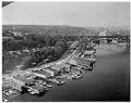
Photograph
Aerial view of Aurora Bridge over Lake Union, Seattle, April 1960
The Aurora Bridge (officially the George Washington Memorial Bridge) is a cantilever and truss bridge that carries State Route 99 (Aurora Avenue North) over the west end of Seattle's Lake Union. Construction on the bridge piers began in 1929, and the bridge was opened to traffic on February 22, 1932, George Washington's 200th birthday. It was listed on the National…
ID Number:2009.23.31
Date:1960
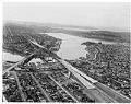
Photograph
Aerial view of Freeway Bridge during Interstate 5 construction, Seattle, January 1961
Interstate 5 (I-5) is the main Interstate Highway on the West Coast of the United States, and Seattle's widest freeway. The section of I-5 connecting Kent to Seattle to Everett was built between 1960-1966, including "Freeway Bridge," shown in this aerial photograph taken in 1961. The direction of the photograph is looking south and slightly west over Lake Union towards…
ID Number:2009.23.57
Date:1961
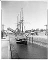
Photograph
Yacht Fantome at Ballard locks, Seattle, circa 1962
The Fantome was a steel-hulled sailing yacht built for Great Britain’s Duke of Westminster in 1927, and later acquired by beer baron Ernest Guinness. It sailed into Seattle in 1939 and became stranded by the outbreak of World War II. After the war, King County blocked its departure in an effort to recover property taxes from Guiness. The vessel ended…
ID Number:2009.23.1048
Date:Circa 1962
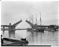
Photograph
Yacht Fatome at drawbridge near Ballard locks, Seattle, circa 1962
The Fantome was a steel-hulled sailing yacht built for Great Britain’s Duke of Westminster in 1927, and later acquired by beer baron Ernest Guinness. It sailed into Seattle in 1939 and became stranded by the outbreak of World War II. After the war, King County blocked its departure in an effort to recover property taxes from Guiness. The vessel ended…
ID Number:2009.23.1054
Date:Circa 1962
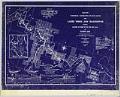
Cartographic material
Map of Waterway Connecting Puget Sound with Lakes Union and Washington, Index, February 1905
Since the city's earliest days, Seattleites proposed canals to cheaply and easily move logs, coal, and other resources between Elliott Bay and Lake Washington. Possible routes extended from the Black River at the south end of Lake Washington to canals through Lake Union and Shilshole Bay in the north. A 1891 report commissioned by the federal government explored five possible…
ID Number:2019.3.11.1
Date:1905
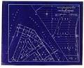
Cartographic material
Waterway Connecting Puget Sound with Lakes Union and Washington, sheet 1, January 1905
Since the city's earliest days, Seattleites proposed canals to cheaply and easily move logs, coal, and other resources between Elliott Bay and Lake Washington. Possible routes extended from the Black River at the south end of Lake Washington to canals through Lake Union and Shilshole Bay in the north. A 1891 report commissioned by the federal government explored five possible…
ID Number:2019.3.11.2
Date:1905
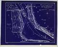
Cartographic material
Waterway Connecting Puget Sound with Lakes Union and Washington, sheet 2, January 1905
Since the city's earliest days, Seattleites proposed canals to cheaply and easily move logs, coal, and other resources between Elliott Bay and Lake Washington. Possible routes extended from the Black River at the south end of Lake Washington to canals through Lake Union and Shilshole Bay in the north. A 1891 report commissioned by the federal government explored five possible…
ID Number:2019.3.11.3
Date:1905
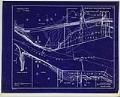
Cartographic material
Waterway Connecting Puget Sound with Lakes Union and Washington, sheet 3, January 1905
Since the city's earliest days, Seattleites proposed canals to cheaply and easily move logs, coal, and other resources between Elliott Bay and Lake Washington. Possible routes extended from the Black River at the south end of Lake Washington to canals through Lake Union and Shilshole Bay in the north. A 1891 report commissioned by the federal government explored five possible…
ID Number:2019.3.11.4
Date:1905
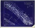
Cartographic material
Waterway Connecting Puget Sound with Lakes Union and Washington, sheet 4, November 1904
Since the city's earliest days, Seattleites proposed canals to cheaply and easily move logs, coal, and other resources between Elliott Bay and Lake Washington. Possible routes extended from the Black River at the south end of Lake Washington to canals through Lake Union and Shilshole Bay in the north. A 1891 report commissioned by the federal government explored five possible…
ID Number:2019.3.11.5
Date:1904
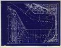
Cartographic material
Waterway Connecting Puget Sound with Lakes Union and Washington, sheet 5, November 1904
Since the city's earliest days, Seattleites proposed canals to cheaply and easily move logs, coal, and other resources between Elliott Bay and Lake Washington. Possible routes extended from the Black River at the south end of Lake Washington to canals through Lake Union and Shilshole Bay in the north. A 1891 report commissioned by the federal government explored five possible…
ID Number:2019.3.11.6
Date:1904