171 results for: Lake Washington Ship Canal
Cartographic material
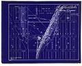
Waterway Connecting Puget Sound with Lakes Union and Washington, sheet 6, November 1904
Since the city's earliest days, Seattleites proposed canals to cheaply and easily move logs, coal, and other resources between Elliott Bay and Lake Washington. Possible routes extended from the Black River at the south end of Lake Washington to canals through Lake Union and Shilshole Bay in the north. A 1891 report commissioned by the federal government explored five possible…
ID Number:2019.3.11.7
Date:1904
Cartographic material
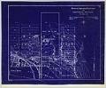
Waterway Connecting Puget Sound with Lakes Union and Washington, sheet 7, November 1904
Since the city's earliest days, Seattleites proposed canals to cheaply and easily move logs, coal, and other resources between Elliott Bay and Lake Washington. Possible routes extended from the Black River at the south end of Lake Washington to canals through Lake Union and Shilshole Bay in the north. A 1891 report commissioned by the federal government explored five possible…
ID Number:2019.3.11.8
Date:1904
Cartographic material
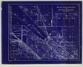
Waterway Connecting Puget Sound with Lakes Union and Washington, sheet 8, November 1904
Since the city's earliest days, Seattleites proposed canals to cheaply and easily move logs, coal, and other resources between Elliott Bay and Lake Washington. Possible routes extended from the Black River at the south end of Lake Washington to canals through Lake Union and Shilshole Bay in the north. A 1891 report commissioned by the federal government explored five possible…
ID Number:2019.3.11.9
Date:1904
Cartographic material
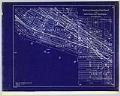
Waterway Connecting Puget Sound with Lakes Union and Washington, sheet 9, November 1904
Since the city's earliest days, Seattleites proposed canals to cheaply and easily move logs, coal, and other resources between Elliott Bay and Lake Washington. Possible routes extended from the Black River at the south end of Lake Washington to canals through Lake Union and Shilshole Bay in the north. A 1891 report commissioned by the federal government explored five possible…
ID Number:2019.3.11.10
Date:1904
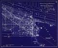
Cartographic material
Waterway Connecting Puget Sound with Lakes Union and Washington, sheet 10, November 1904
Since the city's earliest days, Seattleites proposed canals to cheaply and easily move logs, coal, and other resources between Elliott Bay and Lake Washington. Possible routes extended from the Black River at the south end of Lake Washington to canals through Lake Union and Shilshole Bay in the north. A 1891 report commissioned by the federal government explored five possible…
ID Number:2019.3.11.11
Date:1904
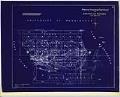
Cartographic material
Waterway Connecting Puget Sound with Lakes Union and Washington, sheet 11, circa 1905
Since the city's earliest days, Seattleites proposed canals to cheaply and easily move logs, coal, and other resources between Elliott Bay and Lake Washington. Possible routes extended from the Black River at the south end of Lake Washington to canals through Lake Union and Shilshole Bay in the north. A 1891 report commissioned by the federal government explored five possible…
ID Number:2019.3.11.12
Date:Circa 1905
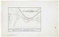
Cartographic material
Map of Lake Washington Canal Entrance and Profile of Lake Washington Canal, Seattle, circa 1911
Since the city's earliest days, Seattleites proposed canals to cheaply and easily move logs, coal, and other resources between Elliott Bay and Lake Washington. Possible routes extended from the Black River at the south end of Lake Washington to canals through Lake Union and Shilshole Bay in the north. A 1891 report commissioned by the federal government explored five possible…
ID Number:2019.3.49
Date:Circa 1911
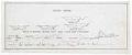
Cartographic material
North Canal section drawings, Seattle, circa 1911
Since the city's earliest days, Seattleites proposed canals to cheaply and easily move logs, coal, and other resources between Elliott Bay and Lake Washington. Possible routes extended from the Black River at the south end of Lake Washington to canals through Lake Union and Shilshole Bay in the north. A 1891 report commissioned by the federal government explored five possible…
ID Number:2019.3.50
Date:Circa 1911
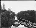
Photograph
Montlake canal, Seattle, circa 1900
Before the building of the Lake Washington Ship Canal, a small canal connected Lake Washington with Lake Union's Portage Bay. This photo shows the canal in the Montlake area. Caption on image: S.P.Co.Photographer's Reference Number: 1587
ID Number:Lib1988.33.30
Date:Circa 1900
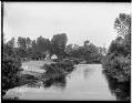
Photograph
Black River, near Renton, circa 1898
The Black River, at the south end of Lake Washington, was once the lake's main drainage channel. It was also the main route for commerce between the lakeside towns and Seattle on Elliott Bay. In the 1910s, the building of the Lake Washington Ship Canal changed the drainage pattern of the lake, and the Black River slowly disappeared. The old…
ID Number:Lib1988.33.92
Date:Circa 1898