171 results for: Lake Washington Ship Canal
Photograph
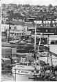
Fishing and industry in Ballard, July 12, 1976
Seattle's Ballard neighborhood was a city in its own right between 1890 and 1906. The first claim in the future city and neighborhood of Ballard was filed in 1852, the same year settlers arrived in Seattle itself. Development proceeded slowly until the influx of immigrants escaping famine and tensions in Scandinavia provided a skilled work force for local mills and…
ID Number:2000.107.165.09.02
Date:1976
Photograph
Fisherman's Terminal, Seattle, February 21, 1952
On May 17, 1952 the Port of Seattle's Fishermen's Terminal at Salmon Bay between the Interbay and Ballard neighborhoods was rededicated as the home of the Pacific Northwest fishing fleet after an expansion and modernization that allowed for moorage, drydock, repair, maintenance, and supply facilities for 1,000 vessels. This image of fishing boats docked at Fishermen's Terminal was taken facing…
ID Number:2000.107.171.31.01
Date:1952
Photograph
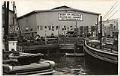
Band playing at Fisherman's Festival, Seattle, September 19, 1937
This image was taken during a performance by the Seattle Symphonic Band at the Fisherman's Festival, held September 17-18, 1937, at the Port of Seattle's Fishermen's Terminal (then Fishermen's Dock) at Salmon Bay between the Interbay and Ballard neighborhoods. The large storage shed, visible behind the revelers, had recently been competed for fishermen to hang their nets and other gear…
ID Number:2000.107.171.31.02
Date:1937
Photograph
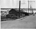
Abandoned Fremont railroad station, Seattle, July 28, 1948
This derelict railroad station in Seattle's Fremont neighborhood is located just east of the George Washington Memorial Bridge (commonly called the Aurora Bridge), which is visible in the background of this image. The small depot building was remodeled and is still standing at the foot of Stone Way North as of 2017. The station was probably part of the Seattle,…
ID Number:2000.107.173.03.01
Date:1948
Photograph
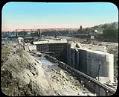
Ballard locks under construction, Seattle, ca. 1915
Ground was broken for the Lake Washington Ship Canal locks in 1911, and the first concrete was poured for the lock chambers in 1913. The first ship traveled through the locks in 1916. This photo, taken about 1915, shows the two lock chambers under construction. The main waterway has been diverted around the construction site. Handwritten on mount: Building the…
ID Number:2002.3.2022
Date:Circa 1915
Photograph
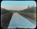
Montlake cut under construction, Seattle, circa 1915
The Lake Washington Ship Canal followed the routes of earlier canals and streams which connected Lake Washington, Lake Union, and Salmon Bay. This view looks west through the Montlake Cut towards the north end of Capitol Hill. Handwritten on mount: Canal Excavation - Tapping Lake Washington, Seattle. Lake Wash. Ship Canal, excavation.
ID Number:2002.3.2023
Date:Circa 1915
Photograph
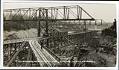
Lake Washington Ship Canal under construction, Seattle, circa 1914
The Lake Washington Ship Canal followed the routes of earlier canals and streams which connected Lake Washington, Lake Union, and Salmon Bay. This photo shows a large construction site for the canal in Ballard. Caption on image: Working on government canal, Ballard, Seattle, Washington. Handwritten on verso: Ballard, WA.Publisher's Number: 130
ID Number:2002.48.945
Date:Circa 1914
Postcard
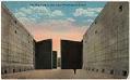
Empty chamber in Ballard Locks, Seattle, circa 1917
For years, there was no easy or cheap way to move logs, coal, and other resources directly from the east side of Lake Washington to Elliott Bay. There were many plans and several attempts to build a canal via Lake Union. However, none was successful until the Lake Washington Ship Canal was built in 1911 to 1917. The Hiram Chittenden…
ID Number:2002.48.947
Date:Circa 1917
Photograph
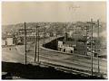
Temporary Fremont Bridge, Seattle, March 18, 1915
The original bridge to Fremont was razed in 1911 to make way for the dredging of the Lake Washington Ship Canal; during this time, all traffic was rerouted to the temporary Stone Way Bridge, just five blocks to the east. A second temporary bridge served the original gap until 1915, when traffic was again rerouted to the Stone Way Bridge…
ID Number:2006.7.1
Date:1915
Photograph
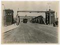
Fremont Bridge on opening day, Seattle, June 15, 1917
The original Fremont Bridge was razed in 1911 to make way for the dredging of the Lake Washington Ship Canal, and a new permanent bridge was constructed to connect Fremont Avenue North in Fremont and Fourth Avenue North in Queen Anne. The new bridge is one of four double-leaf bascule bridges that carry vehicle and pedestrian traffic across the Lake…
ID Number:2006.7.2
Date:1917