157 results for: Aerial Views
Photograph
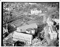
Aerial view of University of Washington central plaza, Seattle, 1948
Founded in 1861, the Territorial University of Washington was located in downtown Seattle until 1895, when the campus relocated north of Lake Union in what is now know as the University District. This aerial view looks north over Suzzallo Library towards Parrington Hall. The Central Plaza, the large open space in front of Suzzallo Library, was excavated in 1969 for…
ID Number:1986.5.15717.4
Date:1948
Photograph
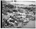
Aerial view of U.W. School of Medicine under construction, looking northeast, Seattle, 1948
The University of Washington, founded in 1861 is one of the oldest public universities in the western United States. This view shows Union Bay and Husky Stadium at the top of the photo and the Health Sciences Building under construction on the shores of Portage Bay. The U.W. School of Medicine, School of Dentistry, and School of Pharmacy would eventually…
ID Number:1986.5.15719.1
Date:1948
Photograph
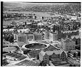
Aerial view of University of Washington campus, looking southwest, Seattle, 1948
The University of Washington, founded in 1861, is one of the oldest public universities in the western United States. This view shows Geyser Basin, also known as Frosh Pond. Today the pond contains Drumheller Fountain, built in 1961. Designed by John C. Olmsted for the the 1909 Alaska-Yukon-Pacific Exposition, the Basin was a focal point along a vista that drew…
ID Number:1986.5.15719.2
Date:1948
Photograph
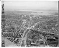
Aerial view of the University of Washington looking east, Seattle, 1949
This view towards Lake Washington shows the University of Washington campus, the University District and University Bridge. Handwritten on sleeve: WASHINGTON UNIVERSITY, (U.W.) Campus, airview. Date photograph was filed by the Seattle Post-Intelligencer (date of photograph and file date may differ by a month or more): December 21, 1949.
ID Number:1986.5.15832.1
Date:1949
Photograph
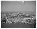
Aerial view of the University of Washington looking north, Seattle, 1955
This aerial view shows the Showboat Theatre, the UW Fisheries Department, and the UW Medical Center along the shores of Portage Bay. The University of Washington campus is visible in the center of the photo. Handwritten on sleeve: WASHINGTON UNIVERSITY, (U.W), Campus, airview. Date photograph was filed by the Seattle Post-Intelligencer (date of photograph and file date may differ by…
ID Number:1986.5.15838.1
Date:1955
Photograph
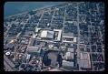
Aerial view of the Seattle World's Fair grounds, 1962
The Century 21 Exposition (also known as the Seattle World's Fair) ran from April 21, 1962, to October 21, 1962. Nearly 10 million people attended the fair. As planned, the exposition left behind a fairground and numerous public buildings and public works; some credit it with revitalizing Seattle's economic and cultural life. The site, slightly expanded since the fair, is…
ID Number:1987.59.131.60
Date:1962
Photograph
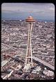
Aerial view of the Space Needle, Seattle, 1962
Designed by architect John Graham, the Space Needle is easily the most recognizable structure built for the 1962 Century 21 Exposition (Seattle World's Fair). The Space Needle was built in less than one year for 4.5 million dollars by the Howard S. Wright Construction Company. The top of the Needle is 605 feet high, with the main observation deck at…
ID Number:1987.59.131.61
Date:1962
Photograph
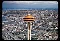
Aerial view, looking northeast, of the top of the Space Needle, Seattle, 1962
Designed by architect John Graham, the Space Needle is easily the most recognizable structure built for the 1962 Century 21 Exposition (Seattle World's Fair). The Space Needle was built in less than one year for 4.5 million dollars by the Howard S. Wright Construction Company. The top of the Needle is 605 feet high, with the main observation deck at…
ID Number:1987.59.131.63
Date:1962
Photograph
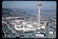
Aerial view, looking north, of the Space Needle and Seattle World's Fair grounds, 1962
The Century 21 Exposition (also known as the Seattle World's Fair) ran from April 21, 1962, to October 21, 1962. Nearly 10 million people attended the fair. As planned, the exposition left behind a fairground and numerous public buildings and public works; some credit it with revitalizing Seattle's economic and cultural life. The site, slightly expanded since the fair, is…
ID Number:1987.59.131.66
Date:1962
Photograph
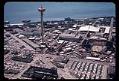
Aerial view, looking west, of the Space Needle and Seattle World's Fair grounds with Elliott Bay, 1962
The Century 21 Exposition (also known as the Seattle World's Fair) ran from April 21, 1962, to October 21, 1962. Nearly 10 million people attended the fair. As planned, the exposition left behind a fairground and numerous public buildings and public works; some credit it with revitalizing Seattle's economic and cultural life. The site, slightly expanded since the fair, is…
ID Number:1987.59.131.130
Date:1962