157 results for: Aerial Views
Photograph
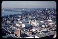
Aerial view, looking northwest, of the U.S. Science Pavilion and the Seattle World's Fair grounds, with Elliott Bay, 1962
The Century 21 Exposition (also known as the Seattle World's Fair) ran from April 21, 1962, to October 21, 1962. Nearly 10 million people attended the fair. As planned, the exposition left behind a fairground and numerous public buildings and public works; some credit it with revitalizing Seattle's economic and cultural life. The site, slightly expanded since the fair, is…
ID Number:1987.59.131.131
Date:1962
Postcard
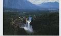
Aerial of Snoqualmie Falls, near Snoqualmie, circa 1965
The Snoqualmie River drops 268 feet at Snoqualmie Falls. The waterfall was spiritually important to the Snoqualmie people who once lived in the area and was a scenic wonder to the settlers who came later. After the Seattle, Lake Shore, and Eastern Railway was built along the south shore in 1889, the falls became a popular place for day trips…
ID Number:1994.27.160
Date:Circa 1965
Photograph
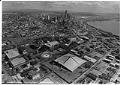
Aerial view of Seattle Center, April, 1987
Twenty-five years after the Seattle Center was created for the Century 21 Exposition (Seattle Worlds' Fair) the city council endorsed plans to replace the International Fountain with a small watercourse and plazas, to replace Memorial Stadium with a meadow-covered underground parking lot, and to replace the Center House with an amphitheater. These specific plans did not come to fruition, however…
ID Number:2000.107.168.23.03
Date:1987
Photograph
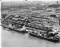
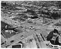
Aerial view of Foreign Trade Zone, Seattle, September 21, 1949
Foreign-Trade Zones (FTZs) are duty-free, quota-free, secured areas in a designated customs “port of entry,” considered outside U. S. Customs territory and exempt from customs tariffs. The FTZ program was established in 1934 to stimulate economic growth and development in the United States by lowering the cost of international trade.This image shows two ships docked at Seattle's FTZ: the French…
ID Number:2000.107.173.01.03
Date:1949
Photograph
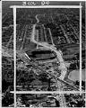
Aerial view of South Lake Union neighborhood looking northeast, 1953
The shores of Lake Union were inhabited by the Duwamish people since time immemorial. They called the lake “meman hartshu” meaning “little lake” and had several settlements surrounding it. Seattle’s Cascade or South Lake Union (SLU) neighborhood began growing quickly in the 1880s, as the city expanded north from downtown. Industrial activity on the lake increased in the early 1900s…
ID Number:2000.107.188.36.01
Date:1953
Photograph
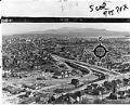
Aerial view of Empire Way and Sick's Stadium, July 11, 1953
Empire Way’s route was first laid out in 1913, as a state highway heading southeast out of Seattle. It was named for James J. Hill, the head of the Great Northern Railway, who was nicknamed the “Empire Builder.” At first, Empire Way was put together from parts of older roads on the same route. From the 1930s to the 1950s,…
ID Number:2000.107.189.11.01
Date:1953
Photograph
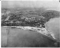
View of Rainier Avenue and Lake Way looking east, March 1954
Seattle's Atlantic neighborhood (which has also been referred to as Yesler/Atlantic and Judkins Park) is a triangular community in the Central District area, between Mount Baker Ridge and Beacon Hill. One of oldest residential neighborhoods, it was home to Seattle's largest Italian enclaves during the early years of the twentieth century. Like other neighborhoods in central and southeast Seattle, Black…
ID Number:2000.107.189.16.01
Date:1954
Photograph
Aerial view of Fort Lawton and Magnolia, Seattle, April 24, 1964
In 1897, the city of Seattle donated land on Magnolia Bluff to the US government to build a new Army post as part of a defense system for Puget Sound; this was designated as Fort Lawton in 1900. During most of its active service, the fort served as an embarkation station where troops gathered before being sent to duty in…
ID Number:2000.107.216.25.01
Date:1964
Photograph
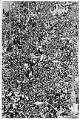
Sonics victory parade after winning NBA championship, Seattle June 4, 1979
On June 4, 1979, Seattle honored the SuperSonics victory in the NBA championship with a celebratory 16-block parade from the Kingdome to University Plaza. An estimated 300,000 spectators lined the parade route, with some perched precariously on roofs, window ledges, and street signs to see the cars bearing NBA Hall of Fame coach Lenny Wilkens and the Sonics players, including…
ID Number:2000.107.240.02.01
Date:1979
Photograph
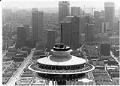
Musicians performing atop Space Needle, Seattle, August 26, 1988
In this image, two members of the Mendelssohn String Quartet perform on the top of Seattle's Space Needle to publicize the Santa Fe Chamber Music Festival, held at Meany Theater August 26 - September 1, 1988. Caption information derived from captions written by Post-Intelligencer staff and attached to the back of the photograph.
ID Number:2000.107.264.03.01
Date:1988