157 results for: Aerial Views
Photograph
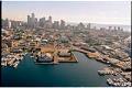
Aerial view of South Lake Union neighborhood looking south, September 28, 1993
The shores of Lake Union were inhabited by the Duwamish people since time immemorial. They called the lake “meman hartshu” meaning “little lake” and had several settlements surrounding it. Seattle’s Cascade or South Lake Union (SLU) neighborhood began growing quickly in the 1880s, as the city expanded north from downtown. Industrial activity on the lake increased in the early 1900s…
ID Number:2000.107.19930928.8.21
Date:1993
Postcard
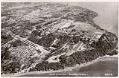
Aerial of Fort Lawton from northwest, Seattle, circa 1940
In 1897, the city of Seattle donated land on Magnolia Bluff to the US government to build a new Army post as part of a defense system for Puget Sound; this was designated as Fort Lawton in 1900. During most of its active service, the fort served as an embarkation station where troops gathered before being sent to duty in…
ID Number:2002.48.823
Date:Circa 1940
Photograph
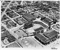
Aerial view of Washington State Coliseum construction site showing original buildings, Seattle, 1960
The Howard S. Wright Construction Company broke ground for the Washington State Coliseum (now Key Arena) on May 12, 1960. This aerial photograph depicts the surrounding city and fairgrounds, including the original Stadium, Ice Arena, and Armory buildings prior to renovation for the Century 21 Exposition. Stamped on verso with business stamp of Jesse Ebert Photographers, 3225 California Avenue Southwest,…
ID Number:2004.48.2.7
Date:1960
Photograph
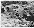
Aerial view of Washington State Coliseum construction site, Seattle, 1960
The Howard S. Wright Construction Company broke ground for the Washington State Coliseum (now Key Arena) on May 12, 1960. This aerial photograph, probably taken during the summer of 1960, shows a view of the concrete pour wooden framework, and the first V-shaped concrete pillars erected. Stamped on verso with business stamp of Jesse Ebert Photographers, 3225 California Avenue Southwest,…
ID Number:2004.48.4.11
Date:1960
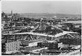
Photograph
Century 21 Exposition fairgrounds, with view of Washington State Coliseum construction site, Seattle, 1961
This aerial view shows the Washington State Coliseum (now Key Arena) construction site and the surrounding fairgrounds and city, looking south, with the Smith Tower visible in the upper left corner. The image depicts the completed steel and concrete supporting structures and reinforcing girders in place shortly before completion of the roof.
ID Number:2004.48.8.4
Date:1961
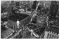
Photograph
Aerial photograph of Bon Marché with Christmas star and downtown extending east and north, Seattle, circa 1965
The Bon Marché was founded in 1890 by German immigrant Edward Nordhoff and his wife Josephine. Originally located in Seattle’s Belltown district at First Avenue and Cedar Street, in 1896 it moved to a more central location downtown at Second Avenue and Pike Street. The holiday star hangs annually on the corner of the Bon Marché building at Fourth Avenue…
ID Number:2009.20.74
Date:Circa 1965
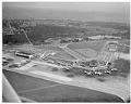
Photograph
Aerial view of Seattle-Tacoma International Airport, March 7, 1959
On March 7, 1942, three months after Japan attacked Pearl Harbor, the Port of Seattle undertook development of Seattle-Tacoma International Airport at the urging of the federal government. A new airport was desperately needed to help relieve pressure on Seattle’s Boeing Field and Tacoma’s McChord Field, which were commandeered for warplane production and military use in World War II. Sea-Tac’s…
ID Number:2009.23.21
Date:1959
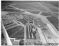
Photograph
Aerial view of Seattle-Tacoma International Airport, May 8, 1959
On March 7, 1942, three months after Japan attacked Pearl Harbor, the Port of Seattle undertook development of Seattle-Tacoma International Airport at the urging of the federal government. A new airport was desperately needed to help relieve pressure on Seattle’s Boeing Field and Tacoma’s McChord Field, which were commandeered for warplane production and military use in World War II. Sea-Tac’s…
ID Number:2009.23.23
Date:1959
Photograph
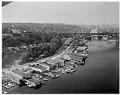
Aerial view of Aurora Bridge over Lake Union, Seattle, April 1960
The Aurora Bridge (officially the George Washington Memorial Bridge) is a cantilever and truss bridge that carries State Route 99 (Aurora Avenue North) over the west end of Seattle's Lake Union. Construction on the bridge piers began in 1929, and the bridge was opened to traffic on February 22, 1932, George Washington's 200th birthday. It was listed on the National…
ID Number:2009.23.31
Date:1960
Photograph
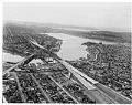
Aerial view of Freeway Bridge during Interstate 5 construction, Seattle, January 1961
Interstate 5 (I-5) is the main Interstate Highway on the West Coast of the United States, and Seattle's widest freeway. The section of I-5 connecting Kent to Seattle to Everett was built between 1960-1966, including "Freeway Bridge," shown in this aerial photograph taken in 1961. The direction of the photograph is looking south and slightly west over Lake Union towards…
ID Number:2009.23.57
Date:1961