157 results for: Aerial Views
Photograph
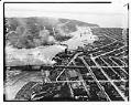
Aerial view of Ballard looking west, Seattle, 1937
The first Ballard Bridge opened in December 1917, crossing the Lake Washington Ship Canal and linking the Ballard district by road to Seattle. This aerial photo shows the Ballard Bridge and Salmon Bay, with the Hiram M. Chittenden Locks and Puget Sound at the top of the image. Log rafts floating in the bay are visible at the bottom left…
ID Number:1986.5.7332.1
Date:1937
Photograph
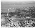
Aerial of Evergreen Point Bridge under construction from west, Seattle, 1963
Washington's Evergreen Point Floating Bridge carries State Route 520 across Lake Washington, connecting Seattle with the growing area east of the lake. When it opened, the bridge's 7,578 foot floating span was the longest in the world. This was the second floating bridge to cross Lake Washington, and both bridges are overcrowded daily with commuters in their automobiles. This photo…
ID Number:1986.5.7595.4
Date:1963
Photograph
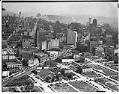
Aerial view of Seattle's business district, 1937
This view looking southeast towards First Hill includes Fifth Avenue and Olive Way. Downtown Seattle is visible at the top of the photo. Handwritten on sleeve: SEATTLE, Business district, airviews.
ID Number:1986.5.7723.1
Date:1937
Photograph
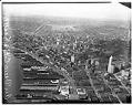
Aerial view of downtown Seattle looking northeast, 1937
Handwritten on negative: Air views City of Seattle. Handwritten on sleeve: SEATTLE, Business district, airviews. Date photograph was filed at the Seattle Post-Intelligencer (date of photograph and file date may differ by a month or more): 1937
ID Number:1986.5.7723.2
Date:1937
Photograph
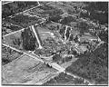
Aerial view of Firland Sanatorium, Shoreline, May 1938
Firland Sanatorium, Seattle’s municipal tuberculosis hospital, opened on May 2, 1911, to help combat what was at the time Seattle’s leading cause of death. Firland was located north of Seattle, on land donated by railroad magnate Horace C. Henry (1844-1928), whose son Walter had died of TB. The hospital served there until its move in 1947 to a former Naval…
ID Number:1986.5.9372.1
Date:1938
Photograph
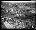
Aerial view of Museum of History & Industry, Seattle, 1952
The Museum of History & Industry opened its doors on February 15, 1952, just south of the Montlake cut. The original south entrance circular driveway disappeared with the construction of the Evergreen Point Floating Bridge and State Route 520 that opened on August 28, 1963. Other modifications included blocking out the southerly windows of the transportation ramp on the west…
ID Number:1986.5.9955.1
Date:1952
Photograph
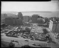
Aerial of Seattle Public Library under construction from northeast, Seattle, 1959
Since 1906 Seattle Public Library's central branch has been located at 1000 Fourth Avenue. The original Carnegie building was demolished after 50 years of service to make way for the second Central Library. This southwest view over Fifth Avenue shows the early construction stages of the new library that opened in 1960. Handwritten on sleeve: SEATTLE PUBLIC LIBRARY, New, construction.Date…
ID Number:1986.5.11240.1
Date:1959
Photograph
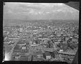
Aerial view of the Alaskan Way Viaduct, Seattle, 1953
Seattle's Alaskan Way Viaduct carried traffic over the waterfront area, linking the northern part of the city to the industrial area south of the central business district. The first unit of the elevated roadway, from Battery Street to Dearborn Street, was completed in 1953 and a southern extension in 1959. The Viaduct closed in January 2019 after being replaced by…
ID Number:1986.5.12214.1
Date:1953
Photograph
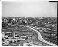
Aerial of Alaskan Way Viaduct extension south to Spokane Street with a view northeast toward Seattle, 1959
Seattle's Alaskan Way Viaduct carried traffic over the waterfront area, linking the northern part of the city to the industrial area south of the central business district. The first unit of the elevated roadway, from Battery Street to Dearborn Street, was completed in 1953 and a southern extension in 1959. The Viaduct closed in January 2019 after being replaced by…
ID Number:1986.5.12223.1
Date:1959
Photograph
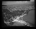
Aerial view of Aqua Theatre, Seattle, 1950
Seattle's Aqua Theatre, an open air stadium at the south end of Green Lake, began hosting performances during the summer of 1950. Sell out crowds enjoyed the premier act of that first season, The Aqua Follies, which included water ballet, musical groups and high-diving clowns. Due to its great success, in 1960 the seating area was expanded. However, in 1964…
ID Number:1986.5.12603.1
Date:1950