157 results for: Aerial Views
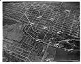
Photograph
Aerial view looking down on nine Martin bombers in formation, 1938
Date photograph was filed at the Seattle Post-Intelligencer (date of photograph and file date may differ by a month or more): August 9, 1938
ID Number:1986.5.255.3
Date:1938
Photograph
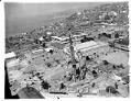
Aerial view, looking northwest, of the construction of the Space Needle, Seattle, 1961
Designed by architect John Graham, the Space Needle is easily the most recognizable structure built for the 1962 Century 21 Exposition (Seattle World's Fair). The Space Needle was built in less than one year for 4.5 million dollars by the Howard S. Wright Construction Company. The top of the Needle is 605 feet high, with the main observation deck at…
ID Number:1986.5.2794.1
Date:1961
Photograph
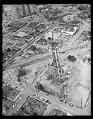
Aerial view of construction of the Space Needle, Seattle, 1961
Designed by architect John Graham, the Space Needle is easily the most recognizable structure built for the 1962 Century 21 Exposition (Seattle World's Fair). The Space Needle was built in less than one year for 4.5 million dollars by the Howard S. Wright Construction Company. The top of the Needle is 605 feet high, with the main observation deck at…
ID Number:1986.5.2795.2
Date:1961
Photograph
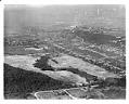
Aerial view of the West Seattle Golf Course, looking northeast, 1937
Henry Chandler Egan, famed architect and accomplished player, laid out the original design for West Seattle Golf Course in 1935. It opened in May of 1940, and continues to operate as one of Seattle's municiple golf courses. Written on sleeve: GOLF, Seattle, West Seattle Course, airview Date photograph was filed at the Seattle Post-Intelligencer (date of photograph and file date…
ID Number:1986.5.3780.1
Date:1937
Photograph
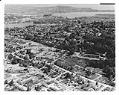
Aerial view, looking northeast, of the construction of Interstate 5, Lakeview Boulevard section, Seattle, circa 1958
The 1956 Federal-Aid Highway Act kicked off the Interstate construction program. Completed in the 1960s, Interstate-5 (I-5), of which the Tacoma-Seattle-Everett Freeway forms a part, is the only Interstate highway running from Canada to Mexico. Written on sleeve: HIGHWAYS, Freeway, Seattle, right-of-way, Lakeview BLVD. section, airview Date photograph was filed at the Seattle Post-Intelligencer (date of photograph and file date…
ID Number:1986.5.3992.1
Date:Circa 1958
Photograph
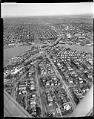
Aerial of freeway bridge under construction, Seattle, 1959
This aerial view shows the initial construction phase of the Tacoma-Seattle-Everett Freeway that was to become Interstate 5 (I-5). Bridge piers stand on either side of the Lake Washington Ship Canal. The University Bridge sits to the right of the new piers, which were used to construct a 4,429-foot-long bridge completed in fall 1961. Construction of the Tacoma-Seattle-Everett freeway, which…
ID Number:1986.5.3998.1
Date:1959
Photograph
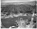
Aerial view looking north from the freeway bridge under construction, Seattle, 1959
This aerial view shows construction phase of the Tacoma-Seattle-Everett Freeway that was to become Interstate 5 (I-5). Bridge piers stand on either side of the Lake Washington Ship Canal. The 4,429-foot-long bridge completed in fall 1961.Construction of the Tacoma-Seattle-Everett freeway, which opened to traffic in December 1962, took up 6,600 parcels of land, 4,500 of them in Seattle. In 1958-59,…
ID Number:1986.5.4000.2
Date:1959
Photograph
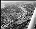
Aerial of freeway construction, Seattle, 1967
This aerial view shows the construction of the Tacoma-Seattle-Everett Freeway that was to become Interstate 5 (I-5). Construction of the Tacoma-Seattle-Everett freeway, which opened to traffic in December 1962, took up 6,600 parcels of land, 4,500 of them in Seattle. In 1958-59, the Washington State Highway Department paid homeowners fair market value for their homes, then auctioned the buildings for…
ID Number:1986.5.4077.1
Date:1967
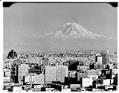
Photograph
Mount Rainier from downtown Seattle, July 1960
This photo was taken with infrared film.Date photograph was filed at the Seattle Post-Intelligencer (date of photograph and file date may differ by a month or more): July 18, 1960
ID Number:1986.5.5747.1
Date:1960
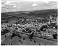
Photograph
Aerial view of Redmond, Washington, September 14, 1956
Located 16 miles east of Seattle, Redmond has a long history of prosperity from its early logging days to currently being a worldwide center for technology. In this aerial photo, the downtown core as well as roads and rail lines leading to it are visible. Handwritten on sleeve: REDMOND, Wash., Airview. Date photograph was filed at the Seattle Post-Intelligencer (date…
ID Number:1986.5.6655.1
Date:1956