1580 results for: City of Seattle
Ephemera
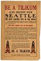
Golden Potlatch advertisement, 1913
The Tilikums of Elttaes were a fraternal, civic organization composed primarily of influential white Seattle area businessmen, who used Native American imagery to promote tourism and the economic development of the city. In July 1911 the Tilikums ("Friends" in Chinook Jargon; Elttaes is Seattle spelled backward) organized the first Golden Potlatch celebration. The Golden Potlatch was a city-wide festival held…
ID Number:2018.3.3.42
Date:1913
Ephemera
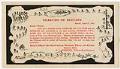
Tilikums of Elttaes invitation, 1912
The Tilikums of Elttaes were a fraternal, civic organization composed primarily of influential white Seattle area businessmen, who used Native American imagery to promote tourism and the economic development of the city. In July 1911 the Tilikums ("Friends" in Chinook Jargon; Elttaes is Seattle spelled backward) organized the first Golden Potlatch celebration. The Golden Potlatch was a city-wide festival held…
ID Number:2018.3.3.43
Date:1912
Program
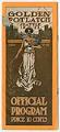
Golden Potlatch program, 1911
The Tilikums of Elttaes were a fraternal, civic organization composed primarily of influential white Seattle area businessmen, who used Native American imagery to promote tourism and the economic development of the city. In July 1911 the Tilikums ("Friends" in Chinook Jargon; Elttaes is Seattle spelled backward) organized the first Golden Potlatch celebration. The Golden Potlatch was a city-wide festival held…
ID Number:2018.3.3.44
Date:1911
Postcard
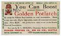
Golden Potlatch booster advertisement, 1912
The Tilikums of Elttaes were a fraternal, civic organization composed primarily of influential white Seattle area businessmen, who used Native American imagery to promote tourism and the economic development of the city. In July 1911 the Tilikums ("Friends" in Chinook Jargon; Elttaes is Seattle spelled backward) organized the first Golden Potlatch celebration. The Golden Potlatch was a city-wide festival held…
ID Number:2018.3.3.45
Date:1912
Ephemera
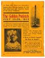
Golden Potlatch advertisement, 1912
The Tilikums of Elttaes were a fraternal, civic organization composed primarily of influential white Seattle area businessmen, who used Native American imagery to promote tourism and the economic development of the city. In July 1911 the Tilikums ("Friends" in Chinook Jargon; Elttaes is Seattle spelled backward) organized the first Golden Potlatch celebration. The Golden Potlatch was a city-wide festival held…
ID Number:2018.3.3.46
Date:1912
Program
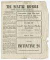
The Seattle Referee, November 3, 1916
The issue of "The Seattle Referee" pictured here was published as a program for a boxing match between William August "Willie" Hoppe (b.1890) of San Francisco and "Smilin' George" Ingle of Seattle. The date on this program, November 3, 1915, is a misprint. The bout actually took place on Friday, November 3, 1916, at the Dreamland Pavilion in Seattle, and…
ID Number:2018.3.3.54
Date:1916
Program
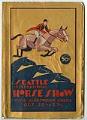
Seattle International Horse Show program, October 1928
The Seattle International Horse Show was first held in 1928 at the city's recently constructed Civic Auditorium (site of the present-day Seattle Center). The show was held annually until 1969, featuring events governed by the Association of American Horse Shows (now the United States Equestrian Federation or USEF). The program pictured here is from the first show, October 20-27, 1928.
ID Number:2018.3.3.56
Date:1928
Correspondence
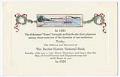
Dexter Horton National Bank Christmas card, 1920
Seattle pioneer Dexter Horton (1825-1904) arrived in Washington Territory in 1853, and after working at his uncle Henry Yesler's mill, opened a general store in Seattle. He also served as an informal banker, making loans and accepting deposits from loggers, trappers, and others. In 1870, Horton opened the city's first official bank, and in 1876, he built the city's first…
ID Number:2018.3.3.60
Date:1920
Ephemera
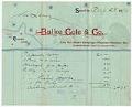
Balke, Cole, & Co. account statement, August 28, 1890
According to the 1890 Polk Directory, Balke, Cole, & Co. was located at 1217 and 1219 Front Street (now First Avenue) in downtown Seattle. Proprietors Francis Cole, Rudolph L. Balke, and Walter James Coffman (1867-1898) sold mirrors, pictures, and art material. The receipt pictured here details sales made to John Leary totaling $24.35 (about $650 in 2018). Lawyer, businessman, and…
ID Number:2018.3.3.62
Date:1890
Ephemera
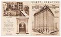
New Washington Hotel brochure, circa 1925
In 1908, real estate investors John Edward Chilberg (1867-1954) and James Crawford Marmaduke (1871-1945) opened the New Washington Hotel on the northeast corner of Stewart Street and Second Avenue in what is now Seattle's Belltown neighborhood. As the city's premier hotel for several decades the New Washington Hotel welcomed many prominent guests over the years, including four U. S. Presidents…
ID Number:2018.3.3.71
Date:Circa 1925