1580 results for: City of Seattle
Ephemera
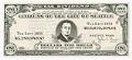
Dollars for bread instead of dollars for taxes flier, 1933
John Francis Dore (1881-1938) served as Mayor of Seattle twice during the Great Depression. Thousands of people were out of work, and many families had lost their homes, overwhelming the traditional city, county, and private relief agencies. Confidence in the economic and political systems was shaken and Mr. Dore won the mayoral election on March 8, 1932 when he proposed…
ID Number:2018.3.3.16
Date:1933
Ephemera
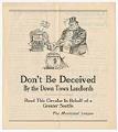
"Don't be deceived by the down town landlords" leaflet, 1912
The Municipal Plans Commission of Seattle, established in 1910, hired civil engineer Virgil G. Bogue to prepare a strategic development plan for the city. Bogue’s 1911 proposal was very ambitious, including a Civic Center in the Denny Regrade area, a park and boulevard system, separation of railroad tracks from streets, and a variety of other municipal improvements. The plan, as…
ID Number:2018.3.3.17
Date:1912
Ephemera
Keep the ball rolling for Cotterill campaign advertisement, circa 1910
George Fletcher Cotterill (1865-1958), born in Oxford, England, was an American civil servant and politician. He came to Seattle in 1883 and found work as a civil engineer, and later ran for various city and state offices. He served as a state senator from 1906 to1910, as mayor of Seattle from 1912 to 1914, as chief engineer of the State…
ID Number:2018.3.3.18
Date:Circa 1910
Postcard
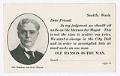
Vote for Ole Hanson postcard, 1918
Ole Hanson (1874-1940) was a man who packed multiple lives into one. He's best known in Washington for his role, as Seattle's mayor, in ending the city's General Strike of 1919, but he's also well known for founding the city of San Clemente, California, six years later. Though opportunistic and erratic, Hanson was a shrewd politician and realtor who left…
ID Number:2018.3.3.19
Date:1918
Ephemera
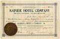
Rainier Hotel Company stock certificate, 1889
This stock certificate for the Rainier Hotel Company was issued on November 10, 1889, to Bailey Gatzert for 10 shares, valued at $500. The company owned the Rainier Hotel on Seattle's First Hill, located on Fifth Avenue between Marion Street and Columbia Street. The hotel was rushed to completion in 1889 following the Great Seattle Fire, which had destroyed much…
ID Number:2018.3.3.22
Date:1889
Ephemera
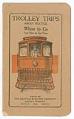
Seattle Electric Company trip guide, 1909
In 1898 the Seattle Electric Company was granted a contract to consolidate the city's 22 separate streetcar lines and private street railways. The SEC was an arm of the national Stone & Webster utility cartel, which also controlled the city’s electrical grid and operated the Puget Sound Electric Railway (PSER), an interurban line linking Tacoma, Seattle, and Everett. Due to…
ID Number:2018.3.3.25
Date:1909
Ephemera
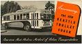
Seattle trolley coach brochure, 1940
In 1940, the Transportation Commission of the City of Seattle (now King County Metro) debuted Seattle's trolley bus system, which in 2018 is the second largest in the country. This leaflet announces the new trolley coaches added to Seattle's public transportation system, billed as "America's Most Modern Method of Urban Transportation." Caption information source: "Metro: Municipality of Metropolitan Seattle," by…
ID Number:2018.3.3.27
Date:1940
Program
Chief Seattle Day program, 1915
The Tilikums of Elttaes were a fraternal, civic organization composed primarily of influential white Seattle area businessmen, who used Native American imagery to promote tourism and the economic development of the city. In 1912 the Tilikums ("Friends" in Chinook Jargon; Elttaes is Seattle spelled backward) organized the first Potlatch celebration (an early version of Seafair) and financed the statue of…
ID Number:2018.3.3.32
Date:1915
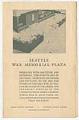
Program
Seattle War Memorial Plaza opening program, January 1951
During World War II, the King County War Finance Committee's Victory Square in downtown Seattle was a gathering place and symbol of Seattle's war efforts. After the war, Mayor William F. Devin (1898-1982) established a War Memorial Committee who oversaw design and construction of a memorial plaza that was built as part of the new Public Safety Building. The building…
ID Number:2018.3.3.34
Date:1951
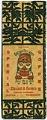
Ephemera
Golden Potlatch themed coffee bag, 1912
The Tilikums of Elttaes were a fraternal, civic organization composed primarily of influential white Seattle area businessmen, who used Native American imagery to promote tourism and the economic development of the city. In July 1911 the Tilikums ("Friends" in Chinook Jargon; Elttaes is Seattle spelled backward) organized the first Golden Potlatch celebration. The Golden Potlatch was a city-wide festival held…
ID Number:2018.3.3.39
Date:1912