1580 results for: City of Seattle
Ephemera
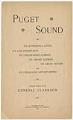
Reprint of "Puget Sound" from P-I, July 10, 1890
In June 1890, the First Assistant Postmaster General of the United States, James S. Clarkson (1842-1918) toured the Puget Sound region on behalf of the Postal Service. Appointed by President Grover Cleveland (1837-1908), a Democrat, Mr. Clarkson, a Republican, served from 1891-1892 and immediately began firing Democratic fourth-class postmasters throughout the country. Mr. Clarkson was later chairman of the Republican…
ID Number:2018.3.3.72
Date:1890
Book
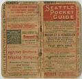
Seattle Pocket Guide, December 1900
The directory pictured here, the "Seattle Pocket Guide," was published monthly beginning in 1891, and was sold at local book stores for $0.10. The guide features helpful information about Seattle, such as the locations of the 28 fire alarm boxes and 23 police patrol boxes; time tables for the railroads, steamboats, ferries, and street car lines; lists of all elected…
ID Number:2018.3.3.73
Date:1900
Ephemera
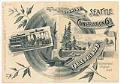
Invitation to opening of Cable Railroad, September 29, 1888
In September 1888, Seattle's second street railway line was built by Pacific Cable Construction Company as a single-track cable car line, running in a loop from Pioneer Square to Leschi Park. This line, the Yesler Way line, effectively linked the steamers docking at Elliott Bay with the ferries crossing Lake Washington. When the line was built the residential and recreational…
ID Number:2018.3.3.75
Date:1888
Ephemera
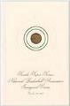
Super Sonics inaugural game reception invitation, October 20, 1967
Seattle's professional men's basketball team, the SuperSonics, played in the National Basketball Association (NBA) from 1967 until 2008, when the team relocated to Oklahoma City as the Oklahoma City Thunder. The Sonics first official NBA home game was played against the San Diego Rockets at the Seattle Center Coliseum (now KeyArena) on October 20, 1967. The invitation picture here is…
ID Number:2018.3.3.77
Date:1967
Ephemera
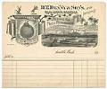
D.T. Denny & Sons receipt, 1890
Seattle pioneer David Thomas Denny (1832-1903) came to the area in 1851 and with his wife, Louisa (Boren) Denny (1827-1916), staked a claim to the future site of Seattle Center. Mr. Denny pursued a diverse career as a farmer, capitalist, streetcar operator, and developer. He was also a well-regarded civic leader, serving as probate judge, King County Commissioner, Seattle City…
ID Number:2018.3.3.79
Date:1890
Correspondence
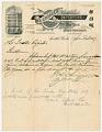
Wa Chong Company letter, April 20, 1909
On December 15, 1868, the man believed to be Seattle's first Chinese immigrant, Chun Ching Hock (1844-1927) opened the Wa Chong Company at the foot of Mill Street (now Yesler Way). The store sold imported Chinese goods, tea, rice, coffee, flour, and fireworks, but the company's most profitable business was labor contracting - recruiting and placing Chinese immigrants in domestic…
ID Number:2018.3.3.91
Date:1909
Ephemera
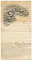
Washington Hotel stationery, 1905
The Denny Hotel project was begun in Seattle in 1889 by a group of developers that included Seattle founding father Arthur Denny (1822-1899). Unfortunately, the Panic of 1893 halted the proceedings with interiors incomplete, and the building was unfinished until 1903 when developer James A. Moore (1861-1929) bought the building at about Second Avenue and Pine Street. Mr. Moore convinced…
ID Number:2018.3.3.93
Date:1905
Ephemera
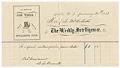
Subscription receipt for Weekly Intelligencer, January 30, 1873
Seattle's oldest newspaper, The Seattle Post-Intelligencer, was founded in 1863 as The Weekly Intelligencer (also known as Seattle Gazette), when the city of Seattle was little more than a sawmill, a few dozen buildings, and a couple of hundred people. In 1881, The Intelligencer merged with The Seattle Post and moved into the newly completed Post building, on the northeast…
ID Number:2018.3.3.94
Date:1973
Ephemera
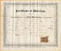
Marriage certificate of Amos Brown and Annie Peebles, November 5, 1867
Seattle's population had more than doubled in the decade since the first families founded the city in 1852, however the population largely consisted of young bachelor men who came to work in the timber and fishing industries. In the early 1860s Asa Shinn Mercer (1839-1917), first president of the Territorial University of Washington (now University of Washington) and its only…
ID Number:2018.3.3.106
Date:1867
Ephemera
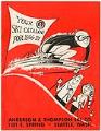
Anderson & Thompson Ski Company catalog, 1956
In the 1930s, Norwegian Jorgen Aaland experimented with making a laminated wooden ski. He lived in Seattle at the time and took his idea to Ray Anderson, a ski instructor and president of the city's General Furniture Company. Anderson developed the idea further and received a patent from the US Patent Office in May 1933. Anderson and mountaineer Ben Thompson…
ID Number:2018.3.3.110
Date:1956