1580 results for: City of Seattle
Photograph
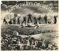
Earl Whaley's Orchestra photo collage, circa 1937
Many American jazz musicians traveled to Shanghai during the city's golden age in the 1930s, when "the Paris of the Orient" was the newest horizon on an increasingly international jazz music scene. For Black musicians, who were often excluded from white musicians' unions in the U. S. and subjected to other forms of segregation, Shanghai provided steady, well-paid work, and…
ID Number:2016.84.2.10.2
Date:Circa 1937
Photograph
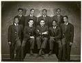
Earl Whaley's band, Shanghai, China, circa 1937
Many American jazz musicians traveled to Shanghai during the city's golden age in the 1930s, when "the Paris of the Orient" was the newest horizon on an increasingly international jazz music scene. For Black musicians, who were often excluded from white musicians' unions in the U. S. and subjected to other forms of segregation, Shanghai provided steady, well-paid work, and…
ID Number:2016.84.2.10.3
Date:Circa 1937
Poster
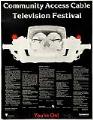
Community Access Cable Television Festival poster, Seattle, November 12-16, 1979
The poster pictured here advertises the Community Access Cable Television Festival, an event held in Seattle by the City of Seattle's Office of Cable Communications. Local viewers were invited to sample programming on and about local access networks. Caption information source: The Seattle Times, November 11, 1979, p. 206.
ID Number:2016.88.1
Date:1979
Program
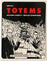
Seattle Totems program, 1967
The Seattle Totems were a professional ice hockey franchise in the Pacific Coast Hockey League (later Western Hockey League or WHL) from 1944-1974 and in the Central Hockey League for the 1974-1975 season. The Totems won three WHL Lester Patrick Cup championships: 1959, 1967, and 1968.The appropriation of Indigenous names for professional sports teams has been popular since the 19th…
ID Number:2017.19.1
Date:1967
Poster
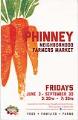
Phinney Neighborhood Farmers Market poster, Seattle, June 3 - September 30, 2016
On May 29, 1993, the University District Farmers Market opened in Seattle at the University Heights Community Center. Continuing from late May through early November, the market drew on Seattle's long history of the Pike Place Market, which opened in August of 1907 and allowed farmers to sell directly to consumers. In 2000, Chris Curtis, one of the originators of…
ID Number:2017.60.2
Date:2016
Poster
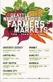
Seattle Neighborhood Farmers Markets poster, 2016
On May 29, 1993, the University District Farmers Market opened in Seattle at the University Heights Community Center. Continuing from late May through early November, the market drew on Seattle's long history of the Pike Place Market, which opened in August of 1907 and allowed farmers to sell directly to consumers. In 2000, Chris Curtis, one of the originators of…
ID Number:2017.60.6
Date:2016
Poster
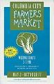
Columbia City Farmers Market poster, Seattle, May 2 - October 17, 2007
On May 29, 1993, the University District Farmers Market opened in Seattle at the University Heights Community Center. Continuing from late May through early November, the market drew on Seattle's long history of the Pike Place Market, which opened in August of 1907 and allowed farmers to sell directly to consumers. In 2000, Chris Curtis, one of the originators of…
ID Number:2017.60.9
Date:2007
Cartographic material
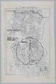
Operation Northwest Passage, Seattle Civil Defense Corps, July 10, 1951
World War II, which ended with the atomic bombing of Japan, was followed by the period known as the Cold War, a rivalry between the United States and the USSR. Fearing the spread of communism and the possibility of Russian nuclear attack, the U. S. organized and promoted an active nationwide civil defense program. The Seattle Civilian Defense Corps created…
ID Number:2018.3.1
Date:1951
Ephemera
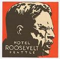
Hotel Roosevelt brochure, 1929
Downtown Seattle's Roosevelt Hotel, located at Seventh Avenue and Pine Street, opened in 1929, and at 22 stories was the tallest hotel in the city at the time. Designed in the modernistic Art Deco mode by prominent local architect John Graham, Sr. (1873-1955), and constructed by A.W. Quist & Company, the building was owned by Western Hotels, Inc. The new…
ID Number:2018.3.3.2
Date:1929
Ephemera
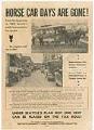
"Horse car days are gone!" leaflet, 1937
Seattle’s transportation system grew out of a mixture of privately-owned cable car lines, streetcars, and buses. When the city took these over in 1918, it turned out to be a financial disaster. By 1936, the infrastructure was aging, and the system was $4 million in debt. The city explored alternatives and, in 1937, promoted a plan to modernize the system…
ID Number:2018.3.3.14
Date:1937