106 results for: Williams
Ephemera
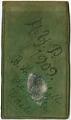
AYPE monthly pass in a handmade holder, Seattle, 1909
The Alaska-Yukon-Pacific Exposition (AYPE) was a world's fair held in Seattle to publicize the development of the Pacific Northwest. The fairgrounds were located on the campus of the University of Washington (UW) and were open from June 1, 1909, to October 16, 1909. Several of the buildings and the landscaping survive, continuing to shape the layout of the campus.The monthly…
ID Number:2018.35.1
Date:1909
Cartographic material
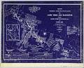
Map of Waterway Connecting Puget Sound with Lakes Union and Washington, Index, February 1905
Since the city's earliest days, Seattleites proposed canals to cheaply and easily move logs, coal, and other resources between Elliott Bay and Lake Washington. Possible routes extended from the Black River at the south end of Lake Washington to canals through Lake Union and Shilshole Bay in the north. A 1891 report commissioned by the federal government explored five possible…
ID Number:2019.3.11.1
Date:1905
Cartographic material
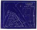
Waterway Connecting Puget Sound with Lakes Union and Washington, sheet 1, January 1905
Since the city's earliest days, Seattleites proposed canals to cheaply and easily move logs, coal, and other resources between Elliott Bay and Lake Washington. Possible routes extended from the Black River at the south end of Lake Washington to canals through Lake Union and Shilshole Bay in the north. A 1891 report commissioned by the federal government explored five possible…
ID Number:2019.3.11.2
Date:1905
Cartographic material
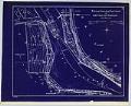
Waterway Connecting Puget Sound with Lakes Union and Washington, sheet 2, January 1905
Since the city's earliest days, Seattleites proposed canals to cheaply and easily move logs, coal, and other resources between Elliott Bay and Lake Washington. Possible routes extended from the Black River at the south end of Lake Washington to canals through Lake Union and Shilshole Bay in the north. A 1891 report commissioned by the federal government explored five possible…
ID Number:2019.3.11.3
Date:1905
Cartographic material
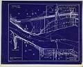
Waterway Connecting Puget Sound with Lakes Union and Washington, sheet 3, January 1905
Since the city's earliest days, Seattleites proposed canals to cheaply and easily move logs, coal, and other resources between Elliott Bay and Lake Washington. Possible routes extended from the Black River at the south end of Lake Washington to canals through Lake Union and Shilshole Bay in the north. A 1891 report commissioned by the federal government explored five possible…
ID Number:2019.3.11.4
Date:1905
Cartographic material
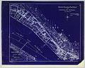
Waterway Connecting Puget Sound with Lakes Union and Washington, sheet 4, November 1904
Since the city's earliest days, Seattleites proposed canals to cheaply and easily move logs, coal, and other resources between Elliott Bay and Lake Washington. Possible routes extended from the Black River at the south end of Lake Washington to canals through Lake Union and Shilshole Bay in the north. A 1891 report commissioned by the federal government explored five possible…
ID Number:2019.3.11.5
Date:1904
Cartographic material
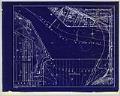
Waterway Connecting Puget Sound with Lakes Union and Washington, sheet 5, November 1904
Since the city's earliest days, Seattleites proposed canals to cheaply and easily move logs, coal, and other resources between Elliott Bay and Lake Washington. Possible routes extended from the Black River at the south end of Lake Washington to canals through Lake Union and Shilshole Bay in the north. A 1891 report commissioned by the federal government explored five possible…
ID Number:2019.3.11.6
Date:1904
Cartographic material
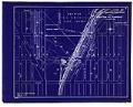
Waterway Connecting Puget Sound with Lakes Union and Washington, sheet 6, November 1904
Since the city's earliest days, Seattleites proposed canals to cheaply and easily move logs, coal, and other resources between Elliott Bay and Lake Washington. Possible routes extended from the Black River at the south end of Lake Washington to canals through Lake Union and Shilshole Bay in the north. A 1891 report commissioned by the federal government explored five possible…
ID Number:2019.3.11.7
Date:1904
Cartographic material
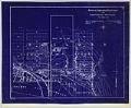
Waterway Connecting Puget Sound with Lakes Union and Washington, sheet 7, November 1904
Since the city's earliest days, Seattleites proposed canals to cheaply and easily move logs, coal, and other resources between Elliott Bay and Lake Washington. Possible routes extended from the Black River at the south end of Lake Washington to canals through Lake Union and Shilshole Bay in the north. A 1891 report commissioned by the federal government explored five possible…
ID Number:2019.3.11.8
Date:1904
Cartographic material
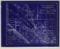
Waterway Connecting Puget Sound with Lakes Union and Washington, sheet 8, November 1904
Since the city's earliest days, Seattleites proposed canals to cheaply and easily move logs, coal, and other resources between Elliott Bay and Lake Washington. Possible routes extended from the Black River at the south end of Lake Washington to canals through Lake Union and Shilshole Bay in the north. A 1891 report commissioned by the federal government explored five possible…
ID Number:2019.3.11.9
Date:1904