106 results for: Williams
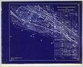
Cartographic material
Waterway Connecting Puget Sound with Lakes Union and Washington, sheet 9, November 1904
Since the city's earliest days, Seattleites proposed canals to cheaply and easily move logs, coal, and other resources between Elliott Bay and Lake Washington. Possible routes extended from the Black River at the south end of Lake Washington to canals through Lake Union and Shilshole Bay in the north. A 1891 report commissioned by the federal government explored five possible…
ID Number:2019.3.11.10
Date:1904
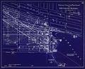
Cartographic material
Waterway Connecting Puget Sound with Lakes Union and Washington, sheet 10, November 1904
Since the city's earliest days, Seattleites proposed canals to cheaply and easily move logs, coal, and other resources between Elliott Bay and Lake Washington. Possible routes extended from the Black River at the south end of Lake Washington to canals through Lake Union and Shilshole Bay in the north. A 1891 report commissioned by the federal government explored five possible…
ID Number:2019.3.11.11
Date:1904
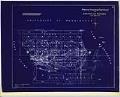
Cartographic material
Waterway Connecting Puget Sound with Lakes Union and Washington, sheet 11, circa 1905
Since the city's earliest days, Seattleites proposed canals to cheaply and easily move logs, coal, and other resources between Elliott Bay and Lake Washington. Possible routes extended from the Black River at the south end of Lake Washington to canals through Lake Union and Shilshole Bay in the north. A 1891 report commissioned by the federal government explored five possible…
ID Number:2019.3.11.12
Date:Circa 1905
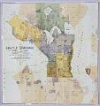
Cartographic material
Seattle Sewerage Skeleton Map, July 1891
This 1891 map shows the proposed design for the Seattle Sewer System by Benezette Williams, a nationally renowned civil engineer who was called in by the City of Seattle to design its first municipal water system. After the Great Seattle fire in June of 1889, Seattle was forced to rethink and rebuild its water supply and fire prevention systems. Mayor…
ID Number:2019.3.27
Date:1891
Cartographic material
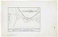
Map of Lake Washington Canal Entrance and Profile of Lake Washington Canal, Seattle, circa 1911
Since the city's earliest days, Seattleites proposed canals to cheaply and easily move logs, coal, and other resources between Elliott Bay and Lake Washington. Possible routes extended from the Black River at the south end of Lake Washington to canals through Lake Union and Shilshole Bay in the north. A 1891 report commissioned by the federal government explored five possible…
ID Number:2019.3.49
Date:Circa 1911
Cartographic material
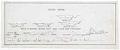
North Canal section drawings, Seattle, circa 1911
Since the city's earliest days, Seattleites proposed canals to cheaply and easily move logs, coal, and other resources between Elliott Bay and Lake Washington. Possible routes extended from the Black River at the south end of Lake Washington to canals through Lake Union and Shilshole Bay in the north. A 1891 report commissioned by the federal government explored five possible…
ID Number:2019.3.50
Date:Circa 1911
Photograph
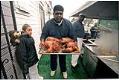
Henry Williams carrying deep-fried turkeys outside Catfish Corner, Seattle, November 20, 2001
In 1985, Woodrow “Woody” Jackson and his wife Rosemary opened Catfish Corner at the corner of East Cherry Street and Martin Luther King Boulevard in Seattle’s Central District. Although focusing on seafood, Jackson later began experimenting with deep-frying turkeys at Thanksgiving. Using a five-gallon doughnut fryer and a Cajun recipe, he tried various injected marinades until settling on a garlic-butter…
ID Number:2020.42.5.09.01.21
Date:2001
Photograph
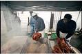
Woody Jackson and Henry Williams frying turkeys outside Catfish Corner, Seattle, November 20, 2001
In 1985, Woodrow “Woody” Jackson and his wife Rosemary opened Catfish Corner at the corner of East Cherry Street and Martin Luther King Boulevard in Seattle’s Central District. Although focusing on seafood, Jackson later began experimenting with deep-frying turkeys at Thanksgiving. Using a five-gallon doughnut fryer and a Cajun recipe, he tried various injected marinades until settling on a garlic-butter…
ID Number:2020.42.5.09.02.18
Date:2001
Photograph
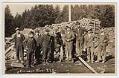
Wood chopping crew, Tulalip Indian School, circa 1912
The Tulalip Tribes are a confederation of several Coast Salish peoples including the Snohomish, Snoqualmie, Skykomish, Skagit, Suiattle, Samish, Stillaguamish, and other allied tribes and bands. In the 1855 Treaty of Point Elliott, these groups ceded most of their land to the United States and reserved the Tulalip Indian Reservation for their permanent homeland. They also reserved rights for hunting,…
ID Number:Lib1988.11.32
Date:Circa 1912
Photograph
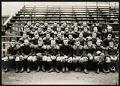
Football team sitting on bleachers, U.S. Naval Training Station at University of Washington, 1917
During World War I a temporary Naval Training Station was set up on the University of Washington campus, near where the university's health sciences center is now located. The training camp was active from 1917-1919, during which time over 5,000 mostly college students were trained for both naval and naval aviation units. This image shows the Naval Training Station football…
ID Number:Lib1993.35.3.38
Date:1917