844 results for: Puget Sound
Photograph
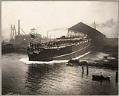
U.S.S. Nebraska launching October 7, 1904
In 1904, the Moran Brothers shipyard in Seattle launched the battleship "Nebraska." This vessel was the first steel ship to be built on Puget Sound and the first naval battleship to be built in the Pacific Northwest. At the launching, bands played, people cheered, dignitaries made speeches, and the daughter of the Governor of Nebraska christened the vessel with a…
ID Number:SHS2042
Date:1904
Photograph
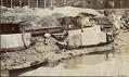
Indigenous encampment at the Seattle waterfront, circa 1895
In 1865 the Board of Trustees of Seattle passed Ordinance No. 5 banning Indigenous people from living in the city unless they worked for a non-Indigenous resident and lived on their employer’s property. Despite this attempt to enforce separation between Indigenous people and the settlers, Seattle depended on Indigenous people. Settlers relied on Native people for domestic work and for…
ID Number:SHS2210
Date:Circa 1895
Photograph
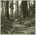
Military road on Beacon Hill, Seattle, circa 1900
The Fort Steilacoom to Fort Bellingham Military Road was a network of roads running through the Puget Sound area to promote the migration of settlers to Washington Territory and to secure U. S. interests in the region from those of Native Americans. Today’s I-5 roughly follows the route north from Fort Vancouver, built in 1924 by the Hudson's Bay Company…
ID Number:SHS2354
Date:Circa 1900
Photograph
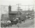
Fire Station No. 5, Seattle, 1911
The Seattle Fire Department opened Fire Station No. 5 in 1902. It was located on the waterfront at the foot of Madison Street, where the fireboat “Snoqualmie” (known as Engine 5) was berthed. The building, shown here, housed the fireboat crew as well as Hose Company 5, with its chemical and hose wagon. Fire Chief Frank Stetson condemned the building…
ID Number:SHS2781
Date:1911
Photograph
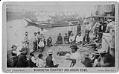
Game of slahal on a Puget Sound beach, circa 1884
Slahal, also called the bone game, is one of many games played by Indigenous peoples of the Pacific Northwest. A team member held up their hands, each of which contained a small bone, and the members of the opposite team tried to guess if a marked bone was in the right or left hand. Slahal often also involved gambling between…
ID Number:SHS3488
Date:Circa 1884
Photograph
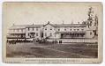
Industrial Boarding School buildings on the Puyallup Reservation, circa 1885
The Puyallup people are a Coast Salish group whose historic lands are along the Puyallup River Valley. They call themselves “Spuyalepabs” in their native language of Lushootseed, meaning “people from the bend at the bottom of the river.” Before settlers arrived, the Puyallup lived in villages that spread from the Cascade foothills to the shores of Puget Sound. In 1854,…
ID Number:SHS3491
Date:Circa 1885
Photograph
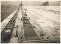
Workers pouring concrete for Beacon Hill reservoir, Seattle, circa 1911
Washington's Cedar River originates in the Cascade Mountain Range and drains into Puget Sound via Lake Washington. Since 1899 the upper Cedar River watershed, and its subsequent reservoirs and pipeline infrastructure, have been operated by Seattle Public Utilities, providing drinking water for about two-thirds of King County. The population of Seattle and King County grew quickly after the establishment of…
ID Number:SHS3768
Date:Circa 1911
Photograph
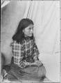
Young Indigenous woman named Tasha seated by a tent, circa 1900
From the late 1860s to the early 1890s, hop farming was an important activity in the valleys of the Puget Sound region, including Puyallup, White River, and Snoqualmie. Indigenous workers came from throughout the Pacific Northwest, Canada, and Alaska (but especially from regional tribes like the Puyallup, Snoqualmie, Muckleshoot, Duwamish, Sammamish, Lummi, and Nisqually) as a seasonal labor force to…
ID Number:SHS4880
Date:Circa 1900
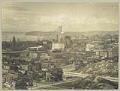
Photograph
Downtown Seattle from Beacon Hill, 1914
Seattle’s Beacon Hill blocked easy access for people and goods between the downtown commercial area of Seattle and the more agricultural Rainier Valley. Starting in 1906, a series of regrades cut through Beacon Hill, first at Jackson Street and a few years later at Dearborn Street.Here, standing on Beacon Hill, the photographer looks northwest over Chinatown (now the Chinatown -…
ID Number:SHS5194
Date:1914
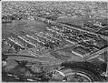
Photograph
Aerial of Fishermen's Terminal from southwest, Seattle, 1950
For many years, commercial fishermen have kept their boats at Fishermen's Terminal, in Salmon Bay, just west of the Ballard Bridge. This sheltered area of the Lake Washington Ship Canal gives easy access to Puget Sound. Typed on verso: Air view of Salmon Bay Terminal. Largest commercial fishing terminal in U.S., 1950.
ID Number:SHS6172
Date:1950