771 results for: Transportation
Cartographic material
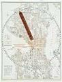
E-Z Map of Seattle with indicator, 1926
This E-Z Guide Map is a folding map of 1926 Seattle, with a riveted rotating pointer to "easily locate" your destination using a letter-number key. It also highlights bus routes, street cars, hotels, motion picture houses, hospitals and parks, among other Seattle attractions of the time. The back of the map gives an index of streets and the locations of…
ID Number:2019.3.44
Date:1926
Cartographic material
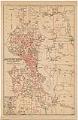
Share the Ride Zone Map, Seattle, 1942
In 1942, during World War II, the federal government’s War Production Transport Commission mandated that citizens cut back on the use of gasoline and rubber tires for the war effort. Seattle and other cities developed city-wide carpooling plans. Businesses and neighborhoods formally registered share-the-ride groups, and members were eligible for additional gasoline stamps once rationing began. By the fall of…
ID Number:2019.3.46
Date:1942
Cartographic material
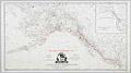
Pacific Steamship Co. Explanation of Routes, 1917
The Pacific Coast Steamship Company was an important early shipping company that operated steamships on the west coast of North America. Organized in 1867 under the name of Goodall, Nelson and Perkins, the company effectively ceased business in 1916 when its vessels were purchased by the Admiral Line. The Admiral Line (also American Mail Line, and later Admiral Oriental Line)…
ID Number:2019.3.60
Date:1917
Audio recording
Oral history interview with Marlene Koob, May 10, 2006
Interview with Marlene Koob, the station agent at King Street Station at the time of this interview. The interview was conducted by Lorraine McConaghy for the King Street Station Oral History Project on May 10, 2006. Koob's father and grandfather also worked at King Street Station, and she retired from this role in September 2010.
ID Number:2019.35.11.4
Date:2006
Photograph
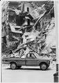
Olympic Block building after collapse, Seattle, March 23, 1972
A section of the Olympic Block building at the corner of First Avenue and Yesler Streets in Pioneer Square collapsed in a cloud of dust and rubble on the night of March 22, 1972. The building was being renovated at the time. Two people who were inside escaped unharmed, but a nearby car was destroyed and another damaged. Owners of…
ID Number:2019.48.2
Date:1972
Photograph
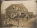
Mortensen Livery Barn in South Park, Seattle, circa 1907
South Park is located south of Seattle on the west bank of the Duwamish River. Once a separate city, it became part of Seattle in 1907, around the time this photo was taken. During this period, many of South Park’s residents were farmers who supplied produce to Seattle’s Pike Place Market. Mortensen’s Livery Stable, shown here, would have been a…
ID Number:2019.92.8
Date:1907
Photograph
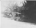
B.F. Middleton Groceries cart, Seattle, circa 1900
B.F. Middleton moved to Seattle after the 1889 Great Fire and settled in South Park in the Duwamish Valley in 1893. He ran a large grocery business and general store at 8207 Dallas Avenue in South Park’s business district. This image shows the store’s horse-drawn delivery wagon. Caption information source: The Seattle Daily Times: November 11, 1956, p. 57.
ID Number:2019.92.11
Date:1900
Ephemera
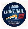
Souvenir sticker from opening of Link light rail, Seattle, July 18, 2009
The Link light rail route connecting Westlake station to the Sea-Tac airport opened on Saturday, July 18, 2009 and was free to ride for its opening weekend. The 14 mile Central Link (now called 1 Line) had approximately 45,000 riders on the opening day, which featured a ribbon cutting ceremony at the Mt. Baker station and musical entertainment for waiting…
ID Number:2020.25.14
Date:2009
Photograph
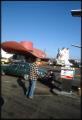
Customer getting gas at the Hat 'n' Boots Texaco station, Seattle, 1985
Seattle’s Hat ‘n’ Boots Premium Tex gas station opened at 6800 Corson Avenue South near Georgetown in 1955. The designer received a patent for its design the following year. A 44-foot cowboy hat sheltered the office, and restrooms occupied the 22-foot-tall boots. Built as an attraction for a frontier-themed shopping center, the station led statewide gas sales for its first…
ID Number:2020.42.1.20.02.16
Date:1985
Photograph
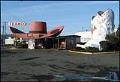
Hat 'n' Boots Texaco gas station, Seattle, 1985
Seattle’s Hat ‘n’ Boots Premium Tex gas station opened at 6800 Corson Avenue South near Georgetown in 1955. Its designer, Lewis H. Nasmyth, received a patent for its design the following year. A 44-foot cowboy hat sheltered the office, and restrooms occupied the 22-foot-tall boots. Built as an attraction for a frontier-themed shopping center, the station led statewide gas sales…
ID Number:2020.42.1.20.03.19
Date:1985