65 results for: Regrades
Photograph
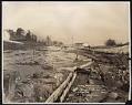
Alki Avenue regrade showing water cannon, with flour mill in distance, September 24, 1913
In the winter of 1913, the Seattle-based hydraulic contracting firm Lewis, Wiley & Morse began work on a regrade, fill and seawall project along Alki Avenue in West Seattle. The construction continued through 1913 and was completed in the spring of 1914. The project involved a hydraulic hillside regrade near the intersection of Fairmount Avenue and Alki Avenue. A new…
ID Number:2010.3.32.76
Date:1913
Photograph
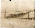
Wooden bridge near Alki Avenue regrade area, West Seattle, September 24, 1913
In the winter of 1913, the Seattle-based hydraulic contracting firm Lewis, Wiley & Morse began work on a regrade, fill and seawall project along Alki Avenue in West Seattle. The construction continued through 1913 and was completed in the spring of 1914. The project involved a hydraulic hillside regrade near the intersection of Fairmount Avenue and Alki Avenue. A new…
ID Number:2010.3.32.78
Date:1913
Photograph
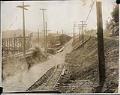
Alki Avenue regrade area showing new grade and bridge approach, West Seattle, September 24, 1913
In the winter of 1913, the Seattle-based hydraulic contracting firm Lewis, Wiley & Morse began work on a regrade, fill and seawall project along Alki Avenue in West Seattle. The construction continued through 1913 and was completed in the spring of 1914. The project involved a hydraulic hillside regrade near the intersection of Fairmount Avenue and Alki Avenue. A new…
ID Number:2010.3.32.79
Date:1913
Photograph
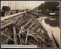
Bulkhead along Alki Avenue SW, October 28, 1913
In the winter of 1913, the Seattle-based hydraulic contracting firm Lewis, Wiley & Morse began work on a regrade, fill and seawall project along Alki Avenue in West Seattle. The construction continued through 1913 and was completed in the spring of 1914. The project involved a hydraulic hillside regrade near the intersection of Fairmount Avenue and Alki Avenue. A new…
ID Number:2010.3.32.89
Date:1913
Photograph
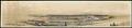
Harbor Island and Beacon Hill, Seattle, 1917
Seattle’s main industrial area, which includes Harbor Island, was built on tidelands at the mouth of the Duwamish River using dirt from the 1907-1909 Jackson Street and other Beacon Hill regrades. In 1911, Fisher Flouring Mills built a large plant on Harbor Island. Shipbuilding and related industries followed. This panoramic photograph, taken from Admiral Way in West Seattle, looks east…
ID Number:2019.3.3
Date:1917
Cartographic material
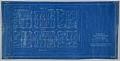
Condemnation of Lane Street et al Establishing Grades map, Seattle, July 1916
Starting in 1897 and continuing through 1930, the topography of central Seattle was radically altered by a series of regrades. An estimated 50 tons of earth removed from the city's hills were moved into the tide flats and other low areas, and into Elliott Bay.In June 1916, a bill was passed for the condemnation of property for changing and establishing…
ID Number:2019.3.21
Date:1916
Cartographic material
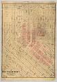
Denny Regrade District, Seattle, 1928
Begun in 1898, the Denny Hill Regrade leveled one of Seattle's steepest hills, with an aim to connect neighborhoods and facilitate traffic flow. Before the regrade, Second Avenue rose 190 feet in the twelve blocks between Pioneer Square and Lenora Avenue. The project began by flattening First Avenue between Pine Street and Denny Way. The sluiced-away dirt was dumped into…
ID Number:2019.3.25
Date:1928
Photograph
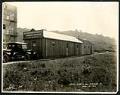
Puget Sound Bridge and Dredging Company office building on Dearborn Street, Seattle, April 23, 1923
Founded in 1889, the Puget Sound Bridge and Dredging Company was also called Puget Sound Bridge and Drydock, Associated Shipbuilders, and Lockheed Shipbuilding and Construction Company. The company participated in most major construction sites in the Pacific Northwest, including the construction of Harbor Island at the mouth of the Duwamish River in Seattle. Lockheed Shipbuilding continued to build ships ranging…
ID Number:Lib1988.13.7.2.16
Date:1923
Photograph
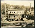
Salvation Army Industrial Department on Holgate Street, Seattle, May 22, 1923
This photograph of the exterior of the Salvation Army Industrial Department building on Holgate Street in Seattle was taken on May 22, 1923. This area south of downtown Seattle was originally made up of tidal flats; soil dredged from the Duwamish River and sluiced from the Denny triangle and Beacon Hill regrades was used to create this industrial area needed…
ID Number:Lib1988.13.7.2.18
Date:1923
Photograph
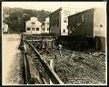
View of Holgate Street looking east at 9th Avenue South, Seattle, May 22, 1923
This photograph of Holgate Street looking east towards Beacon Hill depicts two workmen at ground level, perhaps working on the pilings which raise the street and buildings above the marshy ground. Other pedestrians are also visible. This area south of downtown Seattle was originally made up of tidal flats; soil dredged from the Duwamish River and sluiced from the Denny…
ID Number:Lib1988.13.7.2.19
Date:1923