65 results for: Regrades
Photograph
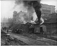
Regrading Third Avenue near Cherry Street, Seattle, circa 1907
Seattle's hills are steep, but they used to be steeper. During various regrading projects, the city tried to make the streets and avenues more level. Some areas were raised and some were lowered. Nearby buildings were raised or lowered too. Others were torn down or moved away. Handwritten on sleeve: Regrade - 3rd Ave. about Cherry.Photographer's Reference Number: 9123
ID Number:1983.10.8161
Date:Circa 1907
Photograph
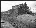
Washington Hotel during regrading of Second Avenue, Seattle, circa 1906
Workers began regrading Seattle's Denny Hill in 1898. At first, the owners of the Washington Hotel didn't want the city to remove their part of the hill. This left the hotel sitting on a raw peak of land while the blocks to the west were regraded. In 1906, the owners decided to tear the hotel down and regrade the property…
ID Number:1983.10.8163
Date:Circa 1906
Photograph
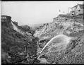
Using water hoses to regrade Denny Hill, circa 1909
Workers in the first Denny Hill regrading project sometimes used high pressure jets of water to wash away the hill. Over five million gallons of water were pumped from Elliott Bay and Lake Union every day. The dirt was washed out into the bay through tunnels and flumes.This photo was taken on Third Avenue in downtown Seattle in about 1909.…
ID Number:1983.10.8164
Date:Circa 1909
Photograph
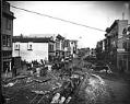
Street under construction, Seattle, circa 1909
Signs in image: Edison Phonographs. [...] Furniture. Children's Sleighs at Factory Prices. [...] Ward Real Estate. McIntyre Block. McLaughlin & [McLe...]. Handwritten on sleeve: Street Construction & Regrade (4th Ave?)Webster & Stevens number: 18091
ID Number:1983.10.9069
Date:Circa 1909
Photograph
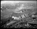
Regrading on Beacon Hill, 1910
Before the Jackson Street regrading project, Beacon Hill formed a barrier between Seattle's waterfront and the Rainier Valley. Between 1907 and 1910, over three million cubic yards of earth were moved to make a cut through the hill. Most of the dirt was used to fill in Seattle's tidal flats.This photo shows what is probably the Jackson Street regrading project,…
ID Number:1983.10.9115.2
Date:1910
Photograph
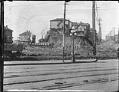
Denny Hill being regraded, Seattle, circa 1909
Handwritten on sleeve: Regrade.Webster & Stevens number: 19128
ID Number:1983.10.9136
Date:Circa 1909
Photograph
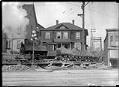
Regrade dirt train, circa 1913
Earth was moved in a variety of ways during Seattle's regrading projects. In this photo, taken around 1913, an engine pulls cars full of dirt along a track. Some of these rail lines were movable and could be shifted to wherever they were needed. Webster & Stevens number: 20062
ID Number:1983.10.9298
Date:Circa 1913
Photograph
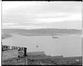
Harbor Island from downtown Seattle, circa 1913
With the expansion of Japanese trade and the start of construction on the Panama Canal, Seattle expected its port business to boom. Beginning around 1905, developers filled in an area of tide flats at the mouth of the Duwamish River for huge new piers and warehouses. This was called Harbor Island.This photo, taken from downtown Seattle, shows Harbor Island in…
ID Number:1983.10.9745
Date:Circa 1913
Photograph
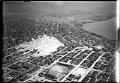
Aerial view of Denny regrade area, Seattle, 1931
Seattle's present-day Denny Triangle neighborhood was created between 1897-1930 by removing Denny Hill in stages. The neighborhood is located in the triangle formed by Denny Way on the north, Third Avenue on the southwest, and Olive Way on the southeast. This aerial view of the newly cleared neighborhood faces south towards downtown Seattle. It was taken after completion of the…
ID Number:1983.10.17948
Date:1931
Photograph
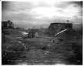
Denny Regrade project in progress, Seattle, 1909
This photograph was taken in 1909 during the regrading project on Third Avenue in the Denny Triangle area of downtown Seattle. Men using high power hoses to blast away the hillside can be seen near a house and downhill from the Washington Hotel.Otto D. Goetze (b. 1871) was an American photographer who owned the Alaska Photo Studio in Seattle from…
ID Number:1995.38.33.6
Date:1909