771 results for: Transportation
Photograph
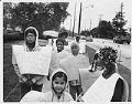
Seattle School District students protesting halting of mandatory busing, September 1, 1971
In the 1960s, after decades of discrimination in housing had created an increasingly segregated school system in Seattle, civil rights activists wanted the School Board to promote integration and, with it, intercultural empathy and understanding. After various attempts to promote voluntary integration, and faced with the threat of legal action from advocates of integration, in 1972 the School District launched…
ID Number:2000.107.185.37.01
Date:1971
Photograph
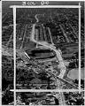
Aerial view of Empire Way and Sick's Stadium, July 11, 1953
Empire Way’s route was first laid out in 1913, as a state highway heading southeast out of Seattle. It was named for James J. Hill, the head of the Great Northern Railway, who was nicknamed the “Empire Builder.” At first, Empire Way was put together from parts of older roads on the same route. From the 1930s to the 1950s,…
ID Number:2000.107.189.11.01
Date:1953
Photograph
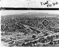
View of Rainier Avenue and Lake Way looking east, March 1954
Seattle's Atlantic neighborhood (which has also been referred to as Yesler/Atlantic and Judkins Park) is a triangular community in the Central District area, between Mount Baker Ridge and Beacon Hill. One of oldest residential neighborhoods, it was home to Seattle's largest Italian enclaves during the early years of the twentieth century. Like other neighborhoods in central and southeast Seattle, Black…
ID Number:2000.107.189.16.01
Date:1954
Photograph
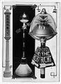
Collage of automatic traffic signals, April 21, 1924
Traffic signals were first tested in Seattle in 1924, through a collaboration between the Street Department and the police traffic division. The first automatic traffic signal was installed at Fourth Avenue South and Jackson Street for motorists to determine whether the automatic method was better than traffic control by an officer stationed in the center of the intersection.This graphic by…
ID Number:2000.107.190.05.02
Date:1924
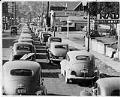
Photograph
Morning traffic on Roosevelt Way, Seattle, August 9, 1946
In this image, a slow-moving stream of automobiles clog southbound lanes of Roosevelt Way to East 50th during peak morning traffic. The extra heavy commute was due to the temporary closure of the Montlake Bridge, forcing motorists to use the Fremont and Aurora Bridges instead. Signs in image: Mobilgas; Osborne's RadioCaption information derived from captions written by Post-Intelligencer staff and…
ID Number:2000.107.190.05.03
Date:1946
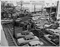
Photograph
Christmas traffic in downtown Seattle, December 22, 1955
In this image pedestrians literally battle their way across Westlake Avenue at Pine Street. Cars headed north (toward top of image) on Westlake are attempting to turn left (west) onto Pine Street, thus clogging the intersection for westbound cars on Pine Street. Signs in image: Packard; Clark's Restaurant; Moss; Hart's Jewelers; Rhodes of Seattle; Frederick & Nelson; Best'sCaption information derived…
ID Number:2000.107.190.06.01
Date:1955
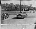
Photograph
Children crossing 32nd Ave. N. near Harrison School, Seattle, April 26, 1951
The intersection shown here is located at 32nd Avenue North and East Republican Street, in the Harrison/Denny-Blaine neighborhood of Seattle's Central District. The intersection was described by residents at the time as a bad place for children to cross because there were no traffic lights. The cars in the picture are traveling north on 32nd Ave. as the children at…
ID Number:2000.107.190.06.02
Date:1951
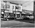
Photograph
Cars passing through crosswalk at 15th and Republican, Seattle, April 15, 1951
In this image cars are shown at the intersection of 15th Avenue North and Republican Street, an intersection locals considered so dangerous due to the increase in motor traffic that they lobbied for a traffic light to replace the ineffective cross walk signal. Signs in image: Dugan's; Pittsburgh Paints, Child's Hardware; Helen's Professional Permanents; Holdsworth 10 cent storeCaption information derived…
ID Number:2000.107.190.06.03
Date:1951
Photograph
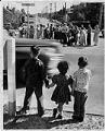
Children waiting to cross Lake Washington Blvd., Seattle, May 11, 1953
In this image three children hold hands as they wait for a car to pass before they cross Lake Washington Boulevard at 49th Avenue South. Parents, standing on the far side of the boulevard, met to protest the city's failure to put in a painted crosswalk at this spot, where three children were struck by a car on May 10,…
ID Number:2000.107.190.06.04
Date:1953
Photograph
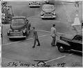
Pedestrians crossing intersection at 7th Ave and Battery St., Seattle, May 25, 1951
In this image pedestrians attempt to cross the street at Seventh Avenue and Battery Street. During construction of the Alaskan Way viaduct Battery Street was restricted to one-way traffic, prompting locals to complain that the traffic lights installed put pedestrians in danger of being hit from the Dexter Avenue traffic. Caption information derived from captions written by Post-Intelligencer staff and…
ID Number:2000.107.190.06.05
Date:1951