771 results for: Transportation
Photograph
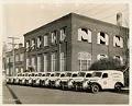
New trucks parked at the Metropolitan Laundry Company, Seattle, January 8, 1938
In 1938, the Metropolitan Laundry Company took delivery of ten new International D-2 panel trucks, shown here in front of the laundry. The company was located at 244 Pontius Avenue N., in Seattle's Cascade neighborhood. Numerous ads in The Seattle Times urged housewives to save time by sending their family clothing out to be washed or dry cleaned by Metropolitan.As…
ID Number:2000.107.177.01.02
Date:1938
Photograph
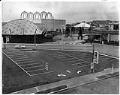
Empty parking lot after World's Fair, Seattle, December 28, 1962
After the closing of the Seattle World's Fair, or Century 21 Exposition, on October 21, 1962, nearby parking prices plummeted. At this lot, near what is now the Pacific Science Center, prices dropped from $2.00 for the day to 50 cents.The domed building to the left was the Ford exhibit. Queen Anne Hill and what is now Climate Pledge Arena…
ID Number:2000.107.178.04.01
Date:1962
Photograph
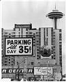
Reduced parking fees after World's Fair, Seattle, December 28, 1962
After the Seattle World's Fair, or Century 21 Exposition, closed on October 21, 1962, nearby parking prices plummeted. The sign at this lot, located at Bell Street and 6th Avenue, advertises all-day parking for 35 cents. During the fair, it cost around $2.00 per day to park here.Grosvenor House, the large apartment building at 500 Wall Street, shown here between…
ID Number:2000.107.178.04.02
Date:1962
Photograph
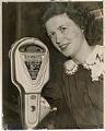
Jane Abernathy posing with new parking meter, July 11, 1941
Starting in 1935, a controversy raged in Seattle over whether people should have to pay for parking on downtown streets. Here, Jane Abernathy poses by one of the new Dual meters during the summer of 1941, when meter installation began. The caption that appeared with this photo referred to the meter as a "curbside slot machine." The parking fee was…
ID Number:2000.107.178.06.01
Date:1941
Photograph
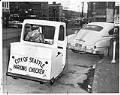
Parking enforcement officer sitting in vehicle, Seattle, Seattle, January 22, 1958
Here, in 1958, an employee of the Seattle Police Department Parking Enforcement division inspects an illegally parked Pontiac sedan in downtown Seattle. A comment on the back of the photo points out that the Parking Checker's vehicle lacks a license plate. Caption information derived from captions written by Post-Intelligencer staff and attached to the back of the photograph.
ID Number:2000.107.178.06.02
Date:1958
Photograph
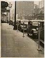
New parking meters on Third Avenue, Seattle, February 5, 1942
Starting in 1935, controversy raged in Seattle over whether people should have to pay to park on downtown streets. New parking meters finally went into operation at 9 AM on February 5th, 1942. The fee was five cents per hour. Nine citations were issued on the first day.This image shows the new parking meters installed on February 3, 1942 on…
ID Number:2000.107.178.06.03
Date:1942
Photograph
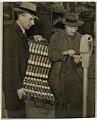
City employees collecting money from parking meters, Seattle, February 7, 1942
Stating in 1935, controversy raged in Seattle over whether people should have to pay to park on downtown streets. The first parking meters went into operation on February 5, 1942. The fee was five cents per hour.Here, Seattle Police Department Parking Enforcement division employees Ed Lorentzen and Einar Larson make the first collection from the 77 new meters. They replaced…
ID Number:2000.107.178.06.04
Date:1942
Photograph
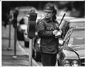
Mariana Matthews writing a parking ticket, Seattle, May 7, 1991
In the spring of 1991, the city of Seattle's Parking Enforcement Unit ran a 2-week experiment to see whether foot patrols might be more efficent than the usual three-wheeled gas-powered carts. Officer Mariana Matthews, shown here on foot patrol writing an overtime parking citation near Pike Place Market, reports that while she is no fan of the scooters, she does…
ID Number:2000.107.178.07.01
Date:1991
Photograph
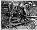
Seattle Police Department bicycle patrol, Seattle, June 5, 1990
Although bicycle patrol units had been used in some large cities in the 19th century, bicycles were gradually dropped in favor of motorcycles or cars. The Seattle Police Department re-instituted the practice in 1987, starting with two officers. Bicycles allowed the officers to move about the urban and suburban setting quickly and easily.Here, Alex Wiggins, Tony Little, and Steve Kilburg…
ID Number:2000.107.180.15.01
Date:1990
Photograph
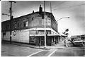
Apartment building set for demolition, Seattle, February 10, 1982
In the early 1980s, the state of Washington planned to widen the western end of Interstate 90 (I-90) and extend it to meet Interstate 5 (I-5) in Seattle’s Central Area. This expansion required the demolition of the Atlantic Street neighborhood near the I-90 overpass at Rainier Avenue. State agents began buying property in Atlantic Street and coercing residents into moving…
ID Number:2000.107.185.01.04
Date:1982