157 results for: Aerial Views
Photograph
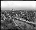
View to the east from the Volunteer Park water tower, circa 1913
In 1906, the Seattle Water Department built a water tower at the highest point of Capitol Hill. It quickly became a popular place for people to go for a good view of the city.This photo, taken around 1913, shows the view over Capitol Hill to the east, towards Lake Washington. Holy Names Academy towers over the neighborhood's houses. Webster &…
ID Number:1983.10.8771.2
Date:Circa 1913
Photograph
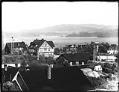
Madrona neighborhood, Seattle, circa 1910
Handwritten on sleeve: Panorama Madrona District.Photographer's Reference Number: 16721
ID Number:1983.10.8937.2
Date:Circa 1910
Photograph
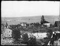
Madrona neighborhood, Seattle, circa 1910
Handwritten on sleeve: Panorama Madrona District.Photographer's Reference Number: 16722
ID Number:1983.10.8937.3
Date:Circa 1910
Photograph
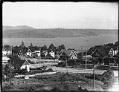
Madrona neighborhood, Seattle, circa 1910
This view looks towards Lake Washington and shows Denny Way running from right to left with the intersection of 37th Avenue at the center left of the picture. Handwritten on sleeve: Panorama Madrona District.Photographer's Reference Number: 16723
ID Number:1983.10.8937.4
Date:Circa 1910
Photograph
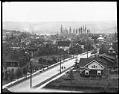
View east from Volunteer Park water tower, Seattle, circa 1910
In 1906, the Seattle Water Department built a water tower at the highest point of Capitol Hill. It quickly became a popular place for people to go for a good view of the city. Handwritten on sleeve: Panorama East from Vol. Park Tower.Webster & Stevens number: 16749
ID Number:1983.10.8940.3
Date:Circa 1910
Photograph
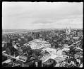
View northeast from Smith Tower, Seattle, circa 1914
As the tallest building west of the Mississippi, the Smith Tower, at Second Avenue and Yesler Way, offered fantastic views of Seattle and surrounding areas. In this scene Lake Union lies directly north in the distance. In the lower right corner is the dome-roofed Seattle First United Methodist Church and the gable-roofed Rainier Club. In left center rise the two…
ID Number:1983.10.9650.1
Date:Circa 1914
Photograph
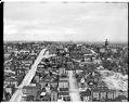
View east from Smith Tower, Seattle, circa 1914
At the time of its completion in 1914 the Smith Tower was the fourth tallest building in the world, allowing for unobstructed views. This northeasterly view shows the old King County Courthouse with its raised dome at right center atop Profanity Hill. Harborview Hospital now stands in its place. Handwritten on sleeve: City View E. from Smith Tower.Photographer's Reference Number:…
ID Number:1983.10.9650.2
Date:Circa 1914
Photograph
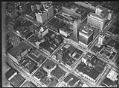
Aerial of downtown Seattle, August 9, 1933
Prominent downtown buildings in this view include, clockwise left to right near top of frame, the Vance and 1411-4th Avenue Buildings, the United States Post Office, the Seattle Tower (formerly Northern Life Tower), the Olympic Hotel, and the White-Henry-Stuart Building. Caption on image: Laidlaw.Handwritten on sleeve: City Center showing Rhodes Dept Store, Northern Life Tower, Olympic Hotel, PO & Tel.…
ID Number:1983.10.17510
Date:1933
Photograph
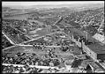
Aerial view of Georgetown, from the south, September 19, 1933
The Georgetown district lies south of downtown Seattle, below Beacon Hill. This aerial view, looking to the north, shows the Seattle Brewing & Malting Company's Bayview Brewery and businesses along Airport Way to the right, and newly-paved S. Harney Street passing through the residential area in the foreground. Beyond S. Corson Street (center to left) are the Georgetown Elementary School…
ID Number:1983.10.17511
Date:1933
Photograph
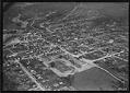
Aerial of Renton looking southeast, May 31, 1933
The city of Renton is located at the southern shore of Lake Washington, on the site of earlier Native encampments. Settlers built a sawmill in the area in the 1850s, and coal was discovered nearby in the 1870s. Renton was also an agricultural center. For many years, its primary crop was hops, used in brewing beer.This view of Renton shows…
ID Number:1983.10.17530.1
Date:1933