157 results for: Aerial Views
Photograph
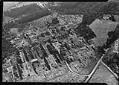
Aerial of Hollywood Chicken Farm, Woodinville, 1940
Hollywood Farm, in Woodinville, was built by the Frederick Stimson family. They used it as a weekend retreat and summer home. Milk and cream from the farm's prize-winning Holstein dairy herd was sent to Seattle by railroad. Seattleites visited by train and bought cream, ice cream, and sausages at the farm's ice cream parlor.This aerial photo is part of a…
ID Number:1974.5923.361.3
Date:1940
Photograph
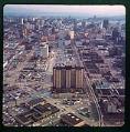
Aerial view of Seattle, showing Grosvenor House, Seattle, circa 1967
The end of World War II stimulated a huge demand for housing in Seattle. The modernist-style Grosvenor House, a large reinforced concrete apartment building designed by Earl W. Morrison, was built in the Belltown/Denny Triangle area of the city. Its 18 stories, with 370 units, housed some 1200 people. The base of the building occupied a full block. It had…
ID Number:1980.7067.1.18.1
Date:Circa 1967
Photograph
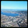
Aerial view of Lake Union, taken from the southwest, Seattle, 1967
In 1882, lumber mills, shipyards, and other industries began to move north from Seattle’s waterfront to the shores of Lake Union. Industrial development continued with Seattle’s growth but shrank after World War II. A few shipyards remained by the late 1960s, plus some light industry, apartments, parking lots, fast food restaurants, marinas, and a seaplane terminal. Roads were built and…
ID Number:1980.7067.1.24.1
Date:1967
Photograph
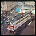
Aerial view of Bartell Drugs building in downtown Seattle, 1967
The first Bartell Drugs store opened in 1890, when George Bartell bought the Lake Washington Pharmacy located in what became the Leschi neighborhood. The Bartell Drug Company incorporated in 1904 and moved to downtown Seattle. It expanded in early 20th century, coming to include a candy factory and photo lab in addition to pharmacy locations. The company remained under Bartell…
ID Number:1980.7067.1.26.1
Date:1967
Photograph
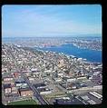
Aerial view of Lake Union looking northeast, Seattle, 1967
In 1882, lumber mills, shipyards, and other industries began to move north from Seattle’s waterfront to the shores of Lake Union. Industrial development continued with Seattle’s growth but shrank after World War II. A few shipyards remained by the late 1960s, plus some light industry, apartments, parking lots, fast food restaurants, marinas, and a seaplane terminal. Roads were built and…
ID Number:1980.7067.1.29.1
Date:1967
Photograph
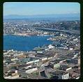
Aerial view of South Lake Union looking northeast, Seattle, 1967
In 1882, lumber mills, shipyards, and other industries began to move north from Seattle’s waterfront to the shores of Lake Union. Industrial development continued with Seattle’s growth but shrank after World War II. A few shipyards remained by the late 1960s, plus some light industry, apartments, parking lots, fast food restaurants, marinas, and a seaplane terminal. Roads were built and…
ID Number:1980.7067.1.36.1
Date:1967
Photograph
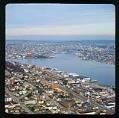
Aerial view of the northern part of Lake Union, looking northeast, Seattle, 1967
In 1882, lumber mills, shipyards, and other industries began to move north from Seattle’s waterfront to the shores of Lake Union. Industrial development continued with Seattle’s growth but shrank after World War II. A few shipyards remained by the late 1960s, plus some light industry, apartments, parking lots, fast food restaurants, marinas, and a seaplane terminal. Roads were built and…
ID Number:1980.7067.1.36.2
Date:1967
Photograph
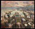
Aerial of Alaska-Yukon-Pacific Exposition from southeast, Seattle, 1909
This aerial photo shows the fairgrounds of the Alaska-Yukon-Pacific Exposition. Caption on image: The AYPE Exposition from Captive Balloon A Quarter of a Mile Above the Earth. Copyright 1909 by F.H. Nowell.Handwritten on mount: A.Y.P. Expo. AYP '09, Taken from baloon [sic].
ID Number:1980.7158.2.16
Date:1909
Photograph
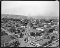
View of the Denny Regrade area, circa 1925
Denny Hill, which stood north of Seattle's downtown was thought to block the city's growth. The steep hill was removed in two stages between the 1890s and the 1930s, and the land was regraded. The area where Denny Hill stood is still known as the Denny Regrade.This photo was taken in about 1925, after the first Denny Hill regrading project.…
ID Number:1983.10.498
Date:Circa 1925
Photograph
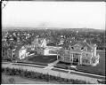
View looking south from Volunteer Park water tower, Seattle, circa 1913
In 1906, the Seattle Water Department built a water tower at the highest point of Capitol Hill. It quickly became a popular place for people to go for a good view of the city. This photo looks south towards 14th Avenue East and East Prospect and shows the George H. Parker residence in the foreground. Handwritten on sleeve: View from…
ID Number:1983.10.8771.1
Date:Circa 1913