672 results for: Lake Washington
Photograph
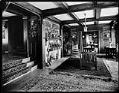
Rolland H. Denny residence living room, Seattle, circa 1912
In 1907, Rolland H. Denny and his wife Alice M. Denny purchased 50 acres of land in what is now Windermere and developed it. They built a home overlooking Lake Washington and named it Lochkelden ("kel" for Alice's maiden name of Kellogg and "den" for Denny). This photograph of the interior of the home shows the type of furnishings favored…
ID Number:1983.10.7888
Date:Circa 1912
Photograph
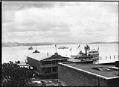
University of Washington canoe house, Seattle, circa 1910
Handwritten on sleeve: U of W Shell House [sic].Photographer's Reference Number: 9935
ID Number:1983.10.8277
Date:Circa 1910
Photograph
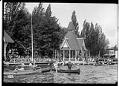
Canoeists at Madison Park, Seattle, circa 1910
Madison Park, at the end of the Madison Street cable car line, was one of Seattle's privately-developed "trolley parks." In addition to a ferry landing, it had a pavilion, a boathouse, picnic areas, piers, a promenade, and offshore bandstands with shoreline seating. Webster & Stevens number: 15290
ID Number:1983.10.8642
Date:Circa 1910
Photograph
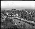
View to the east from the Volunteer Park water tower, circa 1913
In 1906, the Seattle Water Department built a water tower at the highest point of Capitol Hill. It quickly became a popular place for people to go for a good view of the city.This photo, taken around 1913, shows the view over Capitol Hill to the east, towards Lake Washington. Holy Names Academy towers over the neighborhood's houses. Webster &…
ID Number:1983.10.8771.2
Date:Circa 1913
Photograph
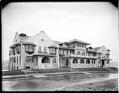
L'Amourita Apartments, circa 1925
During the 1920s, a number of Seattle architects designed and built homes and apartment buildings in the Mission Revival style. These buildings had the stucco walls, red tile roofs, and lines of Spanish-style buildings seen in southern California.This photo shows the Mission Revival L'Amourita Apartments on a rainy day in the 1920s. The building still stands on Franklin Avenue East,…
ID Number:1983.10.8863.1
Date:Circa 1925
Photograph
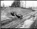
Montlake Cut under construction, Seattle, circa 1914
The Lake Washington Ship Canal followed the routes of earlier canals and streams which connected Lake Washington, Lake Union, and Salmon Bay. This photo shows the Montlake Cut between Portage Bay, shown in the background, and Union Bay in about 1914, about three years after construction started. A steam shovel is excavating the hillside; the tracks were for a train…
ID Number:1983.10.8865
Date:Circa 1914
Photograph
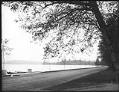
Lake Washington Boulevard, Seattle, circa 1914
Handwritten on sleeve: Mt. Baker Blvd.Photographer's Reference Number: 16537
ID Number:1983.10.8911.2
Date:Circa 1914
Photograph
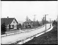
Homes on Cascadia Avenue South, Seattle, circa 1914
Perched along the eastern rise of Mount Baker ridge, Cascadia Avenue South afforded spectacular views of Lake Washington and the Cascade Range when this residential community was developed over a century ago. Handwritten on sleeve: Mt. Baker Park, Cascade Ave.Photographer's Reference Number: 16539
ID Number:1983.10.8912
Date:Circa 1914
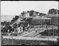
Photograph
Madrona neighborhood, Seattle, circa 1910
Handwritten on sleeve: Panorama Madrona District.Photographer's Reference Number: 16720
ID Number:1983.10.8937.1
Date:Circa 1910
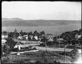
Photograph
Madrona neighborhood, Seattle, circa 1910
This view looks towards Lake Washington and shows Denny Way running from right to left with the intersection of 37th Avenue at the center left of the picture. Handwritten on sleeve: Panorama Madrona District.Photographer's Reference Number: 16723
ID Number:1983.10.8937.4
Date:Circa 1910