835 results for: Neighborhoods
Photograph
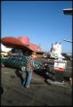
Customer getting gas at the Hat 'n' Boots Texaco station, Seattle, 1985
Seattle’s Hat ‘n’ Boots Premium Tex gas station opened at 6800 Corson Avenue South near Georgetown in 1955. The designer received a patent for its design the following year. A 44-foot cowboy hat sheltered the office, and restrooms occupied the 22-foot-tall boots. Built as an attraction for a frontier-themed shopping center, the station led statewide gas sales for its first…
ID Number:2020.42.1.20.02.16
Date:1985
Photograph
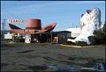
Hat 'n' Boots Texaco gas station, Seattle, 1985
Seattle’s Hat ‘n’ Boots Premium Tex gas station opened at 6800 Corson Avenue South near Georgetown in 1955. Its designer, Lewis H. Nasmyth, received a patent for its design the following year. A 44-foot cowboy hat sheltered the office, and restrooms occupied the 22-foot-tall boots. Built as an attraction for a frontier-themed shopping center, the station led statewide gas sales…
ID Number:2020.42.1.20.03.19
Date:1985
Poster
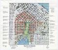
Seattle Commons Draft Plan poster, 1992
In 1991 Seattle architect Fred Bassetti and Seattle Times columnist John Hinterberger first proposed the idea for a 61-acre park stretching from downtown Seattle to Lake Union, envisioning a vast civic lawn framed by high-tech laboratories, condos, restaurants, and urban amenities. Microsoft co-founder Paul Allen donated $20 million to buy property for the Seattle Commons, but the plan eventually failed…
ID Number:2020.51.2.1
Date:1992
Cartographic material
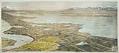
Birdseye View of Lake Forest Park and Seattle, 1910
The land that is now Lake Forest Park was originally occupied by a winter village of the Snohomish tribe, which increasing white settlement displaced in the late 19th century. In 1909, property developer (and future Seattle mayor) Ole Hanson formed the North Seattle Improvement Company and began buying land at the north end of Lake Washington in order to build…
ID Number:2023.3.4
Date:1910
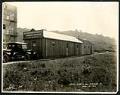
Photograph
Puget Sound Bridge and Dredging Company office building on Dearborn Street, Seattle, April 23, 1923
Founded in 1889, the Puget Sound Bridge and Dredging Company was also called Puget Sound Bridge and Drydock, Associated Shipbuilders, and Lockheed Shipbuilding and Construction Company. The company participated in most major construction sites in the Pacific Northwest, including the construction of Harbor Island at the mouth of the Duwamish River in Seattle. Lockheed Shipbuilding continued to build ships ranging…
ID Number:Lib1988.13.7.2.16
Date:1923
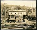
Photograph
Salvation Army Industrial Department on Holgate Street, Seattle, May 22, 1923
This photograph of the exterior of the Salvation Army Industrial Department building on Holgate Street in Seattle was taken on May 22, 1923. This area south of downtown Seattle was originally made up of tidal flats; soil dredged from the Duwamish River and sluiced from the Denny triangle and Beacon Hill regrades was used to create this industrial area needed…
ID Number:Lib1988.13.7.2.18
Date:1923
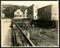
Photograph
View of Holgate Street looking east at 9th Avenue South, Seattle, May 22, 1923
This photograph of Holgate Street looking east towards Beacon Hill depicts two workmen at ground level, perhaps working on the pilings which raise the street and buildings above the marshy ground. Other pedestrians are also visible. This area south of downtown Seattle was originally made up of tidal flats; soil dredged from the Duwamish River and sluiced from the Denny…
ID Number:Lib1988.13.7.2.19
Date:1923
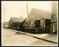
Photograph
View of Holgate Street and Plum Street intersection at 9th Avenue South, Seattle, May 22, 1923
The image is looking southwest on Holgate Avenue at the Plum Street intersection, from 9th Avenue. This area south of downtown Seattle was originally made up of tidal flats; soil dredged from the Duwamish River and sluiced from the Denny triangle and Beacon Hill regrades was used to create this industrial area needed by area businesses and railroads.This photo is…
ID Number:Lib1988.13.7.2.20
Date:1923
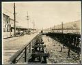
Photograph
View of 9th Avenue South and Stacy Street, Seattle, May 23, 1923
This photograph looks north on 9th Avenue South and Stacy Street in Seattle. Several wooden buildings belonging to Frye & Company are visible, with large white painted letters reading, "Frye's Delicious Brand Hams & Bacon, Wild Rose Lard." Motorcars line the street as well as horses hitched to delivery wagons. This area south of downtown Seattle was originally made up…
ID Number:Lib1988.13.7.2.29
Date:1923
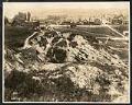
Photograph
View of Seattle west from Beacon Hill, May 28, 1923
This photograph of the northwest side of Beacon Hill in Seattle is facing west out towards Elliott Bay, which is just visible at the top of the frame. Visible in the image are residential homes as well as many commercial properties and buildings, showing the early development of what would be come an important industrial area of Seattle. This area…
ID Number:Lib1988.13.7.2.33
Date:1923