171 results for: Lake Washington Ship Canal
Photograph
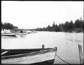
Lake Washington Ship Canal, Seattle, circa 1915
The Lake Washington Ship Canal followed the routes of earlier canals and streams which connected Lake Washington, Lake Union, and Salmon Bay. This photo was taken from a dock on Salmon Bay, at the west end of the canal route, looking east. Handwritten on sleeve: Lake Wn Canal.Photographer's Reference Number: 2510
ID Number:1983.10.6933
Date:Circa 1915
Photograph
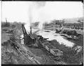
Lake Washington Ship Canal under construction, Seattle, circa 1915
The Lake Washington Ship Canal followed the routes of earlier canals and streams which connected Lake Washington, Lake Union, and Salmon Bay. This photo shows part of the canal about four years after construction started and looks east from 5th Avenue NW towards the northern edge of Queen Anne. Handwritten on sleeve: Lake Wn Canal.Webster & Stevens number: 2511
ID Number:1983.10.6934
Date:Circa 1915
Photograph
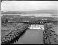
Lake Washington Ship Canal spillway near Fremont, circa 1915
During the building of the Lake Washington Ship Canal in Seattle, temporary dams were built at various places to control the water level. This photo, taken around 1915, shows the spillway of a temporary dam at the western end of Lake Union, near Fremont. Logs for a nearby lumber mill float behind the dam. The Stone Way Bridge and Capitol…
ID Number:1983.10.6935
Date:Circa 1915
Photograph
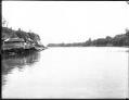
Lake Washington Ship Canal, Seattle, circa 1915
The Lake Washington Ship Canal followed the routes of earlier canals and streams which connected Lake Washington, Lake Union, and Salmon Bay. This photo was probably taken at Salmon Bay, looking to the east. Many such small wooden houses bordered the shore of the waterway. Handwritten on sleeve: Lake Wn Canal.Photographer's Reference Number: 2513
ID Number:1983.10.6936
Date:Circa 1915
Photograph
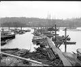
Ballard Boat House on Salmon Bay, 1905
The Ballard Boat House once stood at the foot of 24th Street, near Ballard's business district. People could rent boats at the boathouse to go out on Salmon Bay.This photo was taken in 1905, looking south across Salmon Bay. It shows the Ballard Boat House dock and boats for rent. Rafts of logs float offshore. The farms and houses of…
ID Number:1983.10.6979
Date:1905
Photograph
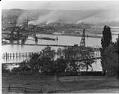
Ballard neighborhood from across Salmon Bay, Seattle, circa 1913
Note from MOHAI records: Adams School on 28th Street NW. Handwritten on sleeve: Pan - Ballard.Photographer's Reference Number: 5742
ID Number:1983.10.7659.1
Date:Circa 1913
Photograph
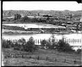
Ballard locks under construction, Seattle, circa 1913
For years, there was no easy or cheap way to move logs, coal, and other resources directly from the east side of Lake Washington to Elliott Bay. There were many plans and several attempts to build a canal via Lake Union. However, none was successful until the Lake Washington Ship Canal was built. Ground was broken for the Lake Washington…
ID Number:1983.10.7659.2
Date:Circa 1913
Photograph
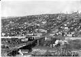
Fremont neighborhood, Seattle, circa 1906
Seattle's Fremont neighborhood, northwest of Lake Union, was named for a town in Nebraska where some of its founders hailed from. Fremont started in the 1880s as a settlement around a sawmill, and grew to a town of 5,000 before it became part of Seattle in 1891. Lake Union emptied into Salmon Bay through a narrow channel called the Outlet.…
ID Number:1983.10.7716.2
Date:Circa 1906
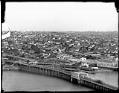
Photograph
Stone Avenue Bridge and Wallingford neighborhood, Seattle, circa 1912
Before the Lake Washington Ship Canal was built, a temporary bridge on Stone Avenue carried traffic across to Fremont. Most of the bridge consisted of a wooden roadway on a trestle. The short metal span was just large enough to let logs and small boats pass through. Stone Avenue is now called Stone Way. Handwritten on sleeve: Pan Phinney Dist.Photographer's…
ID Number:1983.10.7717.1
Date:Circa 1912
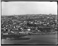
Photograph
Fremont and Wallingford neighborhoods, Seattle, circa 1906
Handwritten on sleeve: Pan Phinney Dist.Photographer's Reference Number: 6093
ID Number:1983.10.7717.2
Date:Circa 1906