835 results for: Neighborhoods
Photograph
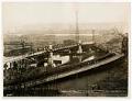
Old and New West Spokane Street Bridges, Seattle, circa 1925
From 1902 to 1917, three temporary wooden bridges were built over the west water way of the Duwamish River, connecting Harbor Island to West Seattle (annexed in 1907). This east-facing view shows one of the old wooden bridges (right) next to the permanent steel bridge (left) under construction. A lone car crosses the new bridge, a low-level bascule bridge, officially…
ID Number:2006.7.96
Date:Circa 1925
Poster
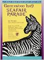
Greenwood Seafair Parade poster, Seattle, 1989
Seafair, Seattle’s annual summer festival, is marked with parades, boat races, and many other events and activities. This poster advertises the Greenwood neighborhood's parade, one of 13 Seafair parades throughout the city that summer. The poster also references Washington State's centennial in 1989. Additional text on poster: Chairman: Lorraine Mintz Welch; Judging: Roger Aase; Grandstand: Jim Coates; Applications Nancy Goodno;…
ID Number:2007.25.35
Date:1989
Poster
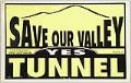
Save our Valley "Yes" Tunnel poster, Seattle, 1999
In 1999, Puget Sound regional transportation authority Sound Transit was finalizing the route of a light rail line set to connect SeaTac airport with Seattle's University District. The proposed route ran through the Rainier Valley, where some residents and businesses concerned about the possible negative effects of street-level light rail formed the "Save Our Valley" group to lobby for a…
ID Number:2007.25.66
Date:1999
Poster
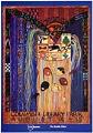
Rainier Valley Heritage Festival poster, Seattle, August 14-15, 1993
Run by the Rainier Chamber of Commerce and begun in 1992, the Rainier Valley Heritage Festival is held annually in August as a celebration of Southeast Seattle's diverse history and cultures, with opportunities for local businesses to connect to the community. In 2018, the festival paired with another Southeast Seattle community celebration, the Othello International Festival.This poster advertises the 1993…
ID Number:2007.52.3
Date:1993
Cartographic material
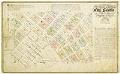
Plat of the Second Addition, City of Seattle, December 1876
Seattle pioneers William Nathaniel Bell (1817-1887) and his wife, Sarah Ann (Peter) Bell (1819-1856), were members of the Denny Party, arriving in present-day West Seattle in 1851. The Bells helped to establish the settlement that became Seattle, settling north of the future downtown in "Belltown." Denny party leaders Arthur Armstrong Denny (1822-1899) and his wife Mary Ann Boren Denny (1822-1910)…
ID Number:2008.54.44
Date:1876
Photograph
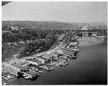
Aerial view of Aurora Bridge over Lake Union, Seattle, April 1960
The Aurora Bridge (officially the George Washington Memorial Bridge) is a cantilever and truss bridge that carries State Route 99 (Aurora Avenue North) over the west end of Seattle's Lake Union. Construction on the bridge piers began in 1929, and the bridge was opened to traffic on February 22, 1932, George Washington's 200th birthday. It was listed on the National…
ID Number:2009.23.31
Date:1960
Photograph
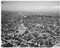
Aerial view of Interstate 5 construction at Denny Way, looking north, January 1961
Interstate 5 (I-5) is the main Interstate Highway on the West Coast of the United States, and Seattle's and widest freeway. The section of I-5 connecting Kent to Seattle to Everett was built between 1960-1966, including the section shown in this aerial photograph taken in 1961. The direction of the photograph is looking north, Lake Union is on the left…
ID Number:2009.23.64
Date:1961
Photograph
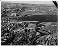
Aerial view of Evergreen Point Floating Bridge construction, Seattle, January 18, 1962
This aerial photograph was taken during construction of the Evergreen Point Floating Bridge, on January 18, 1962. The direction is facing north, with the construction in the foreground, and Husky Stadium and the University of Washington campus beyond.The Evergreen Point Floating Bridge carries State Route 520 across Lake Washington and was second bridge to cross the lake. The bridge is…
ID Number:2009.23.101
Date:1962
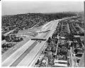
Photograph
Aerial view of I-5 and 520 construction, Seattle, August 1, 1963
Interstate 5 (I-5) is the main Interstate Highway on the West Coast of the United States, and Seattle's largest and widest freeway. The section of I-5 connecting Kent to Seattle to Everett was built between 1960-1966, including the section shown in this aerial photograph taken on August 1, 1963. The direction of the photograph is looking south, and at the…
ID Number:2009.23.114
Date:1963
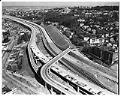
Photograph
Aerial view of I-5 freeway construction at Lakeveiw Boulveard East, Seattle, February 25, 1964
Interstate 5 (I-5) is the main Interstate Highway on the West Coast of the United States, and Seattle's and widest freeway. The section of I-5 connecting Kent to Seattle to Everett was built between 1960-1966, including the section shown in this aerial photograph taken on February 25, 1964. The direction of the photograph is looking north east, in the foreground…
ID Number:2009.23.128
Date:1964