81 results for: Vallentyne, John
Photograph
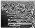
Aerial view of Seattle waterfront, including viaduct construction, October 16, 1961
This aerial photograph of Seattle's waterfront from 1961 features the viaduct nearing completion after what would be 16 years of construction (1950-1966). The Alaskan Way Viaduct was part of a larger effort to develop the remaining two-lane segments of State Route 99, also known as Pacific Highway, into a four-lane roadway from the Oregon border to the Canadian border.The piers…
ID Number:2009.23.77
Date:1961
Photograph
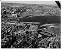
Aerial view of Evergreen Point Floating Bridge construction, Seattle, January 18, 1962
This aerial photograph was taken during construction of the Evergreen Point Floating Bridge, on January 18, 1962. The direction is facing north, with the construction in the foreground, and Husky Stadium and the University of Washington campus beyond.The Evergreen Point Floating Bridge carries State Route 520 across Lake Washington and was second bridge to cross the lake. The bridge is…
ID Number:2009.23.101
Date:1962
Photograph
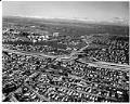
Aerial view of freeway construction, Seattle, January 18, 1962
This aerial photograph was taken during construction of Interstate 5, State Route 520, and the Evergreen Point Floating Bridge, on January 18, 1962. The direction is facing east looking towards Union Bay and Lake Washington. I-5 runs across the center of the frame with the bridge beyond. Husky Stadium and the University of Washington campus are visible in the top…
ID Number:2009.23.104
Date:1962
Photograph
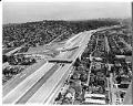
Aerial view of I-5 and 520 construction, Seattle, August 1, 1963
Interstate 5 (I-5) is the main Interstate Highway on the West Coast of the United States, and Seattle's largest and widest freeway. The section of I-5 connecting Kent to Seattle to Everett was built between 1960-1966, including the section shown in this aerial photograph taken on August 1, 1963. The direction of the photograph is looking south, and at the…
ID Number:2009.23.114
Date:1963
Photograph
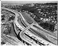
Aerial view of I-5 freeway construction at Lakeveiw Boulveard East, Seattle, February 25, 1964
Interstate 5 (I-5) is the main Interstate Highway on the West Coast of the United States, and Seattle's and widest freeway. The section of I-5 connecting Kent to Seattle to Everett was built between 1960-1966, including the section shown in this aerial photograph taken on February 25, 1964. The direction of the photograph is looking north east, in the foreground…
ID Number:2009.23.128
Date:1964
Photograph
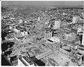
Aerial view of Interstate 5 construction through Seattle, February 25, 1964
Interstate 5 (I-5) is the main Interstate Highway on the West Coast of the United States, and Seattle's largest and widest freeway. The section shown in this aerial photograph was part of I-5 built between 1960-1966 to connect Kent to Seattle. The direction of the photograph is looking north, Lake Union can be seen in the top left of the…
ID Number:2009.23.130
Date:1964
Photograph
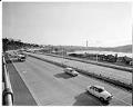
Cars on recently completed Interstate 5, Seattle, April 2, 1964
Interstate 5 (I-5) is the main Interstate Highway on the West Coast of the United States, and Seattle's widest freeway. The section of I-5 connecting Kent to Seattle to Everett was built between 1960-1966, including the section shown in this photograph taken on April 2, 1964.The direction of the photograph is looking south and west, Lake Union is at the…
ID Number:2009.23.137
Date:1964
Photograph
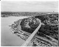
Aerial view of Aurora Bridge over Lake Union, Seattle, July 20, 1964
The Aurora Bridge (officially the George Washington Memorial Bridge) is a cantilever and truss bridge that carries State Route 99 (Aurora Avenue North) over the west end of Seattle's Lake Union. Construction on the bridge piers began in 1929, and the bridge was opened to traffic on February 22, 1932, George Washington's 200th birthday. It was listed on the National…
ID Number:2009.23.143
Date:1964
Photograph
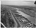
Aerial view of Harbor Island, Seattle, July 20, 1964
Harbor Island is an artificial island in the mouth of Seattle, Washington's, Duwamish River where it empties into Elliott Bay. Built by the Puget Sound Bridge and Dredging Company, Harbor Island was completed in 1909 and was then the largest artificial island in the world, at 350 acres. Harbor Island was made from 24 million yd³ of earth removed in the…
ID Number:2009.23.145
Date:1964
Photograph
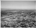
Aerial view of Interstate 5 and Northgate Mall, Seattle, March 10, 1965
Interstate 5 (I-5) is the main Interstate Highway on the West Coast of the United States, and Seattle's largest and widest freeway. The section shown in this aerial photograph was the part of I-5 built between 1960-1966 to connect Kent to Seattle. The direction of the photograph is looking north and west, with Northgate Mall in the center of the…
ID Number:2009.23.173
Date:1965