835 results for: Neighborhoods
Photograph
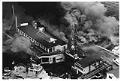
Fire at Ray's Boathouse, Seattle, May 26, 1987
One of Seattle’s landmark waterfront restaurants, Ray’s Boathouse, burned in a spectacular fire on May 26, 1987. A wiring problem beneath Ray’s pier caused plumes of smoke, which spread up into the restaurant through the kitchen floor and prompted the evacuation of customers and staff. Some 50 to 60 fire fighters, plus 20 fire trucks and boats fought the four-alarm…
ID Number:2000.107.185.24.04
Date:1987
Photograph
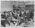
Seattle business leaders in classroom at Sharples Jr. High, Seattle, November 20, 1952
In this image, leaders in the Seattle business world try out the classroom seats on Visiting Day at the newly opened Casper W. Sharples Junior High School (later Aki Kurose Middle School) in the Rainier Valley neighborhood of Seattle. Identifications of back of photo: Front to back, left row: Philip Strack, Stanley Jones, Ray Burhans, R. Burroughs, Eric Bergman; right…
ID Number:2000.107.185.35.04
Date:1952
Photograph
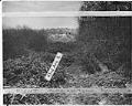
View of sanitary landfill on 43rd. Ave. S. looking south, Seattle, December 1942
This image shows a sanitary landfill on 43rd Ave S between Genesee St. and Lake Washington Boulevard. A sanitary landfill, or fill, was a type of garbage dump in which trash was deposited, spread out and compacted, then covered in several inches of dirt. The city had proposed to expand the fill eastward to 45th Ave S, but residents of…
ID Number:2000.107.188.33.01
Date:1942
Photograph
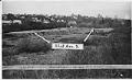
View of sanitary landfill on 43rd. Ave. S. looking west, Seattle, December 1942
This image shows a sanitary landfill on 43rd Ave S between Genesee St. and Lake Washington Boulevard. A sanitary landfill, or fill, was a type of garbage dump in which trash was deposited, spread out and compacted, then covered in several inches of dirt. The city had proposed to expand the fill eastward to 45th Ave S, but residents of…
ID Number:2000.107.188.33.02
Date:1942
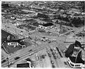
Photograph
Aerial view of South Lake Union neighborhood looking northeast, 1953
The shores of Lake Union were inhabited by the Duwamish people since time immemorial. They called the lake “meman hartshu” meaning “little lake” and had several settlements surrounding it. Seattle’s Cascade or South Lake Union (SLU) neighborhood began growing quickly in the 1880s, as the city expanded north from downtown. Industrial activity on the lake increased in the early 1900s…
ID Number:2000.107.188.36.01
Date:1953
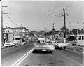
Photograph
Street in the Central Area, Seattle, May 8, 1969
The Central Area (also called the Central District or the CD) is one of the oldest residential neighborhoods in Seattle. Known historically as Seattle’s Black neighborhood, other ethnic groups also called the Central Area home in the early 20th century. Urban development in the area first accelerated in the 1890s, as Seattle’s population rapidly grew. The first settlers were mostly…
ID Number:2000.107.189.01.01
Date:1969
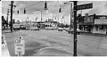
Photograph
Intersection of Beacon Avenue S. and 15th Avenue S., 1974
Beacon Hill was originally inhabited by the Duwamish people, who had a village called Tal-tal-kus at the western foot of the hill. Settlers began moving onto Beacon Hill in the 1850s and growth accelerated around the turn of the 20th century. Starting in the 1920s, Chinese, Italian, and Japanese immigrants settled in Beacon Hill. After World War II, the trend…
ID Number:2000.107.189.08.01
Date:1974
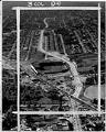
Photograph
Aerial view of Empire Way and Sick's Stadium, July 11, 1953
Empire Way’s route was first laid out in 1913, as a state highway heading southeast out of Seattle. It was named for James J. Hill, the head of the Great Northern Railway, who was nicknamed the “Empire Builder.” At first, Empire Way was put together from parts of older roads on the same route. From the 1930s to the 1950s,…
ID Number:2000.107.189.11.01
Date:1953
Photograph
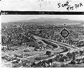
View of Rainier Avenue and Lake Way looking east, March 1954
Seattle's Atlantic neighborhood (which has also been referred to as Yesler/Atlantic and Judkins Park) is a triangular community in the Central District area, between Mount Baker Ridge and Beacon Hill. One of oldest residential neighborhoods, it was home to Seattle's largest Italian enclaves during the early years of the twentieth century. Like other neighborhoods in central and southeast Seattle, Black…
ID Number:2000.107.189.16.01
Date:1954
Photograph
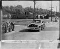
Children crossing 32nd Ave. N. near Harrison School, Seattle, April 26, 1951
The intersection shown here is located at 32nd Avenue North and East Republican Street, in the Harrison/Denny-Blaine neighborhood of Seattle's Central District. The intersection was described by residents at the time as a bad place for children to cross because there were no traffic lights. The cars in the picture are traveling north on 32nd Ave. as the children at…
ID Number:2000.107.190.06.02
Date:1951