672 results for: Lake Washington
Photograph
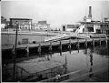
Lake Washington ferry dock at Leschi Park, Seattle, circa 1920
This image of the Leschi was taken at the main terminal at Leschi Park for Anderson Steamboat Company, founded by John L. Anderson (1868–1941), an immigrant from Sweden. Anderson’s company had over 50 stops on the lake. The Leschi was a steam ferry that operated on Lake Washington between Kirkland and Seattle from 1913 to 1950, and afterward on Puget…
ID Number:2016.59.32
Date:Circa 1920
Photograph
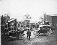
Ferry Issaquah launching, Kirkland, 1914
In 1914, the Anderson Steamboat Company launched the ferry "Issaquah." The vessel was one of the first in the Pacific Northwest designed to carry automobiles as well as horse drawn vehicles. Until 1918, the "Issaquah" sailed between Leschi, Mercer Island, and Newport, where it linked up with the new highway to North Bend. The "Issaquah" could also be rented for…
ID Number:2016.59.54
Date:1914
Photograph
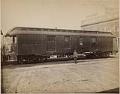
Seattle, Lake Shore & Eastern baggage car, Seattle, circa 1890
The Seattle, Lake Shore & Eastern Railway had a passenger depot and freight office at the foot of Madison Street along the waterfront. This photo shows a railroad employee standing in front of a baggage car near that location.
ID Number:2016.81.6
Date:Circa 1890
Photograph
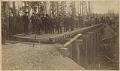
Group of men on Seattle, Lake Shore & Eastern Railway line, 1887
The Seattle, Lake Shore & Eastern Railway extended from the waterfront along the northern shore of Lake Union and then to the north side of Lake Washington, eventually reaching Snoqualmie Falls. In this photo, a group of investors inspect the progress of the line on the way to Woodinville. Colonel A. B. Rogers stands in the center foreground with white…
ID Number:2016.81.10
Date:1887
Poster
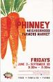
Phinney Neighborhood Farmers Market poster, Seattle, June 3 - September 30, 2016
On May 29, 1993, the University District Farmers Market opened in Seattle at the University Heights Community Center. Continuing from late May through early November, the market drew on Seattle's long history of the Pike Place Market, which opened in August of 1907 and allowed farmers to sell directly to consumers. In 2000, Chris Curtis, one of the originators of…
ID Number:2017.60.2
Date:2016
Poster
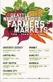
Seattle Neighborhood Farmers Markets poster, 2016
On May 29, 1993, the University District Farmers Market opened in Seattle at the University Heights Community Center. Continuing from late May through early November, the market drew on Seattle's long history of the Pike Place Market, which opened in August of 1907 and allowed farmers to sell directly to consumers. In 2000, Chris Curtis, one of the originators of…
ID Number:2017.60.6
Date:2016
Poster
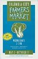
Columbia City Farmers Market poster, Seattle, May 2 - October 17, 2007
On May 29, 1993, the University District Farmers Market opened in Seattle at the University Heights Community Center. Continuing from late May through early November, the market drew on Seattle's long history of the Pike Place Market, which opened in August of 1907 and allowed farmers to sell directly to consumers. In 2000, Chris Curtis, one of the originators of…
ID Number:2017.60.9
Date:2007
Program
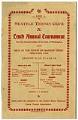
Seattle Tennis Club Tournament program, August 1899
The Seattle Tennis Club was founded in 1890 as the Olympic Tennis Club (renamed in 1896), and the club operated two clay courts at the northwest corner of Madison Street and Minor Avenue on First Hill. By 1919 a larger facility was needed and the club purchased land at their current location on the shore of Lake Washington in Madison…
ID Number:2018.3.3.48
Date:1899
Program
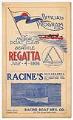
Motor Boat Club regatta program, July 4, 1906
The program pictured here is for the third annual summer Regatta held by the Motor Boat Club of Seattle. Races took place on Lake Washington, and included a one-mile straight course, and three-, five-, and ten-mile triangular courses. The speed boat Comet wowed 3,000 spectators by finishing the ten-mile course in just over 29 minutes. Caption information source: "Comet is…
ID Number:2018.3.3.50
Date:1906
Ephemera
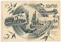
Invitation to opening of Cable Railroad, September 29, 1888
In September 1888, Seattle's second street railway line was built by Pacific Cable Construction Company as a single-track cable car line, running in a loop from Pioneer Square to Leschi Park. This line, the Yesler Way line, effectively linked the steamers docking at Elliott Bay with the ferries crossing Lake Washington. When the line was built the residential and recreational…
ID Number:2018.3.3.75
Date:1888