771 results for: Transportation
Photograph
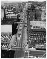
Monorail construction along Fifth Avenue, Seattle, 1961
The Seattle Monorail is an elevated train line that runs approximately one mile along Fifth Avenue from Westlake Center to the Seattle Center. The monorail, which cost 3.5 million to build, opened on March 24, 1962 for the Century 21 Exposition. The line and its trains were constructed by Alweg Rapid Transit Systems, a German company. The image depicts the…
ID Number:2004.48.9.5
Date:1961
Photograph
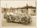
Treat family in car decorated for Golden Potlatch parade, Seattle, 1912
The Tilikums of Elttaes were a fraternal, civic organization composed primarily of influential white Seattle area businessmen who used Native American imagery to promote tourism and the economic development of the city. In July 1911 the Tilikums ("Friends" in Chinook Jargon; Elttaes is Seattle spelled backward) organized the first Golden Potlatch celebration. The Golden Potlatch was a city-wide festival held…
ID Number:2005.19.1
Date:1912
Photograph
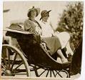
Priscilla Van Sickler and Loyal Nichols at the Olympic Riding and Driving Club, Seattle, 1932
Priscilla Grace Treat (1902-1979) and Loyal Graef Treat (1906-2004) were the daughters of Harry Whitney Treat (1865-1922) and Olive Marion (Graef) Treat (1869-1945). Harry Treat was a real estate developer who established an electric trolley to promote the suburbs of Ballard, Loyal Heights, and Golden Gardens. Harry and Olive were colorful high society figures in Seattle; their Queen Anne mansion…
ID Number:2005.19.3
Date:1932
Photograph
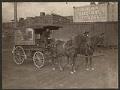
Crescent Manufacturing Company wagon with horses and driver, Seattle, circa 1900
The Crescent Manufacturing Company was founded in Seattle, Washington, in 1883 as Larsen Extract Company. By the early 20th century, Crescent was manufacturing 75 different extracts including Mapleine, as well as importing spices, coffee, and nuts. Crescent was sold to McCormick and Company in 1989, and consolidated its operations in Kent, Washington in 1990.Pictured here is a driver with a…
ID Number:2005.24.38
Date:Circa 1900
Ephemera
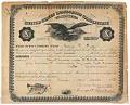
George F. Frye Master of Steam Vessels Certificate, 1873
Born in Germany, George F. Frye arrived in Seattle in 1853 at the age of 20. Frye assisted Henry Yesler with the construction of his steam sawmill. Frye also became close friends with Arthur and Mary Denny, and in 1860 he married their 17-year-old daughter Louisa. Together, George and Louisa Frye ran Seattle's first meat market, opened the Frye Opera…
ID Number:2005.38.2.1
Date:1873
Ephemera
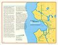
A Guide to Seattle's Monorail, June 2004
The Seattle Monorail Project began in 1997 with a proposed five-line monorail system to be constructed in Seattle as an extension of the existing Seattle Center Monorail. The plan was debated for several years and in November 2005, following the fifth voter initiative on the monorail in eight years, the monorail authority agreed to dissolve itself after having spent $124.7…
ID Number:2005.63.13.1
Date:2004
Ephemera
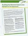
Building the Monorail Green Line, 2005
The Seattle Monorail Project began in 1997 with a proposed five-line monorail system to be constructed in Seattle as an extension of the existing Seattle Center Monorail. The plan was debated for several years and in November 2005, following the fifth voter initiative on the monorail in eight years, the monorail authority agreed to dissolve itself after having spent $124.7…
ID Number:2005.63.13.2
Date:2005
Poster
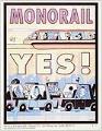
Monorail Yes! poster, Seattle, 2002
This Monorail Yes! poster was part of a long campaign to expand the Seattle Monorail line, which eventually was defeated in 2005. Dick Falkenbury, a long-time political activist, led the effort to draft Initiative 41, which called for construction of a 40-mile monorail system linking Seattle's four corners to downtown Seattle to form a giant "X." The initiative also established…
ID Number:2005.63.15
Date:2002
Photograph
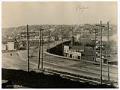
Temporary Fremont Bridge, Seattle, March 18, 1915
The original bridge to Fremont was razed in 1911 to make way for the dredging of the Lake Washington Ship Canal; during this time, all traffic was rerouted to the temporary Stone Way Bridge, just five blocks to the east. A second temporary bridge served the original gap until 1915, when traffic was again rerouted to the Stone Way Bridge…
ID Number:2006.7.1
Date:1915
Photograph
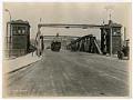
Fremont Bridge on opening day, Seattle, June 15, 1917
The original Fremont Bridge was razed in 1911 to make way for the dredging of the Lake Washington Ship Canal, and a new permanent bridge was constructed to connect Fremont Avenue North in Fremont and Fourth Avenue North in Queen Anne. The new bridge is one of four double-leaf bascule bridges that carry vehicle and pedestrian traffic across the Lake…
ID Number:2006.7.2
Date:1917