584 results for: Alaska
Photograph
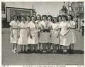
Puget Sound Bridge and Dredging Company employees acting as waitresses for the APL 49 launch party, Seattle, May 29, 1945
Founded in 1889, the Puget Sound Bridge and Dredging Company was also called Puget Sound Bridge and Drydock, Associated Shipbuilders, and Lockheed Shipbuilding and Construction Company. The company participated in most major construction sites in the Pacific Northwest, and they are responsible for many ships, including some of the Washington State ferries and many naval vessels during and after World…
ID Number:Lib1988.13.10.30b.2
Date:1945
Photograph
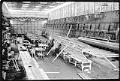
Lockheed Shipbuilding and Construction Company employees working on the USS Plainview, Seattle, 1964
Founded in 1889, the Puget Sound Bridge and Dredging Company was also called Puget Sound Bridge and Drydock, Associated Shipbuilders, and Lockheed Shipbuilding and Construction Company. The company participated in most major construction sites in the Pacific Northwest, and they are responsible for many ships, including some of the Washington State ferries and many naval vessels during and after World…
ID Number:Lib1988.13.12.1bb.4.3
Date:1964
Photograph
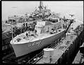
Lockheed Shipbuilding and Construction Company employees working on the USS Plainview, Seattle, circa 1964
Founded in 1889, the Puget Sound Bridge and Dredging Company was also called Puget Sound Bridge and Drydock, Associated Shipbuilders, and Lockheed Shipbuilding and Construction Company. The company participated in most major construction sites in the Pacific Northwest, and they are responsible for many ships, including some of the Washington State ferries and many naval vessels during and after World…
ID Number:Lib1988.13.12.1bb.4.4
Date:Circa 1964
Photograph
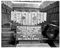
Keel of the USS Plainview at Lockheed Shipbuilding and Construction Company, Seattle, 1964
Founded in 1889, the Puget Sound Bridge and Dredging Company was also called Puget Sound Bridge and Drydock, Associated Shipbuilders, and Lockheed Shipbuilding and Construction Company. The company participated in most major construction sites in the Pacific Northwest, and they are responsible for many ships, including some of the Washington State ferries and many naval vessels during and after World…
ID Number:Lib1988.13.12.1bb.7
Date:1964
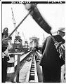
Photograph
Launch of the USS Coronado at the Lockheed Shipbuilding and Construction Company shipyard, Seattle, July 1, 1966
Founded in 1889, the Puget Sound Bridge and Dredging Company was also called Puget Sound Bridge and Drydock, Associated Shipbuilders, and Lockheed Shipbuilding and Construction Company. The company participated in most major construction sites in the Pacific Northwest, and they are responsible for many ships, including some of the Washington State ferries and many naval vessels during and after World…
ID Number:Lib1988.13.12.1j.3
Date:1966
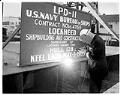
Photograph
Welder at launch of the USS Coronado at the Lockheed Shipbuilding and Construction Company shipyard, Seattle, July 1, 1966
Founded in 1889, the Puget Sound Bridge and Dredging Company was also called Puget Sound Bridge and Drydock, Associated Shipbuilders, and Lockheed Shipbuilding and Construction Company. The company participated in most major construction sites in the Pacific Northwest, and they are responsible for many ships, including some of the Washington State ferries and many naval vessels during and after World…
ID Number:Lib1988.13.12.1j.4
Date:1966
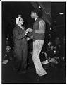
Photograph
Employees dancing at Puget Sound Bridge and Dredging Company, Seattle, January 19, 1944
Founded in 1889, the Puget Sound Bridge and Dredging Company was also called Puget Sound Bridge and Drydock, Associated Shipbuilders, and Lockheed Shipbuilding and Construction Company. The company participated in most major construction sites in the Pacific Northwest, and they are responsible for many ships, including some of the Washington State ferries and many naval vessels during and after World…
ID Number:Lib1988.13.w545
Date:1944
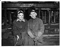
Photograph
Women employees at Puget Sound Bridge and Dredging Company, Seattle, January 19, 1944
Founded in 1889, the Puget Sound Bridge and Dredging Company was also called Puget Sound Bridge and Drydock, Associated Shipbuilders, and Lockheed Shipbuilding and Construction Company. The company participated in most major construction sites in the Pacific Northwest, and they are responsible for many ships, including some of the Washington State ferries and many naval vessels during and after World…
ID Number:Lib1988.13.w546
Date:1944
Photograph
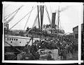
Steamer "Queen" about to depart Seattle for Alaska, March 6, 1898
During the spring and summer of 1898, the steamer "Queen," was very busy carrying people between Seattle and southeastern Alaska. The ship passage was only the first part of the long voyage to the Klondike gold fields.In this photo, a crowd made up almost entirely of men waits at a Seattle pier to board the "Queen" or another Alaska-bound steamer.…
ID Number:Lib1988.33.116
Date:1898
Photograph
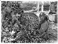
Woman with hop basket, circa 1900
From the late 1860s to the early 1890s, hop farming was an important activity in the valleys of the Puget Sound region, including Puyallup, White River, and Snoqualmie. Indigenous workers came from through the Pacific Northwest, Canada, and Alaska (but especially from regional tribes like the Puyallup, Snoqualmie, Muckleshoot, Duwamish, Sammamish, Lummi, and Nisqually) as a seasonal labor force to…
ID Number:Lib1988.33.139
Date:Circa 1900