835 results for: Neighborhoods
Photograph
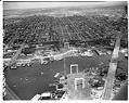
Aerial view looking north from the freeway bridge under construction, Seattle, 1959
This aerial view shows construction phase of the Tacoma-Seattle-Everett Freeway that was to become Interstate 5 (I-5). Bridge piers stand on either side of the Lake Washington Ship Canal. The 4,429-foot-long bridge completed in fall 1961.Construction of the Tacoma-Seattle-Everett freeway, which opened to traffic in December 1962, took up 6,600 parcels of land, 4,500 of them in Seattle. In 1958-59,…
ID Number:1986.5.4000.2
Date:1959
Photograph
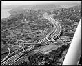
Aerial of freeway construction, Seattle, 1967
This aerial view shows the construction of the Tacoma-Seattle-Everett Freeway that was to become Interstate 5 (I-5). Construction of the Tacoma-Seattle-Everett freeway, which opened to traffic in December 1962, took up 6,600 parcels of land, 4,500 of them in Seattle. In 1958-59, the Washington State Highway Department paid homeowners fair market value for their homes, then auctioned the buildings for…
ID Number:1986.5.4077.1
Date:1967
Photograph
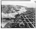
Aerial view of Ballard looking west, Seattle, 1937
The first Ballard Bridge opened in December 1917, crossing the Lake Washington Ship Canal and linking the Ballard district by road to Seattle. This aerial photo shows the Ballard Bridge and Salmon Bay, with the Hiram M. Chittenden Locks and Puget Sound at the top of the image. Log rafts floating in the bay are visible at the bottom left…
ID Number:1986.5.7332.1
Date:1937
Photograph
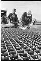
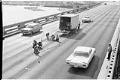
Ironworkers skidproofing 1st Avenue S. bridge, Seattle, March 23, 1964
Seattle's First Avenue South bascule bridge opened in September 1956, connecting the industrial areas northeast of the Duwamish River to the residential neighborhoods to the south and southwest. In this image, ironworkers Whitey Wallace (left) and Roy Garrison weld studs onto the steel deck of the bridge as safety features designed to reduce skidding by automobiles. Caption information derived from…
ID Number:1986.5.7509.8
Date:1964
Photograph
Workers skidproofing 1st Avenue S. bridge, Seattle, March 23, 1964
Seattle's First Avenue South bascule bridge opened in September 1956, connecting the industrial areas northeast of the Duwamish River to the residential neighborhoods to the south and southwest. This image shows skidproofing work being done on the bridge, with ironworkers welding studs to the steel deck of the bridge to reduce skidding by automobiles. Caption information derived from captions written…
ID Number:1986.5.7509.11
Date:1964
Photograph
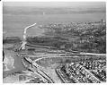
Aerial of Evergreen Point Bridge under construction from west, Seattle, 1963
Washington's Evergreen Point Floating Bridge carries State Route 520 across Lake Washington, connecting Seattle with the growing area east of the lake. When it opened, the bridge's 7,578 foot floating span was the longest in the world. This was the second floating bridge to cross Lake Washington, and both bridges are overcrowded daily with commuters in their automobiles. This photo…
ID Number:1986.5.7595.4
Date:1963
Photograph
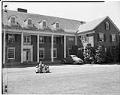
Children playing outside at Seattle Children's Home, July 8, 1944
Seattle's oldest charity, the Seattle Children's Home originated as the Ladies' Relief Society in April 1884 to aid orphaned children. In the 1930s, the home shifted its emphasis from orphans to troubled children. Beginning in the 1980s, it provided comprehensive treatment and services to troubled youth. In 2012, Seattle Children’s Home merged with Navos, one of the largest providers of…
ID Number:1986.5.7817.1
Date:1944
Photograph
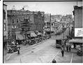
Chinatown street scene looking northeast, Seattle, 1934
In the early 1900s, Chinese businesses began moving to the area around King Street. By the 1920s, most of Seattle's Chinese residents lived and worked there. Other Asian immigrants soon followed, notably Japanese and Filipinos attracted by the area's inexpensive housing and storefronts for their own businesses and restaurants. By the late 1930s, Chinatown was established as a distinct neighborhood…
ID Number:1986.5.7828.4
Date:1934
Photograph
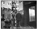
Men on a corner in Seattle's Chinatown, 1932
In the early 1900s, Chinese businesses began moving to the area around King Street. By the 1920s, most of Seattle's Chinese residents lived and worked there. Other Asian immigrants soon followed, notably Japanese and Filipinos attracted by the area's inexpensive housing and storefronts for their own businesses and restaurants. By the late 1930s, Chinatown was established as a distinct neighborhood…
ID Number:1986.5.7830.1
Date:1932
Photograph
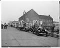
Funeral cars processing down King Street, Seattle, November 28, 1941
Born in China, Chin Fook Hing (1875-1941) came to Seattle from California around 1900. In 1911 he established the Chong Hink Knitting Company at 504 Twelfth Avenue South, which he managed until his death. Through his work in the Seattle Chinese Patriotic League, Mr. Chin was credited with raising more than $50,000 for China war relief. Long active in his…
ID Number:1986.5.7833.1
Date:1941