835 results for: Neighborhoods
Photograph
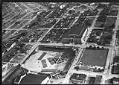
Aerial of National Guard Armory, Seattle, June 29, 1939
This aerial view looks south and west on what would later become the World's Fairgrounds, with the the Civic Auditorium and field in the foreground and the Armory (now the Center House) in the center. Handwritten on sleeve: 6-29-39 National Guard Armory.Photographer's number: T-921
ID Number:1983.10.17888
Date:1939
Photograph
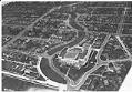
Aerial of Franklin High School and Mount Baker neighborhood looking south, Seattle, May 31, 1932
Franklin High School opened in the fall of 1912 in Seattle's Mount Baker area. The new school had 42 classrooms, two gymnasiums, a library, a home economics model apartment, and a 1,300 seat auditorium. When it opened, the school had 769 students, but the student body grew quickly. The school was built in the popular Renaissance Revival style, and was…
ID Number:1983.10.17937
Date:1932
Photograph
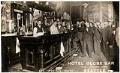
Bartenders and patrons holding beer glasses at Hotel Globe bar, Seattle, circa 1910
Seattle's Globe Hotel operated from 1898 until the mid 1960s in a building originally built in 1891 as a warehouse. The building, historically called the Marshall-Walker Building, is a four story brick block located on the southeast corner of South Main Street and First Avenue South. Part of the city's historic Pioneer Square neighborhood, the building now houses office and…
ID Number:1983.103.1
Date:Circa 1910
Program
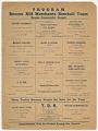
Beacon Hill Merchants Baseball Team program, 1927
The Seattle Community Baseball League was founded in 1926, as a semi-professional league of eight teams. The inaugural teams were the West Seattle Athletic Club, Georgetown Merchants, Fremont Community Club, Alki Merchants, Mercer Athletic Club, Rainier Valley Merchants, and South Park Merchants. Ballard was offered a team, but could not put one together, so Interbay was given the eighth slot.…
ID Number:1984.135.1
Date:1927
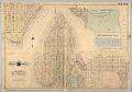
Cartographic material
Baist's Real Estate Atlas of Surveys of Seattle, Plate 12, 1908
The G. William Baist Company of Philadelphia produced real estate and insurance maps of over twenty different cities across the United States between the 1880s and 1967. The company published atlases in Seattle in 1905, 1908, and 1912, illustrating property ownership, building materials and improvements, and transportation routes.This map, labeled Plate 12, was separated from the atlas, and shows the…
ID Number:1985.4.13
Date:1908
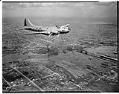
Photograph
Aerial view of an early Boeing B-17E in flight, Seattle, 1941
The redesigned B-17E differed from previous models in that it included an enlarged tail, more guns and extra armor. It also included a tail gunner position, reducing its vulnerability from the rear. Only about 500 B17Es were built. This view looks northeast from the Magnolia area, showing the Ballard bridge below and Green Lake in the distance. Date photograph was…
ID Number:1986.5.186.1
Date:1941
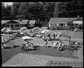
Photograph
Fourth of July party on NW 120th Street showing neighbors meeting in the street seen from the roof of a nearby house, Seattle, 1961
Handwritten on sleeve: FOURTH OF JULY, Seattle, 1200 block NW 120th, 1961; Randy Clark. Date photograph was filed at the Seattle Post-Intelligencer (date of photograph and file date may differ by a month or more): July 5, 1961.
ID Number:1986.5.3569.2
Date:1961
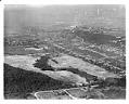
Photograph
Aerial view of the West Seattle Golf Course, looking northeast, 1937
Henry Chandler Egan, famed architect and accomplished player, laid out the original design for West Seattle Golf Course in 1935. It opened in May of 1940, and continues to operate as one of Seattle's municiple golf courses. Written on sleeve: GOLF, Seattle, West Seattle Course, airview Date photograph was filed at the Seattle Post-Intelligencer (date of photograph and file date…
ID Number:1986.5.3780.1
Date:1937
Photograph
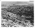
Aerial view, looking northeast, of the construction of Interstate 5, Lakeview Boulevard section, Seattle, circa 1958
The 1956 Federal-Aid Highway Act kicked off the Interstate construction program. Completed in the 1960s, Interstate-5 (I-5), of which the Tacoma-Seattle-Everett Freeway forms a part, is the only Interstate highway running from Canada to Mexico. Written on sleeve: HIGHWAYS, Freeway, Seattle, right-of-way, Lakeview BLVD. section, airview Date photograph was filed at the Seattle Post-Intelligencer (date of photograph and file date…
ID Number:1986.5.3992.1
Date:Circa 1958
Photograph
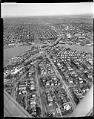
Aerial of freeway bridge under construction, Seattle, 1959
This aerial view shows the initial construction phase of the Tacoma-Seattle-Everett Freeway that was to become Interstate 5 (I-5). Bridge piers stand on either side of the Lake Washington Ship Canal. The University Bridge sits to the right of the new piers, which were used to construct a 4,429-foot-long bridge completed in fall 1961. Construction of the Tacoma-Seattle-Everett freeway, which…
ID Number:1986.5.3998.1
Date:1959