436 results for: Urban Planning
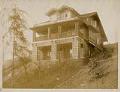
Photograph
House constructed by Long Building Company, Seattle, circa 1920
J. Stanley Long (1883-1959) was a contractor who built homes in Seattle neighborhoods for more than 50 years. Born in Ohio, Long studied law in Chicago, and moved to Seattle in 1906. In Seattle, rather than practicing law, Long focused his energies on the growth potential of the local housing market. Long built and sold his first house in 1906.…
ID Number:2010.76.1.54
Date:Circa 1920
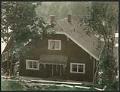
Photograph
House constructed by Long Building Company, Seattle, circa 1920
J. Stanley Long (1883-1959) was a contractor who built homes in Seattle neighborhoods for more than 50 years. Born in Ohio, Long studied law in Chicago, and moved to Seattle in 1906. In Seattle, rather than practicing law, Long focused his energies on the growth potential of the local housing market. Long built and sold his first house in 1906.…
ID Number:2010.76.1.55
Date:Circa 1920
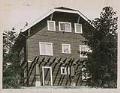
Photograph
House constructed by Long Building Company, Seattle, circa 1920
J. Stanley Long (1883-1959) was a contractor who built homes in Seattle neighborhoods for more than 50 years. Born in Ohio, Long studied law in Chicago, and moved to Seattle in 1906. In Seattle, rather than practicing law, Long focused his energies on the growth potential of the local housing market. Long built and sold his first house in 1906.…
ID Number:2010.76.1.56
Date:Circa 1920
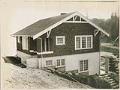
Photograph
House constructed by Long Building Company, Seattle, circa 1920
J. Stanley Long (1883-1959) was a contractor who built homes in Seattle neighborhoods for more than 50 years. Born in Ohio, Long studied law in Chicago, and moved to Seattle in 1906. In Seattle, rather than practicing law, Long focused his energies on the growth potential of the local housing market. Long built and sold his first house in 1906.…
ID Number:2010.76.1.57
Date:Circa 1920
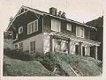
Photograph
House constructed by Long Building Company, Seattle, circa 1920
J. Stanley Long (1883-1959) was a contractor who built homes in Seattle neighborhoods for more than 50 years. Born in Ohio, Long studied law in Chicago, and moved to Seattle in 1906. In Seattle, rather than practicing law, Long focused his energies on the growth potential of the local housing market. Long built and sold his first house in 1906.…
ID Number:2010.76.1.58
Date:Circa 1920
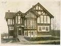
Photograph
House constructed by Long Building Company, Seattle, circa 1920
J. Stanley Long (1883-1959) was a contractor who built homes in Seattle neighborhoods for more than 50 years. Born in Ohio, Long studied law in Chicago, and moved to Seattle in 1906. In Seattle, rather than practicing law, Long focused his energies on the growth potential of the local housing market. Long built and sold his first house in 1906.…
ID Number:2010.76.1.59
Date:Circa 1920
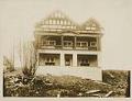
Photograph
House constructed by Long Building Company, Seattle, circa 1920
J. Stanley Long (1883-1959) was a contractor who built homes in Seattle neighborhoods for more than 50 years. Born in Ohio, Long studied law in Chicago, and moved to Seattle in 1906. In Seattle, rather than practicing law, Long focused his energies on the growth potential of the local housing market. Long built and sold his first house in 1906.…
ID Number:2010.76.1.60
Date:Circa 1920
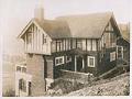
Photograph
House constructed by Long Building Company, Seattle, circa 1920
J. Stanley Long (1883-1959) was a contractor who built homes in Seattle neighborhoods for more than 50 years. Born in Ohio, Long studied law in Chicago, and moved to Seattle in 1906. In Seattle, rather than practicing law, Long focused his energies on the growth potential of the local housing market. Long built and sold his first house in 1906.…
ID Number:2010.76.1.61
Date:Circa 1920
Photograph
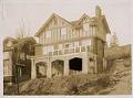
House constructed by Long Building Company, Seattle, circa 1920
J. Stanley Long (1883-1959) was a contractor who built homes in Seattle neighborhoods for more than 50 years. Born in Ohio, Long studied law in Chicago, and moved to Seattle in 1906. In Seattle, rather than practicing law, Long focused his energies on the growth potential of the local housing market. Long built and sold his first house in 1906.…
ID Number:2010.76.1.62
Date:Circa 1920
Photograph
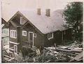
House constructed by Long Building Company, Seattle, circa 1920
J. Stanley Long (1883-1959) was a contractor who built homes in Seattle neighborhoods for more than 50 years. Born in Ohio, Long studied law in Chicago, and moved to Seattle in 1906. In Seattle, rather than practicing law, Long focused his energies on the growth potential of the local housing market. Long built and sold his first house in 1906.…
ID Number:2010.76.1.64
Date:Circa 1920