480 results for: Street Views
Photograph
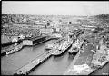
Aerial view of Connecticut Street dock, Seattle, 1935
This aerial view of what is now Seattle's SoDo neighborhood, located just south of downtown, features docks that were owned by the Port of Seattle and utilized by shipping companies. Just north of the docks, at the left center edge of the frame, is what was then Seattle's largest Hooverville, a temporary and improvised shantytown populated by men left unemployed…
ID Number:1983.10.17702.16
Date:1935
Photograph
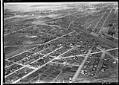
Aerial view of Georgetown from the southeast, 1936
Georgetown is located south of downtown Seattle in the Duwamish River Valley. By the time of this 1936 image, much of the river's original course had been filled in for houses, farms, and factories. Empty land created by the filling of the river’s old oxbows can be seen at the left edge of the image, bisected by South Michigan Street…
ID Number:1983.10.17774.1
Date:1936
Photograph
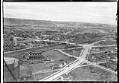
Aerial view from the southeast, looking across Georgetown to West Seattle, 1936
Georgetown is located south of downtown Seattle in the Duwamish River Valley. This image shows an area of Beacon Hill, above Georgetown's commercial area and the railroad. Seventeenth Avenue South is partially paved as it heads north, past a large natural gas storage tank and the North Coast Chemical & Soap Works plant. New sidewalks have been built along Seventeenth…
ID Number:1983.10.17774.3
Date:1936
Photograph
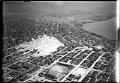
Aerial view of Denny regrade area, Seattle, 1931
Seattle's present-day Denny Triangle neighborhood was created between 1897-1930 by removing Denny Hill in stages. The neighborhood is located in the triangle formed by Denny Way on the north, Third Avenue on the southwest, and Olive Way on the southeast. This aerial view of the newly cleared neighborhood faces south towards downtown Seattle. It was taken after completion of the…
ID Number:1983.10.17948
Date:1931
Photograph
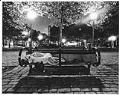
Occidental Park, September 23, 1983, 2:56 am
In 1983, the National Press Photographers Association sponsored a documentary project called "Day in the Life of Washington: September 23, 1983." Photographers from the NPAA, the American Society of Magazine Photographers, and freelancers participated in the 24-hour "Dayshoot," recording the ordinary occurrences of everyday life that might take on larger significance in a historical perspective. One hundred twenty of the…
ID Number:1984.118.188
Date:1983
Photograph
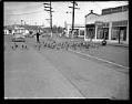
Geese crossing street near Green Lake, Seattle, 1945
Handwritten on sleeve: GEESE, Greenlake.Date photograph was filed at the Seattle Post-Intelligencer (date of photograph and file date may differ by a month or more): March 6, 1945.
ID Number:1986.5.3662.1
Date:1945
Photograph
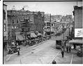
Chinatown street scene looking northeast, Seattle, 1934
In the early 1900s, Chinese businesses began moving to the area around King Street. By the 1920s, most of Seattle's Chinese residents lived and worked there. Other Asian immigrants soon followed, notably Japanese and Filipinos attracted by the area's inexpensive housing and storefronts for their own businesses and restaurants. By the late 1930s, Chinatown was established as a distinct neighborhood…
ID Number:1986.5.7828.4
Date:1934
Photograph
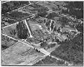
Aerial view of Firland Sanatorium, Shoreline, May 1938
Firland Sanatorium, Seattle’s municipal tuberculosis hospital, opened on May 2, 1911, to help combat what was at the time Seattle’s leading cause of death. Firland was located north of Seattle, on land donated by railroad magnate Horace C. Henry (1844-1928), whose son Walter had died of TB. The hospital served there until its move in 1947 to a former Naval…
ID Number:1986.5.9372.1
Date:1938
Photograph
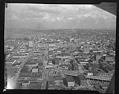
Aerial view of the Alaskan Way Viaduct, Seattle, 1953
Seattle's Alaskan Way Viaduct carried traffic over the waterfront area, linking the northern part of the city to the industrial area south of the central business district. The first unit of the elevated roadway, from Battery Street to Dearborn Street, was completed in 1953 and a southern extension in 1959. The Viaduct closed in January 2019 after being replaced by…
ID Number:1986.5.12214.1
Date:1953
Photograph
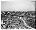
Aerial of Alaskan Way Viaduct extension south to Spokane Street with a view northeast toward Seattle, 1959
Seattle's Alaskan Way Viaduct carried traffic over the waterfront area, linking the northern part of the city to the industrial area south of the central business district. The first unit of the elevated roadway, from Battery Street to Dearborn Street, was completed in 1953 and a southern extension in 1959. The Viaduct closed in January 2019 after being replaced by…
ID Number:1986.5.12223.1
Date:1959