480 results for: Street Views
Photograph
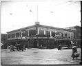
Pike Place Market, Seattle, circa 1917
In 1917 real estate developer Frank Goodwin purchased the Bartell Building (1900) on the southwest corner of First and Pike and renamed it the Economy Market, thus completing the ensemble of core market buildings. Initially the stables for farmer's horses, the building got its name for being the discount or day-old section of the market. Signs in image: Economy Market.…
ID Number:1983.10.10580.2
Date:Circa 1917
Photograph
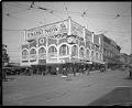
Streetcar signal at First Avenue and Pike Streets, Seattle, circa 1918
Cables support and power a streetcar signal in the middle of the intersection of First and Pike, in downtown Seattle. The signal itself is somewhat camouflaged against the façade of the Corner Market, at Pike Place. It appears to operate by the rotation of triangular panels that indicate which streetcar should stop and which should proceed. Streetcar tracks can be…
ID Number:1983.10.10589
Date:Circa 1918
Photograph
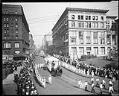
Labor Day parade, September 2, 1918
For many years, Seattle's industries closed on Labor Day, and trade union members marched in the annual Labor Day parade. In 1918, the United States' armed forces were still fighting in Europe. Union members serving at forts and naval stations in the Seattle area marched in the parade in uniform. The Seattle Times reported that 40,000 union members were expected…
ID Number:1983.10.10777.8
Date:1918
Photograph
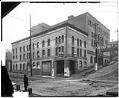
Seattle Theatre, Seattle, circa 1913
The Seattle Theatre was located at 700 Third Avenue, at the northeast corner of Third and Cherry. The first film shown in Seattle was projected in this theater. It was torn down in 1915 for the construction of the Arctic Building, which still occupies the site. A later Seattle Theatre became the Paramount. Signs in image: Seattle Theatre. Y.W.C.A. Cooking…
ID Number:1983.10.10795
Date:Circa 1913
Photograph
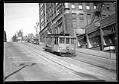
Cable car on James Street, Seattle, July 14, 1930
Seattle's James Street cable car line opened in 1890. The fare was five cents, or $1.00 per month for students. After consolidation into the Union Trunk Line, it carried passengers and freight up the very steep slope of First Hill and on to Broadway and Madrona Park. Signs in image: Radio Telegraphy. Electric Shop. Jasper & McDonald Real Estate. Conner…
ID Number:1983.10.10834.1
Date:1930
Photograph
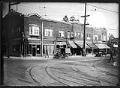
West Seattle Junction, circa 1925
The primary commercial district in the West Seattle neighborhood, commonly called the Junction, was originally formed in 1907 at the crossroads of two street car lines along what are now California Avenue SW and SW Alaska Street. Heavy promotion encouraged a residential real estate boom to the area, and the 1920s saw significant commercial growth. This image of the intersection…
ID Number:1983.10.12198.1
Date:Circa 1925
Photograph
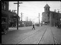
View along Ballard Avenue with City Hall building, Seattle, October 19, 1925
The cornerstone for Ballard's city hall was laid in May 1899, and the building was completed about nine years later, about the same time that Ballard was incorporated as part of Seattle. The building housed a jail, city offices, the fire department, community meeting rooms, a ballroom, and later, a police precinct. This view shows automobiles parked in front of…
ID Number:1983.10.12223.1
Date:1925
Photograph
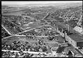
Aerial view of Georgetown, from the south, September 19, 1933
The Georgetown district lies south of downtown Seattle, below Beacon Hill. This aerial view, looking to the north, shows the Seattle Brewing & Malting Company's Bayview Brewery and businesses along Airport Way to the right, and newly-paved S. Harney Street passing through the residential area in the foreground. Beyond S. Corson Street (center to left) are the Georgetown Elementary School…
ID Number:1983.10.17511
Date:1933
Photograph
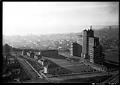
Aerial view of Marine Hospital, Seattle, 1937
The Marine Hospital in Seattle was completed in 1932, and opened in 1933, serving veterans, merchant seamen, the U.S. Coast Guard, U.S. Light House Service, and "federal compensation cases" (the poor and indigent). Now the Pacific Tower, and previously the Pacific Medical Center, the 16-story building is located on Beacon Hill in Seattle, at 1200 12th Avenue South. Designed by…
ID Number:1983.10.17640
Date:1937
Photograph
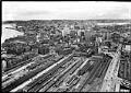
Aerial view of Seattle from south, 1935
This aerial view of downtown Seattle was taken facing north from the present-day location of the SoDo neighborhood. Prominent in the foreground is King Street Station and the rail yard that opened in 1906 to serve both the Great Northern Railway and Northern Pacific Railway, and has served Amtrack since 1971. The waterfront and Elliott Bay are visible on the…
ID Number:1983.10.17697.5
Date:1935