280 results for: Lake Union
Photograph
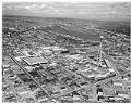
Aerial view of Century 21 Exposition site, Seattle, April 12, 1962
The Century 21 Exposition (also known as the Seattle World's Fair) ran from April 21, 1962, to October 21, 1962.. Nearly 10 million people attended the fair. As planned, the exposition left behind a fairground and numerous public buildings and public works; some credit it with revitalizing Seattle's economic and cultural life. The site, slightly expanded since the fair, is now…
ID Number:2009.23.550
Date:1962
Photograph
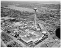
Aerial view of Century 21 Exposition site on opening day, Seattle, April 21, 1962
The Century 21 Exposition (also known as the Seattle World's Fair) ran from April 21, 1962, to October 21, 1962. Nearly 10 million people attended the fair. As planned, the exposition left behind a fairground and numerous public buildings and public works; some credit it with revitalizing Seattle's economic and cultural life. The site, slightly expanded since the fair, is now…
ID Number:2009.23.564
Date:1962
Photograph
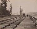
Fremont streetcar and pedestrians along waterfront, Seattle, circa 1900
In this photo, the "Fremont 16" streetcar runs on tracks along the west side of Lake Union, with a smartly dressed couple strolling on the adjacent wooden walkway. The letters "SE Ry" are worked into the ornate metalwork on the electrical poles, initials of the Seattle Electric Railway Company. Though unattributed, the photograph was probably taken by Seattle photographer John…
ID Number:2011.26.7.12
Date:Circa 1900
Poster
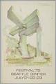
Bumbershoot poster, Seattle, July 21-23, 1972
Begun as "Festival '71" in 1971, Seattle's Bumbershoot has become one of North America's largest urban arts festivals, held annually over Labor Day weekend at the Seattle Center.The poster pictured here features artwork by Claes Oldenburg (b. 1929), a Swedish-born American sculptor known for his public art installations typically featuring large replicas of everyday objects. His painting, "Lake Union, Seattle,…
ID Number:2011.49.2
Date:1972
Menu
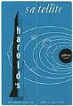
Harold's Satellite restaurant and Galaxy Room menu, circa 1965
Harold's Satellite restaurant and Galaxy Room was located at 2501 Fairview Avenue East on the shores of Lake Union. Harold's was owned by Harold C. and Evelynne F. Frye. The menu, which has a space theme with rockets and astronaut cartoons, includes information on the back about Boeing's orginal lakeside hangar which was located north of the restaurant. Harold's also…
ID Number:2014.3.1.11
Date:Circa 1965
Photograph
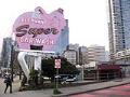
Elephant Super Car Wash sign, Battery Street and Denny Way, Seattle, April 2017
When the first Elephant Car Wash opened at Fourth Avenue and Lander Street in Seattle in 1951, it was the first automatic car wash in Washington State. For the first time, cars received hands-free treatment. The owners opened additional car washes in the region, all with the eye-catching neon signs designed by Bea Haverfield, an area neon designer. This image…
ID Number:2014.43.2.4.ARCH130
Date:2017
Photograph
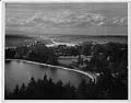
View to the northwest from the Volunteer Park water tower, Seattle, circa 1956
This view of Lake Union, the Ship Canal, and Puget Sound was taken from the top of the water tower in Volunteer Park. Beyond the reservoir in the foreground, one can see the buildings of St. Mark's Cathedral and St. Nicholas School. The trees that surround the water tower have since grown tall enough to obscure this view.
ID Number:2014.49.Box22.Folder19.001
Date:Circa 1956
Photograph
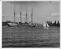
Sailing yacht Fantome in Portage Bay, Seattle, circa 1954
The luxury sailing yacht Fantome, originally built for the Italian navy, belonged for many years to the heir to the Guinness Brewery. The vessel was stranded in Seattle in 1939 due to World War II, and, after the war, was blocked from leaving for nearly 14 years during a tax dispute with King County. Here, a small small sailboat heads…
ID Number:2014.49.Box22.Folder19.004
Date:Circa 1954
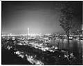
Photograph
View of Seattle from Capitol Hill, 1962
Looking across Lake Union, this night-time view of Seattle includes the construction of I-5 and the stacks of the 1914 Lake Union Steam Plant in the foreground, and the Naval Reserve Armory in the center. The Space Needle glows brightly on the horizon, and the the KING 5 broadcast tower on Queen Anne Hill is visible at far right.
ID Number:2014.49.15.017.02
Date:1962
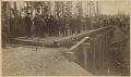
Photograph
Group of men on Seattle, Lake Shore & Eastern Railway line, 1887
The Seattle, Lake Shore & Eastern Railway extended from the waterfront along the northern shore of Lake Union and then to the north side of Lake Washington, eventually reaching Snoqualmie Falls. In this photo, a group of investors inspect the progress of the line on the way to Woodinville. Colonel A. B. Rogers stands in the center foreground with white…
ID Number:2016.81.10
Date:1887