280 results for: Lake Union
Postcard
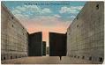
Empty chamber in Ballard Locks, Seattle, circa 1917
For years, there was no easy or cheap way to move logs, coal, and other resources directly from the east side of Lake Washington to Elliott Bay. There were many plans and several attempts to build a canal via Lake Union. However, none was successful until the Lake Washington Ship Canal was built in 1911 to 1917. The Hiram Chittenden…
ID Number:2002.48.947
Date:Circa 1917
Photograph
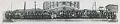
Ford employees posed outside at South Lake Union assembly plant, Seattle, 1916
In the 1920s, the Ford Motor Company had a number of buildings across the country for local assembly of Model T cars. One assembly plant was located in Seattle, at the southern end of Lake Union, at what is now 700 Fairview Avenue North. The building, which still stands, was occupied by The Craftsman Press for a period and, as…
ID Number:2004.39.1
Date:1916
Document
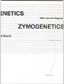
ZymoGenetics annual report, 2001
ZymoGenetics was established in Seattle in 1981 by University of Washington professors Earl Davie and Benjamin Hall, along with University of British Columbia professor Michael Smith. One of the oldest biotechnology/pharmaceutical companies in the U.S., ZymoGenetics was involved in the development of therapeutic proteins. The company was acquired by Novo Nordisk in 1988, and was spun off as a public…
ID Number:2005.26.1
Date:2001
Ephemera
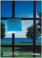
ZymoGenetics NASDAQ advertisement, 2002
ZymoGenetics was established in Seattle in 1981 by University of Washington professors Earl Davie and Benjamin Hall, along with University of British Columbia professor Michael Smith. One of the oldest biotechnology/pharmaceutical companies in the U.S., ZymoGenetics was involved in the development of therapeutic proteins. The company was acquired by Novo Nordisk in 1988, and was spun off as a public…
ID Number:2005.26.2.1
Date:2002
Poster
Japanese language ZymoGenetics posters, 2002
ZymoGenetics was established in Seattle in 1981 by University of Washington professors Earl Davie and Benjamin Hall, along with University of British Columbia professor Michael Smith. One of the oldest biotechnology/pharmaceutical companies in the U.S., ZymoGenetics was involved in the development of therapeutic proteins. The company was acquired by Novo Nordisk in 1988, and was spun off as a public…
ID Number:2005.26.3
Date:2002
Photograph
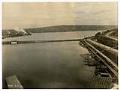
Temporary Stone Way Bridge, Seattle, May 4, 1916
The Stone Way Bridge was a temporary bridge that opened May 31, 1911 over the northwest corner of Lake Union, connecting Westlake Avenue on the south shore to Stone Way on the north. The bridge was in service until June 15, 1917, when the Fremont Bridge, built as part of the Lake Washington Ship Canal project, opened to traffic.This image of…
ID Number:2006.7.50
Date:1916
Photograph
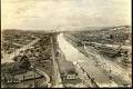
Lake Washington ship canal during construction, Seattle, May 4, 1916
After five and a half years of construction, the Lake Washington Ship Canal opened on May 8, 1917. It connects Lake Washington, Lake Union, Salmon Bay, and Puget Sound. This image looking west from Fremont shows the construction of the Lake Washington ship canal. Prominent in the center of the frame to the right of the canal is the distinctive…
ID Number:2006.7.100
Date:1916
Poster
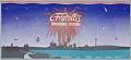
Fratelli's Fireworks Festival over Lake Union poster, Seattle, July 4, 1988
On July 4th, 1988, Seattleites were treated to two fireworks shows: an older show at Elliott Bay, sponsored by restaurateur Ivar Haglund, and a new one at Lake Union, put on by Fratelli’s Ice Cream. The Fratelli festival featured the music of Uncle Bonsai and a two-hour program by the Seattle Symphony. The symphony program was simulcast on KING-FM, the…
ID Number:2007.25.2
Date:1988
Poster
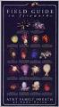
AT&T July 4th fireworks poster, Seattle, circa 1997
Seattle’s fireworks shows at Lake Union began in 1988. AT&T was the title sponsor from 1995 until 2001. This AT&T poster for Lake Union fireworks is an explanatory “field guide” for different kinds of Japanese firework displays. Caption information source: The Seattle Times: August 18, 1998; and July 10, 2009.
ID Number:2007.25.4
Date:Circa 1997
Photograph
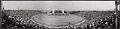
Husky Stadium filled with spectators for President Harding's address, Seattle, July 27, 1923
On July 27, 1923, President Warren G. Harding (1865-1923) arrived in Seattle from Alaska as part of a 40-day tour of the Western United States. His short six-hour stay included a review of the Navy fleet in Elliott Bay, a parade through downtown, greeting schoolchildren at Volunteer Park, speaking to a huge crowd of boys at Woodland Park, making an…
ID Number:2008.7.3
Date:1923