217 results for: Railroads
Audio recording
Oral history interview with Marlene Koob, May 10, 2006
Interview with Marlene Koob, the station agent at King Street Station at the time of this interview. The interview was conducted by Lorraine McConaghy for the King Street Station Oral History Project on May 10, 2006. Koob's father and grandfather also worked at King Street Station, and she retired from this role in September 2010.
ID Number:2019.35.11.4
Date:2006
Ephemera
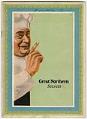
Great Northern Secrets cookbook, circa 1925
The “Oriental Limited” was a train route between Seattle and Chicago operated by the Great Northern Railway. In response to the popularity of the food served on the Oriental Limited, the Great Northern published this cookbook of “secret” recipes from the chefs on the train, and photographs of some of the chefs. Several of the recipes feature ingredients sourced from…
ID Number:2023.14.35
Date:Circa 1925
Photograph
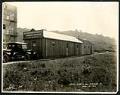
Puget Sound Bridge and Dredging Company office building on Dearborn Street, Seattle, April 23, 1923
Founded in 1889, the Puget Sound Bridge and Dredging Company was also called Puget Sound Bridge and Drydock, Associated Shipbuilders, and Lockheed Shipbuilding and Construction Company. The company participated in most major construction sites in the Pacific Northwest, including the construction of Harbor Island at the mouth of the Duwamish River in Seattle. Lockheed Shipbuilding continued to build ships ranging…
ID Number:Lib1988.13.7.2.16
Date:1923
Photograph
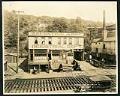
Salvation Army Industrial Department on Holgate Street, Seattle, May 22, 1923
This photograph of the exterior of the Salvation Army Industrial Department building on Holgate Street in Seattle was taken on May 22, 1923. This area south of downtown Seattle was originally made up of tidal flats; soil dredged from the Duwamish River and sluiced from the Denny triangle and Beacon Hill regrades was used to create this industrial area needed…
ID Number:Lib1988.13.7.2.18
Date:1923
Photograph
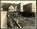
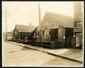
View of Holgate Street looking east at 9th Avenue South, Seattle, May 22, 1923
This photograph of Holgate Street looking east towards Beacon Hill depicts two workmen at ground level, perhaps working on the pilings which raise the street and buildings above the marshy ground. Other pedestrians are also visible. This area south of downtown Seattle was originally made up of tidal flats; soil dredged from the Duwamish River and sluiced from the Denny…
ID Number:Lib1988.13.7.2.19
Date:1923
Photograph
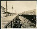
View of Holgate Street and Plum Street intersection at 9th Avenue South, Seattle, May 22, 1923
The image is looking southwest on Holgate Avenue at the Plum Street intersection, from 9th Avenue. This area south of downtown Seattle was originally made up of tidal flats; soil dredged from the Duwamish River and sluiced from the Denny triangle and Beacon Hill regrades was used to create this industrial area needed by area businesses and railroads.This photo is…
ID Number:Lib1988.13.7.2.20
Date:1923
Photograph
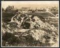
View of 9th Avenue South and Stacy Street, Seattle, May 23, 1923
This photograph looks north on 9th Avenue South and Stacy Street in Seattle. Several wooden buildings belonging to Frye & Company are visible, with large white painted letters reading, "Frye's Delicious Brand Hams & Bacon, Wild Rose Lard." Motorcars line the street as well as horses hitched to delivery wagons. This area south of downtown Seattle was originally made up…
ID Number:Lib1988.13.7.2.29
Date:1923
Photograph
View of Seattle west from Beacon Hill, May 28, 1923
This photograph of the northwest side of Beacon Hill in Seattle is facing west out towards Elliott Bay, which is just visible at the top of the frame. Visible in the image are residential homes as well as many commercial properties and buildings, showing the early development of what would be come an important industrial area of Seattle. This area…
ID Number:Lib1988.13.7.2.33
Date:1923
Photograph
Beacon Hill regrading, Seattle, July 2, 1923
This photograph shows the north end of Beacon Hill facing north. Dearborn Street is visible coming from the left center edge of the frame, between Beacon Hill and what will later be the Chinatown - International District of Seattle. Advertisement billboards visible in the image are for Wrigley's Gum and Wing Foot Tires. This area south of downtown Seattle was…
ID Number:Lib1988.13.7.2.58
Date:1923
Photograph
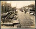
View of 9th Avenue South, Seattle, July 17, 1923
This photograph of 9th Avenue South is looking North, with First Hill in the distance and Beacon Hill on the right. There are two men on the right of the plank road who appear to be at work, another man looks on from the right side of the road. This area south of downtown Seattle was originally made up of…
ID Number:Lib1988.13.7.2.71
Date:1923