1669 results for: Webster
Photograph
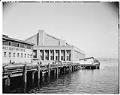
South side of US Naval Reserve Armory, Lake Union, August 22, 1942
Built on the former site of a Duwamish village, the Naval Reserve Armory was announced in 1937 but trouble with funding delayed completion of the project for several years. The Armory was designed by well-known theater architect B. Marcus Priteca and William R. Grant. The Works Progress Administration, one of the New Deal agencies, constructed the building. Groundbreaking occurred in…
ID Number:1983.10.17273.3
Date:1942
Photograph
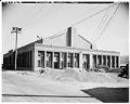
South side of US Naval Reserve Armory, Lake Union, August 22, 1942
Built on the former site of a Duwamish village, the Naval Reserve Armory was announced in 1937 but trouble with funding delayed completion of the project for several years. The Armory was designed by well-known theater architect B. Marcus Priteca and William R. Grant. The Works Progress Administration, one of the New Deal agencies, constructed the building. Groundbreaking occurred in…
ID Number:1983.10.17273.4
Date:1942
Photograph
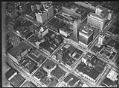
Aerial of downtown Seattle, August 9, 1933
Prominent downtown buildings in this view include, clockwise left to right near top of frame, the Vance and 1411-4th Avenue Buildings, the United States Post Office, the Seattle Tower (formerly Northern Life Tower), the Olympic Hotel, and the White-Henry-Stuart Building. Caption on image: Laidlaw.Handwritten on sleeve: City Center showing Rhodes Dept Store, Northern Life Tower, Olympic Hotel, PO & Tel.…
ID Number:1983.10.17510
Date:1933
Photograph
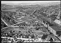
Aerial view of Georgetown, from the south, September 19, 1933
The Georgetown district lies south of downtown Seattle, below Beacon Hill. This aerial view, looking to the north, shows the Seattle Brewing & Malting Company's Bayview Brewery and businesses along Airport Way to the right, and newly-paved S. Harney Street passing through the residential area in the foreground. Beyond S. Corson Street (center to left) are the Georgetown Elementary School…
ID Number:1983.10.17511
Date:1933
Photograph
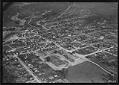
Aerial of Renton looking southeast, May 31, 1933
The city of Renton is located at the southern shore of Lake Washington, on the site of earlier Native encampments. Settlers built a sawmill in the area in the 1850s, and coal was discovered nearby in the 1870s. Renton was also an agricultural center. For many years, its primary crop was hops, used in brewing beer.This view of Renton shows…
ID Number:1983.10.17530.1
Date:1933
Photograph
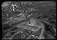
Aerial of Marine Hospital from south, Seattle, April 17, 1933
This view looks northwest over the north tip of Beacon Hill and shows the newly completed Marine Hospital. Designed by John Graham, Sr. in the Art Deco style, the main building was occupied by Amazon from 1998-2010. Handwritten on sleeve: U.S. Marine Hospital 4/17/33.Photographer's number: T-164
ID Number:1983.10.17545.2
Date:1933
Photograph
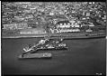
Aerial of Union Oil Co. plant and dock, Seattle, circa 1932
Union Oil Company maintained a large shipping and storage facility along the northern section of Seattle's waterfront. This view looks directly east towards Belltown and shows the many storage tanks that existed at this time between Railroad Avenue and First. Signs in image: Grinnell Company - Automatic Sprinklers, Pipe, Valves, Fittings - Power Piping, Heating & Plumbing Supplies. Union Oil.Handwritten…
ID Number:1983.10.17561.1
Date:Circa 1932
Photograph
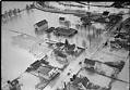
Flood at Orillia, December 12, 1933
Over a week of heavy rains in mid-December 1933 caused mudslides and flooding throughout western Washington state. On December 10, the Seattle Times reported that all area rivers were near flood stage. People from Kelso to Bellingham hoped that continued warm weather wouldn't melt the snow in the mountains and add to the misery.This photo, taken on December 12, 1933…
ID Number:1983.10.17636.9
Date:1933
Photograph
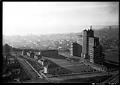
Aerial view of Marine Hospital, Seattle, 1937
The Marine Hospital in Seattle was completed in 1932, and opened in 1933, serving veterans, merchant seamen, the U.S. Coast Guard, U.S. Light House Service, and "federal compensation cases" (the poor and indigent). Now the Pacific Tower, and previously the Pacific Medical Center, the 16-story building is located on Beacon Hill in Seattle, at 1200 12th Avenue South. Designed by…
ID Number:1983.10.17640
Date:1937
Photograph
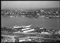
Aerial of Lake Union looking east, Seattle, September 14, 1934
The photographer is taking this view from above Westlake Avenue N. looking towards the east side of Lake Union. The Eastlake neighborhood is visible, with the Montlake Bridge in the distance. Handwritten on sleeve: Diesel Oil Sales Co. 9-14-34.Photographer's Reference Number: T-358
ID Number:1983.10.17641.3
Date:1934