182 results for: Curtis
Photograph
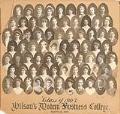
Graduates of Wilson's Modern Business College, Seattle, 1903
Wilson's Modern Business College opened in Seattle in 1895. It was one of several schools in the city which prepared women and men for jobs in business. Daytime and evening classes included arithmetic, geography, and spelling, as well as bookkeeping, shorthand, and commercial law.This photo collage is made up of 72 small oval black and white portraits of the members…
ID Number:2015.59.1
Date:1903
Poster
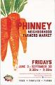
Phinney Neighborhood Farmers Market poster, Seattle, June 3 - September 30, 2016
On May 29, 1993, the University District Farmers Market opened in Seattle at the University Heights Community Center. Continuing from late May through early November, the market drew on Seattle's long history of the Pike Place Market, which opened in August of 1907 and allowed farmers to sell directly to consumers. In 2000, Chris Curtis, one of the originators of…
ID Number:2017.60.2
Date:2016
Poster
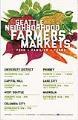
Seattle Neighborhood Farmers Markets poster, 2016
On May 29, 1993, the University District Farmers Market opened in Seattle at the University Heights Community Center. Continuing from late May through early November, the market drew on Seattle's long history of the Pike Place Market, which opened in August of 1907 and allowed farmers to sell directly to consumers. In 2000, Chris Curtis, one of the originators of…
ID Number:2017.60.6
Date:2016
Poster
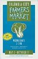
Columbia City Farmers Market poster, Seattle, May 2 - October 17, 2007
On May 29, 1993, the University District Farmers Market opened in Seattle at the University Heights Community Center. Continuing from late May through early November, the market drew on Seattle's long history of the Pike Place Market, which opened in August of 1907 and allowed farmers to sell directly to consumers. In 2000, Chris Curtis, one of the originators of…
ID Number:2017.60.9
Date:2007
Ephemera
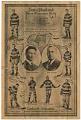
Seattle Metropolitans hockey score card, December 5, 1916
In 1915, Seattle joined the professional men's ice hockey league in western Canada and the western United States with their new team, the Metropolitans. The Mets, as they were known, played their home games at the Seattle Ice Arena (site of the present-day Seattle Center), in a new, state-of-the-art facility built by the Canadian brothers Frank and Lester Patrick. The…
ID Number:2018.3.3.47
Date:1916
Photograph
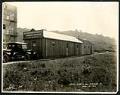
Puget Sound Bridge and Dredging Company office building on Dearborn Street, Seattle, April 23, 1923
Founded in 1889, the Puget Sound Bridge and Dredging Company was also called Puget Sound Bridge and Drydock, Associated Shipbuilders, and Lockheed Shipbuilding and Construction Company. The company participated in most major construction sites in the Pacific Northwest, including the construction of Harbor Island at the mouth of the Duwamish River in Seattle. Lockheed Shipbuilding continued to build ships ranging…
ID Number:Lib1988.13.7.2.16
Date:1923
Photograph
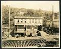
Salvation Army Industrial Department on Holgate Street, Seattle, May 22, 1923
This photograph of the exterior of the Salvation Army Industrial Department building on Holgate Street in Seattle was taken on May 22, 1923. This area south of downtown Seattle was originally made up of tidal flats; soil dredged from the Duwamish River and sluiced from the Denny triangle and Beacon Hill regrades was used to create this industrial area needed…
ID Number:Lib1988.13.7.2.18
Date:1923
Photograph
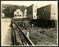
View of Holgate Street looking east at 9th Avenue South, Seattle, May 22, 1923
This photograph of Holgate Street looking east towards Beacon Hill depicts two workmen at ground level, perhaps working on the pilings which raise the street and buildings above the marshy ground. Other pedestrians are also visible. This area south of downtown Seattle was originally made up of tidal flats; soil dredged from the Duwamish River and sluiced from the Denny…
ID Number:Lib1988.13.7.2.19
Date:1923
Photograph
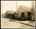
View of Holgate Street and Plum Street intersection at 9th Avenue South, Seattle, May 22, 1923
The image is looking southwest on Holgate Avenue at the Plum Street intersection, from 9th Avenue. This area south of downtown Seattle was originally made up of tidal flats; soil dredged from the Duwamish River and sluiced from the Denny triangle and Beacon Hill regrades was used to create this industrial area needed by area businesses and railroads.This photo is…
ID Number:Lib1988.13.7.2.20
Date:1923
Photograph
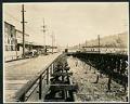
View of 9th Avenue South and Stacy Street, Seattle, May 23, 1923
This photograph looks north on 9th Avenue South and Stacy Street in Seattle. Several wooden buildings belonging to Frye & Company are visible, with large white painted letters reading, "Frye's Delicious Brand Hams & Bacon, Wild Rose Lard." Motorcars line the street as well as horses hitched to delivery wagons. This area south of downtown Seattle was originally made up…
ID Number:Lib1988.13.7.2.29
Date:1923