16 results for: Anderson Map Co.
Cartographic material
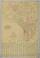
Anderson's 1896 Street and Guide Map of the City of Seattle
Seattle entrepreneur and amateur photographer O.P. (Oliver Phelps) Anderson (1859-1941) was the son of Alexander Jay Anderson (1832-1903), president of the Washington Territorial University (now University of Washington) from 1877-1882. O.P. trained as a draughtsman and by 1890 had started a civil engineering and map publishing business, O. P. Anderson & Company (later O. P. Anderson Map & Blue Print…
ID Number:1952.986.57.2
Date:1896
Cartographic material
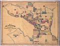
Map of the City of Seattle, King County, Washington Territory, 1887
R. H. (Reginald Heber) Thomson (1856-1949) was Seattle City Engineer from 1892 until 1911 and instrumental in reshaping the landscape of Seattle. Thomson was born in Hanover, Indiana, and worked as a surveyor there before heading west with his father to Oakland, California. In 1881, Thomson arrived in Seattle and soon after partnered with F. H. (Frederick Harrison) Whitworth (1846-1933),…
ID Number:1952.986.57.3
Date:1887
Cartographic material
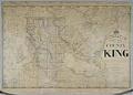
Anderson's New Map of the County of King, State of Washington, 1894
Seattle entrepreneur and amateur photographer O.P. (Oliver Phelps) Anderson (1859-1941) was the son of Alexander Jay Anderson (1832-1903), president of the Washington Territorial University (now University of Washington) from 1877-1882. O.P. trained as a draughtsman and by 1890 had started a civil engineering and map publishing business, O. P. Anderson & Company (later O. P. Anderson Map & Blue Print…
ID Number:1952.986.57.4
Date:1894
Cartographic material
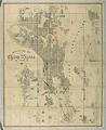
Anderson Map Co.'s Official Map of Greater Seattle, 1909
Seattle entrepreneur and amateur photographer O.P. (Oliver Phelps) Anderson (1859-1941) was the son of Alexander Jay Anderson (1832-1903), president of the Washington Territorial University (now University of Washington) from 1877-1882. O.P. trained as a draughtsman and by 1890 had started a civil engineering and map publishing business, O. P. Anderson & Company (later O. P. Anderson Map & Blue Print…
ID Number:1969.4750.1
Date:1909
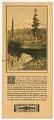
Ephemera
Anderson Supply Co. photo catalog, circa 1910
Seattle entrepreneur Oliver Phelps Anderson (1859-1941) was the son of Alexander Jay Anderson (1832-1903), president of the Washington Territorial University (now University of Washington) from 1877-1882. Oliver trained as a draughtsman and by 1890 had started a civil engineering and map publishing business, O. P. Anderson & Company (later O. P. Anderson Map & Blue Print Company). An avid amateur…
ID Number:1977.6486.3.8.1
Date:Circa 1910
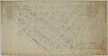
Cartographic material
Bell's 3rd, 4th, and 5th Addition to the City of Seattle, circa 1890
William Nathaniel Bell (1817-1887) and his wife, Sarah Ann (Peter) Bell (1819-1856), were members of the pioneering Denny Party, arriving in present-day West Seattle in 1851. The Bells helped to establish the settlement that became Seattle, settling north of the future downtown in "Belltown." Virginia and Olive streets are named for two of Bell's daughters, and Stewart Street honors Olive's…
ID Number:2019.3.11
Date:Circa 1890
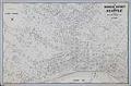
Cartographic material
Business District of Seattle, circa 1940
In 1903 Carl Albert Kroll (1882-1982) immigrated from Germany to the U. S., finding work as a drafting technician at the Moran Brothers shipbuilding company. By 1910, Kroll was the manager at O. P. Anderson Map & Blue Print Company. The following year he acquired both the Anderson Map Company and the Washington Map and Blueprint Company to form the…
ID Number:2019.3.13
Date:Circa 1940
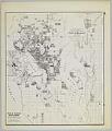
Cartographic material
Anderson's New Guide Map of the City of Seattle & Environs, July 1890
Seattle entrepreneur and amateur photographer O. P. (Oliver Phelps) Anderson (1859-1941) was the son of Alexander Jay Anderson (1832-1903), president of the Washington Territorial University (now University of Washington) from 1877-1882. O. P. trained as a drafting technician and by 1890 had started a civil engineering and map publishing business, O. P. Anderson & Company (later O. P. Anderson Map…
ID Number:2019.3.14
Date:1890
Cartographic material
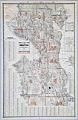
Seattle, Washington, Postal delivery section map, circa 1950
In 1903 Carl Albert Kroll (1882-1982) immigrated from Germany to the U. S., finding work as a drafting technician at the Moran Brothers shipbuilding company. By 1910 Kroll was the manager at O. P. Anderson Map & Blue Print Company. The following year he acquired both the Anderson Map Company and the Washington Map and Blueprint Company and merged them…
ID Number:2019.3.15
Date:Circa 1950
Cartographic material
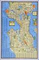
Seattle, Washington, circa 1938
In 1903 Carl Albert Kroll (1882-1982) immigrated from Germany to the U. S., finding work as a drafting technician at the Moran Brothers shipbuilding company. By 1910 Kroll was the manager at O. P. Anderson Map & Blue Print Company. The following year he acquired both the Anderson Map Company and the Washington Map and Blueprint Company to form the…
ID Number:2019.3.18
Date:Circa 1938