1580 results for: City of Seattle
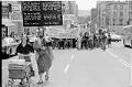
Photograph
Gay Pride march, Seattle, June 25, 1977
Seattle celebrated its first Gay Pride Week in June 1974, with a variety of festive activities at private and public venues around the city. The celebrations included potluck dinners, the opening of a gay community center, and a sing-in and rollerblading at the top of the Volunteer Park water tower. The largest event, a day of celebrations at Occidental Park,…
ID Number:2002.46.2379.3
Date:1977
Photograph
Gay Pride Parade rally at Westlake Mall, Seattle, June 25, 1977
Seattle celebrated its first Gay Pride Week in June 1974, with a variety of festive activities at private and public venues around the city. The celebrations included potluck dinners, the opening of a gay community center, and a sing-in and rollerblading at the top of the Volunteer Park water tower. The largest event, a day of celebrations at Occidental Park,…
ID Number:2002.46.2379.4
Date:1977
Photograph
Gay Pride march, Seattle, June 25, 1977
Seattle celebrated its first Gay Pride Week in June 1974, with a variety of festive activities at private and public venues around the city. The celebrations included potluck dinners, the opening of a gay community center, and a sing-in and rollerblading at the top of the Volunteer Park water tower. The largest event, a day of celebrations at Occidental Park,…
ID Number:2002.46.2379.5
Date:1977
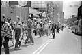
Photograph
Gay Pride march, Seattle, June 25, 1977
Seattle celebrated its first Gay Pride Week in June 1974, with a variety of festive activities at private and public venues around the city. The celebrations included potluck dinners, the opening of a gay community center, and a sing-in and rollerblading at the top of the Volunteer Park water tower. The largest event, a day of celebrations at Occidental Park,…
ID Number:2002.46.2379.7
Date:1977
Photograph
People marching in Gay Pride Parade, Seattle, June 25, 1977
Seattle celebrated its first Gay Pride Week in June 1974, with a variety of festive activities at private and public venues around the city. The celebrations included potluck dinners, the opening of a gay community center, and a sing-in and rollerblading at the top of the Volunteer Park water tower. The largest event, a day of celebrations at Occidental Park,…
ID Number:2002.46.2415.1
Date:1977
Photograph
Couple embracing at Gay Pride march, Seattle, June 25, 1977
Seattle celebrated its first Gay Pride Week in June 1974, with a variety of festive activities at private and public venues around the city. The celebrations included potluck dinners, the opening of a gay community center, and a sing-in and rollerblading at the top of the Volunteer Park water tower. The largest event, a day of celebrations at Occidental Park,…
ID Number:2002.46.2415.2
Date:1977
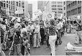
Photograph
People at Gay Pride march, Seattle, June 25, 1977
Seattle celebrated its first Gay Pride Week in June 1974, with a variety of festive activities at private and public venues around the city. The celebrations included potluck dinners, the opening of a gay community center, and a sing-in and rollerblading at the top of the Volunteer Park water tower. The largest event, a day of celebrations at Occidental Park,…
ID Number:2002.46.2415.4
Date:1977
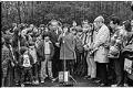
Photograph
Joyce Reyes speaking at site dedication for Native cultural center at Fort Lawton, November 14, 1971
In the late 1960s, the US Army announced its intention to decommission most of the land at Fort Lawton. The City of Seattle planned to turn the land into a park. However, members of Seattle’s Indigenous community wanted instead to reclaim the land for use by Indigenous peoples. On March 8, 1970, members of the United Indians of All Tribes…
ID Number:2002.46.6563.3
Date:1971
Photograph
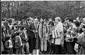
Senator Jackson speaking at site dedication for Native cultural center at Fort Lawton, November 14, 1971
In the late 1960s, the US Army announced its intention to decommission most of the land at Fort Lawton. The City of Seattle planned to turn the land into a park. However, members of Seattle’s Indigenous community wanted instead to reclaim the land for use by Indigenous peoples. On March 8, 1970, members of the United Indians of All Tribes…
ID Number:2002.46.6563.7
Date:1971
Photograph
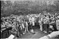
Mayor Uhlman speaking at site dedication for Native cultural center at Fort Lawton, November 14, 1971
In the late 1960s, the US Army announced its intention to decommission most of the land at Fort Lawton. The City of Seattle planned to turn the land into a park. However, members of Seattle’s Indigenous community wanted instead to reclaim the land for use by Indigenous peoples. On March 8, 1970, members of the United Indians of All Tribes…
ID Number:2002.46.6563.18A
Date:1971