835 results for: Neighborhoods
Photograph
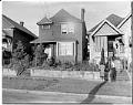
Neighborhood houses, Seattle, circa 1955
Al Smith took many photographs in Seattle’s Central District, located between the downtown business district and out along East Madison. Housing discrimination and restrictive real estate covenants meant that this was one of the few areas where African Americans could live. Much of the neighborhood was made up of small older brick or frame houses. Here, two Central Area residents…
ID Number:2014.49.011.019.0090
Date:Circa 1955
Photograph
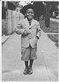
Little boy dressed in a knicker suit, Seattle, circa 1945
In addition to his Seattle jazz club images, photographer Al Smith took many photos of family and friends in their everyday lives in the city’s black community. On this occasion he photographed an unidentified small boy wearing a fedora hat and a wool suit with knickers.
ID Number:2014.49.23.14.07
Date:Circa 1945
Photograph
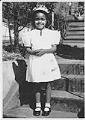
Little girl dressed in her best, Seattle, circa 1948
In addition to his Seattle jazz club images, photographer Al Smith took many photos of family and friends in their everyday lives. On this occasion, he photographed an unidentified little girl, possibly dressed for Easter. She wears a flowered hat and starched dress, and black patent leather shoes.
ID Number:2014.49.23.18.11
Date:Circa 1948
Photograph
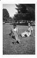
Unidentified couple in a Seattle park, circa 1935
In addition to his Seattle jazz club images, photographer Al Smith took many photos of family and friends in their everyday lives. On this occasion, he took an informal portrait of an unidentified black couple relaxing on a summer day in a Seattle park. The pipe-smoking man wears a fedora hat and a double-breasted “zoot suit” complete with wide jacket…
ID Number:2014.49.052.080.0007
Date:Circa 1935
Photograph
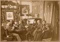
Horton family posing together in parlor, Seattle, circa 1898
In 1871, developer Julius Horton purchased property on the Duwamish River formerly owned by the Luther Collins family, who had been pioneers in the Duwamish Valley. In 1890, Horton incorporated the area, naming it Georgetown after his oldest child. The Hortons built a large home at 119 South Bateman, which may be where this photograph was taken. Julius Horton was…
ID Number:2016.33.2
Date:Circa 1898
Photograph
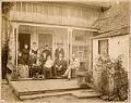
Horton family posing together on porch, Seattle, circa 1890
In 1871, developer Julius Horton purchased property on the Duwamish River formerly owned by the Luther Collins family, pioneers in the Duwamish Valley. In 1890, Horton incorporated the area, naming it Georgetown after his oldest child. Julius Horton was the brother of Seattle banker Dexter Horton (1825-1904).Here, members and friends of the Horton family sit on the porch of a…
ID Number:2016.33.3
Date:Circa 1890
Photograph
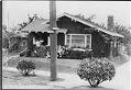
House on northwest corner of Meridian and Kirkwood Place, Seattle, circa 1925
This charming Craftsman style bungalow was located on the eastern side of Green Lake. The two women on the porch may be members of Seattle's Swedish community, as this photo is from an album titled "The Swedes' Life and Work in the State of Washington." Some of the photos in the album are signed Nordlands Foto Company, K.E. Nordland owner,…
ID Number:2016.59.13
Date:Circa 1925
Photograph
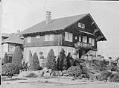
House owned by Dr. Nils A. Johanson on Broadway East, Seattle, circa 1925
Dr. Nils A. Johanson was a prominent Swedish immigrant and helped to found Swedish Hospital. This residence, built in 1909, stands at the northeast corner of Broadway East and Hamlin Streets. It was designed by architect Kirkland Cutter in the Swiss Chalet style. This photo is part of an album titled "The Swedes' Life and Work in the State of…
ID Number:2016.59.21
Date:Circa 1925
Photograph
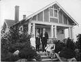
Swedish-American family on porch of house, circa 1925
Between 1890 and 1910, large numbers of Swedes immigrated to the greater Seattle area. Swedes worked in the woods around Preston and High Point, in the Ballard mills, on the railroads building tunnels and laying tracks, in construction (contributing both labor and architectural skills), in the mines at Coal Creek, on the docks on Seattle's waterfront, and as farmers around…
ID Number:2016.59.66
Date:Circa 1925
Poster
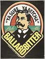
Ballard Bitter poster, Seattle, circa 1986
Redhook Ale Brewery was established in 1981 by Gordon Bowker and Paul Shipman in a garage in Seattle's Ballard neighborhood. One of the company's most popular beers, Ballard Bitter, was first brewed in 1985, when craft beer was still a very small market. However, the popularity of Ballard Bitter soon allowed Redhook to expand operations into a former trolley barn…
ID Number:2016.95.1
Date:Circa 1986