705 results for: KING - TV
Photograph
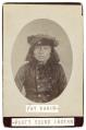
Pat Kanim, Snoqualmie Chief, circa 1855
The Snoqualmie people are a Coast Salish group who have lived in the Snoqualmie River Valley since time immemorial. They made dugout canoes which they used to navigate the river and reach Puget Sound. Traditionally the Snoqualmie burned off the bottom lands of the Snoqualmie Valley to create open areas that ensured an abundance of edible plants for foraging as…
ID Number:SHS1679
Date:Circa 1855
Photograph
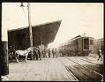
Northern Pacific depot, Seattle, circa 1899
Between 1892 and 1906, the Northern Pacific Railroad had a depot on Railroad Avenue at Columbia Street. Many people who were headed to the northern gold fields arrived by train at this Seattle railroad station. In 1906, the railroad moved its operations to the new King Street Station. Typed on sleeve: Railroad station on Railroad Ave. and Columbia St.
ID Number:SHS2546
Date:Circa 1899
Photograph
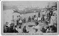
Game of slahal on a Puget Sound beach, circa 1884
Slahal, also called the bone game, is one of many games played by Indigenous peoples of the Pacific Northwest. A team member held up their hands, each of which contained a small bone, and the members of the opposite team tried to guess if a marked bone was in the right or left hand. Slahal often also involved gambling between…
ID Number:SHS3488
Date:Circa 1884
Photograph
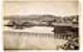
Waterfront from near Yesler's wharf, Seattle, circa 1882
Caption on mount: Peterson & Bro., Seattle, Wash. Ter.Caption on verso: Seattle Art Gallery, Peterson & Bro., Photograph Artists, Front Street, Seattle, King Co. Washington Territory.Typed on verso: View looking north from near Yesler, early 1880's.SHS category: Waterfront
ID Number:SHS3506
Date:Circa 1882
Photograph
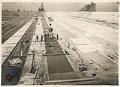
Workers pouring concrete for Beacon Hill reservoir, Seattle, circa 1911
Washington's Cedar River originates in the Cascade Mountain Range and drains into Puget Sound via Lake Washington. Since 1899 the upper Cedar River watershed, and its subsequent reservoirs and pipeline infrastructure, have been operated by Seattle Public Utilities, providing drinking water for about two-thirds of King County. The population of Seattle and King County grew quickly after the establishment of…
ID Number:SHS3768
Date:Circa 1911
Photograph
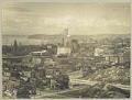
Downtown Seattle from Beacon Hill, 1914
Seattle’s Beacon Hill blocked easy access for people and goods between the downtown commercial area of Seattle and the more agricultural Rainier Valley. Starting in 1906, a series of regrades cut through Beacon Hill, first at Jackson Street and a few years later at Dearborn Street.Here, standing on Beacon Hill, the photographer looks northwest over Chinatown (now the Chinatown -…
ID Number:SHS5194
Date:1914
Photograph
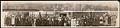
Seattle skyline and suffragists, 1915
The print pictured here features two panoramic images, one of the Seattle skyline, with many landmarks identified, and the other of a large group of people posing together on a city sidewalk. Most of the individuals are women, and several are proudly displaying copies of The Suffragist, a weekly newspaper published by the Congressional Union for Woman Suffrage. Handwritten on…
ID Number:SHS5211
Date:1915
Photograph
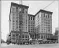
Adding floors to the County-City Building, circa 1930
In 1916, the new King County Courthouse and Municipal Building, also called the County-City Building, opened on Third Avenue in downtown Seattle. The building, designed by Seattle architect Augustus Warren Gould, was five stories tall, with a partial sixth story for the use of the city engineer. In 1929-1931, architect Henry Bittman's six story addition expanded Gould's original building upwards.This…
ID Number:SHS6523
Date:Circa 1930
Photograph
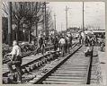
Relief project crew working on streetcar tracks, March 12, 1934
During the Great Depression of the 1930s, the United States government started a number of programs to help the unemployed. The Civil Works Administration (CWA) provided money for short-term public works projects during the winter months of 1933-1934. Thanks to funding from the CWA, King County was able to hire tens of thousands of workers for local projects.This photo, taken…
ID Number:SHS8525
Date:1934
Photograph
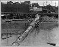
Denny Way sewer outfall into Puget Sound, Seattle, May 12, 1913
Prior to 1890, Seattle relied on a haphazard assortment of sewers and cesspools that, at best, drained into surrounding lakes and salt water. Faced with recurring threats of waterborne diseases including typhoid and cholera, City Engineer Benezette Williams designed the Seattle's first centralized combined sewage system plan in 1891. This plan sought to remove as much city sewage as possible…
ID Number:SHS8888
Date:1913