653 results for: Urban
Photograph
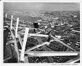
Jack Edwards and Amby Wirkus working on a bracket for the Space Needle observation deck, 1961
The Howard Wright Construction Company broke ground at the Space Needle site on April 17, 1961. The result of a design collaboration among businessman Edward E. Carlson, architect John Graham and University of Washington architecture professor Victor Steinbrueck, the Space Needle was built for the 1962 Century 21 Exposition (World’s Fair) in Seattle. With the addition of the final torch…
ID Number:2005.6.97
Date:1961
Poster
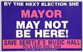
Save Seattle's Music Hall poster, Seattle, circa 1990
Seattle's Music Hall Theatre was a large, single screen theater originally opened as the Fox Theatre at Seventh and Olive in April 1929. It was purchased by the Clise family in 1936 and renamed the 7th Avenue until the 1960s, when it became the Music Hall once again. In response to losing several historic downtown theaters to the new suburban…
ID Number:2005.28.1
Date:Circa 1990
Photograph
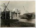
Fremont Bridge under construction, Seattle, November 16, 1916
The original bridge to Fremont was razed in 1911 to make way for the dredging of the Lake Washington Canal and temporary bridges were constructed to reroute traffic. This image was taken during construction of the new permanent bridge, which was completed in 1917 and connects Fremont Avenue North on the Fremont side of the Lake Washington Ship Canal and…
ID Number:2006.7.16
Date:1916
Photograph
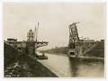
Montlake Bridge under construction, Seattle, March 11, 1925
The Montlake Bridge was completed in 1925 and links the Montlake neighborhood and the University District; it is one of four double-leaf bascule bridges that carry vehicle and pedestrian traffic across the Lake Washington Ship Canal, and has been listed on the National Register of Historic Places since 1982. This image of the bridge was taken during construction, and appears…
ID Number:2006.7.24
Date:1925
Photograph
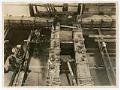
Base of University Bridge pier under construction, Seattle, December 10, 1917
The University Bridge was completed in 1919 and connects Eastlake Avenue traffic over Portage Bay between Eastlake to the south and the University District to the north. The bridge is one of four double-leaf bascule bridges that carry vehicle and pedestrian traffic across the Lake Washington Ship Canal, and has been listed on the National Register of Historic Places since…
ID Number:2006.7.32
Date:1917
Photograph
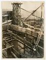
University Bridge under construction, Seattle, January 10, 1918
The University Bridge was completed in 1919 and connects Eastlake Avenue traffic over Portage Bay between Eastlake to the south and the University District to the north. The bridge is one of four double-leaf bascule bridges that carry vehicle and pedestrian traffic across the Lake Washington Ship Canal, and has been listed on the National Register of Historic Places since…
ID Number:2006.7.36
Date:1918
Photograph
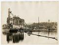
University Bridge piers under construction, Seattle, July 24, 1918
The University Bridge was completed in 1919 and connects Eastlake Avenue traffic over Portage Bay between Eastlake to the south and the University District to the north. The bridge is one of four double-leaf bascule bridges that carry vehicle and pedestrian traffic across the Lake Washington Ship Canal, and has been listed on the National Register of Historic Places since…
ID Number:2006.7.43
Date:1918
Photograph
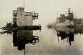
University Bridge under construction, Seattle, October 4, 1918
The University Bridge was completed in 1919 and connects Eastlake Avenue traffic over Portage Bay between Eastlake to the south and the University District to the north. The bridge is one of four double-leaf bascule bridges that carry vehicle and pedestrian traffic across the Lake Washington Ship Canal, and has been listed on the National Register of Historic Places since…
ID Number:2006.7.47
Date:1918
Photograph
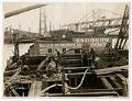
Men working at West Spokane Street Bridge, Seattle, December 27, 1922
From 1902 to 1917, three temporary wooden bridges were built over the west water way of the Duwamish River, connecting Harbor Island to West Seattle (annexed in 1907). The first permanent steel bridge, officially known as West Spokane Street Bridge No. 1 (North), was a low-level bascule bridge that opened on November 27, 1924, Thanksgiving Day, and was in use…
ID Number:2006.7.56
Date:1922
Photograph
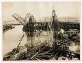
West Spokane Street Bridge under construction, Seattle, December 27, 1922
From 1902 to 1917, three temporary wooden bridges were built over the west water way of the Duwamish River, connecting Harbor Island to West Seattle (annexed in 1907). The first permanent steel bridge, officially known as West Spokane Street Bridge No. 1 (North), was a low-level bascule bridge that opened on November 27, 1924, Thanksgiving Day, and was in use…
ID Number:2006.7.58
Date:1922