461 results for: Hotel Seattle
Photograph
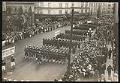
Parade of Naval Training Station personnel, Seattle, circa 1918
During World War I a temporary Naval Training Station was set up on the University of Washington campus, near where the university's health sciences center is now located. The training camp was active from 1917-1919, during which time over 5,000 mostly college students were trained for both naval and naval aviation units. This image of U. S. Navy Training Station…
ID Number:Lib1993.35.3.14
Date:Circa 1918
Ephemera
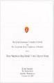
Banquet program for King Harald V's visit, 1995
Norway's King Harald V (b. 1937) and Queen Sonja (b. 1937) came to Seattle in 1995 for a four-day visit that included events around Puget Sound. Harald had visited Seattle twice previously as crown prince, first in January 1964 for an official visit, then in briefly in October 1967 after an official visit to Canada. The Pacific Northwest is home…
ID Number:Lib1996.8.17
Date:1995
Music, notated
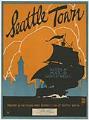
Seattle Town
The popularity of songs about cities prompted the Young Men's Business Club of Seattle to commission local composer Harold Taylor Weeks to write a song for Seattle. Weeks had already gained a national reputation for a number of hits, including his popular 1918 jazz song "Hindustan," which he wrote with Oliver G. Wallace. The Seattle Times reported that the composer…
ID Number:Lib1996.28.16
Date:1923
Ephemera
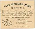
The Bachelors' Club invitation, circa 1885
The Bachelors' Club of Seattle, likely a social club for unmarried men, held its second “Social Party” at the city’s Arlington Hotel on February 16th; the day of the week would place it in either 1882 or 1888 as Washington Territory became Washington State in 1889. The evening featured dancing, card games, and a late meal for $2.50. The members…
ID Number:MS.COLL.148
Date:Circa 1885
Ephemera
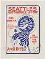
Seattle's Automobile Show advertisement, April 1916
In 1916 the third annual Seattle Automobile Show was held downtown, hosted by the Seattle Auditorium Company, and featured thirty-three passenger models of twenty different makes, and eight motor trucks produced by six different manufacturers. Some of the standouts included a white six-cylinder Paige, a maroon eight-cylinder Oakland, and a Marmon with an aluminum engine. Also on display were the…
ID Number:MS.COLL.872
Date:1916
Photograph
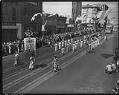
Chinese community marchers in Potlatch parade on Second Avenue, Seattle, 1938
Seattle's Potlatch of Progress opened July 28, 1938. During its four sunny days of events, Seattleites and visitors enjoyed several parades, a Native American canoe race, a swim carnival, horseracing, fishing contests, fireworks at Green Lake and the dedication of Alaskan Way.This photo shows a group from Seattle's Chinese community marching in a parade on Second Avenue. Note the streetcar…
ID Number:PI22612
Date:1938
Photograph
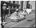
Japanese Chamber of Commerce float in Potlatch parade on Second Avenue, Seattle, 1939
Seattle's 1939 Potlatch Festival opened July 25 and ran for five days. Its Golden Jubilee theme celebrated Washington's 50 years of statehood. Events included a Western horse show, an original play on the history of Seattle, visiting warships, a beauty contest and three parades. On the last day of the festival, an estimated 300,000 people lined the streets and watched…
ID Number:PI22619
Date:1939
Photograph
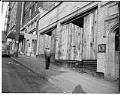
Boarded up storefronts on 6th Ave. S after forced removal of Japanese Americans, Seattle, June 1942
The exclusion of Seattle's Japanese families by the federal government during World War II changed the city in numerous ways. Among the more obvious signs were the shuttered and boarded up Japanese businesses along Main, Jackson and upper King Streets. Many of the families who managed or worked in the stores and shops never returned to the city after they…
ID Number:PI28071
Date:1942
Photograph
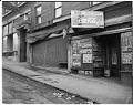
Closed businesses on S. Main St. after forced removal of Japanese Americans, Seattle, June 1942
The exclusion of Seattle's Japanese families by the federal government during World War II changed the city in numerous ways. Among the more obvious signs were the shuttered and boarded up Japanese businesses along Main, Jackson and upper King Streets. Many of the families who managed or worked in the stores and shops never returned to the city after they…
ID Number:PI28075
Date:1942
Photograph
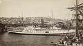
East-facing view of Seattle and the Alaskan, 1888
Seattle in the 1880s was a rapidly growing city, aided in no small part by the 1883 connection with the Northern Pacific Railway Company. Lumber and coal were the primary industries, but the growth of fishing, wholesale trade, shipbuilding, and shipping also contributed to the town's economic expansion and population growth. The Seattle City Census of 1888 records population at…
ID Number:SHS201
Date:1888