480 results for: Street Views
Ephemera
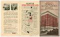
Brochure from the Spring Apartment Hotel, Seattle, circa 1925
The Spring Apartment Hotel was constructed in 1922 for William H. Hainsworth, a representative of the Spring Apartment Hotel Co. The eleven-story building was designed by John Graham Sr. and built by general contractor Hans Petersen for$500,000. There were no retail storefronts and the building was entirely devoted to residential hotel purposes and remained so for three decades.This brochure advertises…
ID Number:2018.3.3.131
Date:Circa 1925
Cartographic material
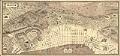
Map of Seattle with illustrations, 1936
Henry Broderick was a highly respected Seattle civic leader and longtime president of the real estate firm, Henry Broderick, Inc., which he founded in 1908. For many years Broderick's firm was the largest real estate firm in Seattle, and there were few parcels of downtown land that were not at some point bought or sold by Henry Broderick, Inc. In…
ID Number:2018.3.8.5
Date:1936
Photograph
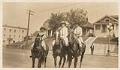
Three women on horseback, Seattle, circa 1920
Hazel Gladys Klinefelter was an active member of the Seattle Riding Academy and enjoyed riding with her friends. Here, Hazel (right) and two unidentified friends ride their horses somewhere near Volunteer Park. Caption information source: The Seattle Daily Times: October 29, 1922, p. 91.
ID Number:2019.7.4
Date:1920
Photograph
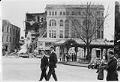
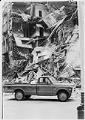
Pioneer Square showing collapsed Olympic Block building, Seattle, March 23, 1972
A section of the Olympic Block building at the corner of First Avenue and Yesler Streets in Pioneer Square collapsed in a cloud of dust and rubble on the night of March 22, 1972. The building was being renovated at the time. Two people who were inside escaped unharmed, but a nearby car was destroyed and another damaged. Owners of…
ID Number:2019.48.1
Date:1972
Photograph
Olympic Block building after collapse, Seattle, March 23, 1972
A section of the Olympic Block building at the corner of First Avenue and Yesler Streets in Pioneer Square collapsed in a cloud of dust and rubble on the night of March 22, 1972. The building was being renovated at the time. Two people who were inside escaped unharmed, but a nearby car was destroyed and another damaged. Owners of…
ID Number:2019.48.2
Date:1972
Photograph
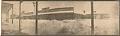
B.F. Middleton grocery in the snow, Seattle, February 1916
A huge blizzard hit Seattle on February 2, 1916, dropping over 21 inches of snow on top of some already there. This view, taken in South Park from behind shoveled snow, looks across Dallas Avenue at the B.F. Middleton general store across the street.
ID Number:2019.92.12
Date:1916
Photograph
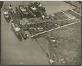
Aerial view looking northeasterly, Todd Dry Docks, Inc., Seattle, April 11, 1905
The Seattle Division of Todd Shipyard Corporation originated in 1916, when the William H. Todd Corporation purchased the Seattle Construction and Dry Dock Company (formerly Moran Brothers Shipyard). Originally located on the Seattle waterfront, the shipyard built cargo vessels for the U.S. Shipping Board during World War I. Todd moved the operation to a new plant on Harbor Island in…
ID Number:2023.36.64
Date:1905
Photograph
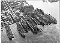
Repair Yard, aerial view looking south, Todd Pacific Shipyards, Inc., Seattle Division, November 17, 1956
The Seattle Division of Todd Shipyard Corporation originated in 1916, when the William H. Todd Corporation purchased the Seattle Construction and Dry Dock Company (formerly Moran Brothers Shipyard). Originally located on the Seattle waterfront, the shipyard built cargo vessels for the U.S. Shipping Board during World War I. Todd moved the operation to a new plant on Harbor Island in…
ID Number:2023.36.66
Date:1956
Photograph
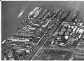
Repair Yard, aerial view of yard, Todd Pacific Shipyards, Inc., Seattle Division, November 17, 1956
The Seattle Division of Todd Shipyard Corporation originated in 1916, when the William H. Todd Corporation purchased the Seattle Construction and Dry Dock Company (formerly Moran Brothers Shipyard). Originally located on the Seattle waterfront, the shipyard built cargo vessels for the U.S. Shipping Board during World War I. Todd moved the operation to a new plant on Harbor Island in…
ID Number:2023.36.67
Date:1956
Photograph
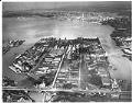
Aerial view of Harbor Island with Todd Shipyards located on NW corner of Island, Todd Shipyards Corporation, Seattle Division, February 1965
The Seattle Division of Todd Shipyard Corporation originated in 1916, when the William H. Todd Corporation purchased the Seattle Construction and Dry Dock Company (formerly Moran Brothers Shipyard). Originally located on the Seattle waterfront, the shipyard built cargo vessels for the U.S. Shipping Board during World War I. Todd moved the operation to a new plant on Harbor Island in…
ID Number:2023.36.68
Date:1965