396 results for: Central Area
Photograph
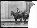
Captain Billy and woman on horseback, circa 1900
The Yakama (formerly spelled Yakima) people have lived in the Columbia River basin since time immemorial. During the winter, they lived in permanent villages built on the valley floor, where the climate was most temperate. Starting in spring, they traveled along the rivers and into the hills to gather food. Some gathered roots and berries, and others fished in rivers,…
ID Number:Lib1992.9.72
Date:Circa 1900
Photograph
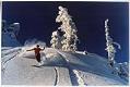
Skier on Denny Mountain, Alpental, 1976
In the winter of 1934, Seattle made national news by opening one of the first municipal ski areas in the country at Snoqualmie summit, championed by Mayor John F. Dore, a skier who envisioned the project as one that could lift his city's spirits during the midst of the Great Depression. The Ski Park grew, installing a rope tow in…
ID Number:Lib1993.20.48
Date:1976
Photograph
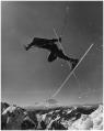
University of Washington ski team member about to crash, Alpental, 1976
In the winter of 1934, Seattle made national news by opening one of the first municipal ski areas in the country at Snoqualmie summit, championed by Mayor John F. Dore, a skier who envisioned the project as one that could lift his city's spirits during the midst of the Great Depression. The Ski Park grew, installing a rope tow in…
ID Number:Lib1993.20.119
Date:1976
Photograph
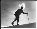
Mark Heilbrun skiing at Snoqualmie Pass, 1980
In the winter of 1934, Seattle made national news by opening one of the first municipal ski areas in the country at Snoqualmie summit, championed by Mayor John F. Dore, a skier who envisioned the project as one that could lift his city's spirits during the midst of the Great Depression. The Ski Park grew, installing a rope tow in…
ID Number:Lib1993.20.168
Date:1980
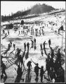
Photograph
Skiers at Snoqualmie Summit, 1954
In the winter of 1934, Seattle made national news by opening one of the first municipal ski areas in the country at Snoqualmie summit, championed by Mayor John F. Dore, a skier who envisioned the project as one that could lift his city's spirits during the midst of the Great Depression. The Ski Park grew, installing a rope tow in…
ID Number:Lib1993.20.262
Date:1954
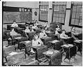
Photograph
Bailey Gatzert School classroom after incarceration of Japanese Americans, Seattle, 1942
Many of the students who attended Bailey Gatzert School in the 1920s and 1930s came from either Chinatown or Niponmachi (Japan Town). The school lost about 45 percent of its student body when Japanese Americans were incarcerated in camps in 1942. Handwritten on negative: Bailey Gatzert school. Handwritten on sleeve: Seattle - schools - Gatzert, Bailey (students).Date photograph was filed…
ID Number:PI25525
Date:1942
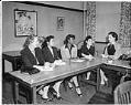
Photograph
Bailey Gatzert School PTA officers, Seattle, 1946
The leaders of the Parent Teacher Association at Bailey Gatzert School reflected the diverse backgrounds of the student body. In the late 1940s, the school children were 10 percent Chinese American, 20 percent African American, 5 percent Filipino American, 27 percent Japanese American, and 35 percent European American, with 3 percent Native American. Caption slip identified officers as Minnie Beach,…
ID Number:PI25782
Date:1946
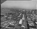
Photograph
Aerial view of Alaskan Way Viaduct under construction from south, Seattle, 1957
Seattle's Alaskan Way Viaduct carried traffic over the waterfront area, linking the northern part of the city to the industrial area south of the central business district. The first unit of the elevated roadway, from Battery Street to Dearborn Street, was completed in 1953 and a southern extension in 1959. The Viaduct closed in January 2019 after being replaced by…
ID Number:PI27481
Date:1957
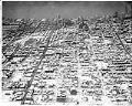
Photograph
Aerial view of the Central Area after snowstorm, November 22, 1946
This aerial view of the Seattle's Central Area was taken after two days of snow blanketed the city in late November 1946. The view looks west across the Central District, toward Elliiott Bay. At the time, most of Seattle's Black population was concentrated in the Central Area because of housing and job discrimination, and restrictive covenants that prohibited the rental…
ID Number:PI27592
Date:1948
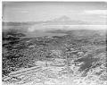
Photograph
Aerial view of the Rainier Valley after snowstorm, November 22, 1946
This aerial view of the Seattle's Rainier Valley was taken after two days of snow blanketed the city in late November 1946. The view looks southeast towards Mount Rainier, with Rainier Avenue South running upward from the bottom of the frame. Sick's Stadium is visible to the left of Rainier Avenue, in the lower third of the photo.At the time…
ID Number:PI27593
Date:1946