480 results for: Street Views
Photograph
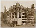
Pacific Net & Twine building under construction, Seattle, circa 1918
The Pacific Net and Twine Company (later Pacific Marine Supply, then Pacific Marine Schwabacher, Inc.) was founded in 1897 in Seattle by Scottish immigrants Edward Cunningham (1878-1960) and Donald B. McBride (1862-1945). Originally selling netting and twine out of a basement, by 1913 the company had grown and moved its operations to Pier 8. In 1918 the company moved once…
ID Number:2007.4.22
Date:Circa 1918
Poster
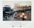
Pike Place Market 25th Anniversary Celebration of "Save the Market" poster, Seattle, May 16 - November 2, 1996
In the summer of 1907 the Seattle City Council designated a public market be held on Pike Place between Pike Street and Pine Street in hopes of appeasing both farmers and consumers, angry over high food prices. The Pike Place Public Market flourished in the first half of the twentieth century but became less utilized with the decline of independent…
ID Number:2007.25.34
Date:1996
Photograph
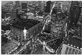
Aerial photograph of Bon Marché with Christmas star and downtown extending east and north, Seattle, circa 1965
The Bon Marché was founded in 1890 by German immigrant Edward Nordhoff and his wife Josephine. Originally located in Seattle’s Belltown district at First Avenue and Cedar Street, in 1896 it moved to a more central location downtown at Second Avenue and Pike Street. The holiday star hangs annually on the corner of the Bon Marché building at Fourth Avenue…
ID Number:2009.20.74
Date:Circa 1965
Photograph
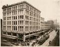
The Bon Marche building at Second Avenue and Pike Street, Seattle, circa 1927
The Bon Marché was founded in 1890 by German immigrant Edward Nordhoff and his wife Josephine. Originally located in Seattle’s Belltown district at First Avenue and Cedar Street, in 1896 it moved to a more central location downtown at Second Avenue and Pike Street. This photo of the exterior of the Bon Marché is looking north from Union Street to…
ID Number:2009.20.145
Date:Circa 1927
Photograph
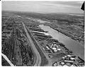
Aerial view of Harbor Island, Seattle, July 20, 1964
Harbor Island is an artificial island in the mouth of Seattle, Washington's, Duwamish River where it empties into Elliott Bay. Built by the Puget Sound Bridge and Dredging Company, Harbor Island was completed in 1909 and was then the largest artificial island in the world, at 350 acres. Harbor Island was made from 24 million yd³ of earth removed in the…
ID Number:2009.23.145
Date:1964
Photograph
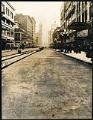
Second Avenue during paving, Seattle, circa 1915
circa 1915
The financial district or central business district of downtown Seattle has several buildings that remain standing from the early twentieth century. Visible in this image is the Smith Tower, at 506 Second Avenue on the northeast corner of Second Avenue and Yesler Way. The 38-story building was completed in 1914, and remained Seattle's tallest building until the Space Needle overtook…
ID Number:2009.55.46.67
Date:Circa 1915
Photograph
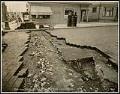
Street repair at 12th Avenue and Spring Street, Seattle, July 12, 1916
This view of the First Hill neighborhood shows a crack that developed in the concrete base beneath brick paved road at 12th Avenue and Spring Street. Repairs were overseen by the Seattle City Engineer's Department. Handwritten on negative: Photo taken 7/12/16. 12th Ave. at Sprint St. Break in Concrete BaseStamped on verso: Frank H. Nowell, 1212 Fourth Ave., Seattle, U.…
ID Number:2009.55.46.75
Date:1916
Photograph
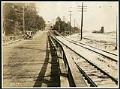
Plank road on Elliott Avenue at West Mercer Place, Seattle, August 3, 1921
This south-facing image of Elliott Avenue at West Mercer Place shows cars traveling on a wood plank road near streetcar tracks.James P. Lee (1894-1963) was the City of Seattle's Engineering Department photographer from 1922-1957. Photographer's number: 4544
ID Number:2009.55.46.92
Date:1921
Photograph
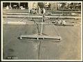
Man smoothing wet concrete on 10th Avenue NE, Seattle, September 28, 1921
This paving project on 10th Avenue NE (Roosevelt Way) near NE 61st Street was likely overseen by the Seattle City Engineer's Department.James P. Lee (1894-1963) was the City of Seattle's Engineering Department photographer from 1922-1957. Photographer's number: 4565
ID Number:2009.55.46.106
Date:1921
Photograph
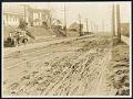
Elliott Avenue from Denny Way to Garfield St., Seattle, January 4, 1922
This north-facing view shows the muddy road conditions along Elliott Avenue between Denny Way and Garfield Street.James P. Lee (1894-1963) was the City of Seattle's Engineering Department photographer from 1922-1957. Photographer's number: 4595
ID Number:2009.55.46.114
Date:1922